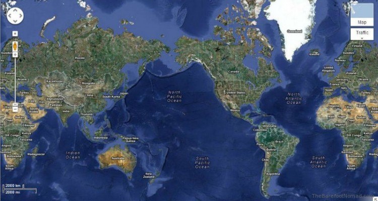
When you spot a tiny star marker on a digital or printed map, it instantly commands attention. Unlike standard gray dots or generic pins, stars carry psychological weight. They signal that something important lives at that exact coordinate. Cartographers use stars to guide the human eye toward priority landmarks, but the exact definition shifts wildly depending on the type of map you're reading.
On commercial road atlases or digital wayfinding platforms, a star usually marks a capital city, a primary point of interest, or a saved user location. On topographic sheets or geological surveys, it might denote a triangulation station, a survey benchmark, or a high-altitude summit. Mapmakers don't rely on random symbols; every icon traces back to standardized cartographic conventions or modern user interface design choices.
The Core Meanings of Star Symbols Across Different Map Types
Map symbols function as a specialized visual language. Without decoding the legend, you're essentially guessing what the creator intended to highlight. Here is what a star symbol typically represents across major mapping formats:
- Political and Road Maps: A five-pointed star typically signifies a capital city—either a national capital or a state/provincial seat of government. A smaller star or a boxed star often denotes secondary administrative centers like county seats.
- Tourism and Navigation Apps: Digital platforms like Google Maps and geographic information systems use a star icon to denote saved favorites, starred locations, or top-rated tourist destinations recommended by travel guide publishers.
- Topographic and USGS Maps: Federal survey maps historically used stars or specialized triangulation markers to indicate survey control points—exact physical markers anchored in the earth used by surveyors to map surrounding terrain accurately.
- Celestial and Star Charts: In astronomy apps and planispheres, stars represent actual celestial bodies, double stars, or constellation nodes mapped against the night sky coordinate grid.
Capital Cities and Administrative Centers
The most rigid tradition in cartography involves political hierarchy. If you open a national road map or an international atlas, you'll notice a strict hierarchy of text size and symbol weight.
National capitals receive the highest prominence. Cartographers traditionally represent a national capital with a circled star, a star enclosed in a square, or a bold solid star. For example, Washington, D.C., on a United States road atlas, uses a distinct star marker that immediately separates it from regular metropolitan areas represented by standard municipal dots.
State and provincial capitals follow suit with slightly smaller star variations. This visual hierarchy prevents clutter while ensuring that lawmakers, travelers, and students can identify the seat of political power at a glance.
Points of Interest and Commercial Tourism Ratings
If you're using a consumer map application or browsing a city visitor guide, the star takes on an entirely different role. It stops being a political marker and becomes a curated recommendation.
Travel publishers like the Michelin Guide or AAA use star ratings to denote excellence in hospitality and dining. When these ratings translate to digital maps, businesses that achieve prestigious tiers earn star icons on the interface.
Similarly, modern mapping software empowers everyday users to curate their own digital atlases. When you tap the star button in navigation apps, you save a coordinate to your personal database. Millions of users leverage this feature to bookmark restaurants, trailheads, and hotels, turning a universal symbol of importance into a personalized travel itinerary.
Topographic and Survey Markers in the Field
If you're hiking with a paper topographic map published by a national geological survey, a star symbol takes on a technical, highly physical meaning.
Surveyors establish precise geographical grids using reference points known as benchmarks or triangulation stations. Historically, mapmakers marked these critical geodetic control points with stars or precise triangles. Finding these markers in the wilderness allowed explorers and cartographers to calculate distances, elevations, and boundaries accurately.
While modern GPS relies on satellite trilateration, legacy topographic maps still preserve these historical survey stations. If you spot a star near a mountain ridge or a remote valley intersection on an older topographic map, it often points to a physical brass disk embedded in rock or concrete by land surveyors decades ago.
Common Misinterpretations and How to Avoid Them
Misreading map symbols leads to missed turns, ruined travel plans, and navigational confusion. Watch out for these frequent mistakes when interpreting star icons:
- Assuming all stars mean tourist traps: Don't assume a star on a wilderness map represents a scenic viewpoint. On a backcountry trail map, it might designate a ranger station, an emergency shelter, or a water source rather than a sightseeing attraction.
- Confusing political stars with local landmarks: A star on a macro-level continental map represents a capital city, not a specific museum or park inside that city. Zooming in reveals how the symbol scales down or disappears entirely.
- Ignoring the map legend: Every reputable map features a key or legend box. Skipping this step is the fastest way to misinterpret specialized icons designed specifically for that single publication.
Frequently Asked Questions
Why do some maps use different colored stars?
Color coding adds an extra layer of data to a map. For instance, a gold or yellow star usually denotes a premier tourist attraction or user-saved favorite, while a red or black star typically indicates an administrative capital or a technical survey benchmark. Always check the specific map legend for color definitions.
How do digital mapping apps handle user-saved star locations?
In apps like Google Maps, starring a location saves its precise latitude and longitude coordinates to your personal account profile. This creates a synchronized list of favorite places that you can access across multiple devices without altering the public map layer visible to other users.
Did historical paper maps use stars differently than digital maps?
Yes. Historical cartographers relied heavily on stars for geodetic survey points, astronomical observation stations, and political capitals because printing technology required clear, high-contrast symbols. Modern digital maps use vector graphics that allow stars to change dynamically based on your zoom level and search filters.
What is the difference between a pin drop and a star on a map?
A pin drop usually represents a temporary selection, a dropped search query, or a specific user-queried address. A star generally represents a permanent, high-value landmark, a capital city, or a deliberate, saved favorite stored for long-term reference.