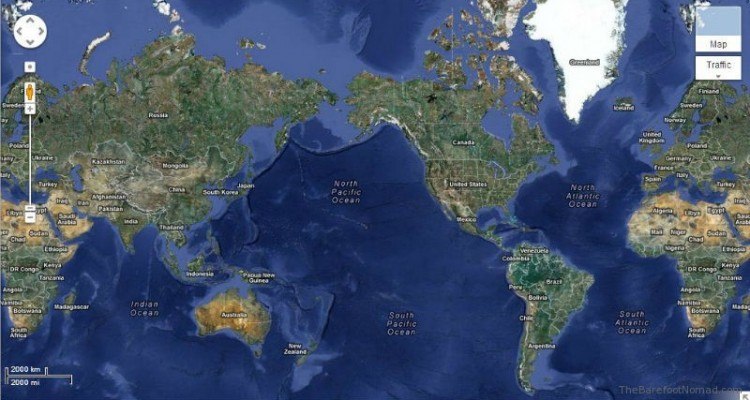
Map orientation hasn't always meant putting north at the top of the page. For thousands of years, human cartography treated east, south, or the political center of an empire as the rightful top of the world. The modern habit of placing north-up is not a law of physics or mathematics; it's a historical artifact born from European maritime expansion, the invention of the magnetic compass, and the dominance of northern hemisphere landmasses. As digital navigation, automated vehicle routing, and GIS data challenge fixed layouts, the standard north-up model faces a quiet functional evolution.
The Fluid Origins of Map Orientation
Before global navigation relied on standardized coordinates, cartographers oriented maps around cultural or environmental reference points. In medieval Europe, maps frequently placed east at the top—derived from the Latin term oriens, meaning to rise. East pointed toward Jerusalem and the Garden of Eden, embedding religious significance directly into physical geography.
Islamic cartography during the medieval period frequently placed south at the top. Scholars like Al-Idrisi drew detailed world maps with south oriented upward because major Islamic population centers lay north of Mecca, meaning travelers looked southward toward the holy site. In ancient China, maps often placed south at the top because the emperor sat facing south, looking out over his subjects and receiving the warmth of the sun.
North was rarely chosen as the primary orientation point in early global history. To many ancient cultures, the northern direction represented darkness, cold, and uncertainty. It wasn't until the widespread adoption of the magnetic compass in maritime trade that north gained traction. Mariners needed a reliable, constant heading on the open ocean. Because the northern hemisphere contained extensive coastlines frequented by European mapmakers, and because the North Star provided a fixed celestial anchor in the night sky, European cartographers steadily standardized north-up charts.
The Mercator Projection and Standardization
The standardisation of north solidified during the European age of discovery. Gerardus Mercator published his famous world map in 1569, designed specifically to help sailors plot straight-line courses across oceans.
While Mercator's cylindrical projection distorted landmass sizes—making Greenland appear as large as Africa—it preserved angles. A constant compass bearing appeared as a straight line. Because European nations drove global trade, exploration, and subsequent colonial mapping initiatives, their specific navigational conventions became the international baseline. What started as a regional convenience for European mariners transformed into an unquestioned global standard.
Even iconic space imagery has faced this psychological conditioning. When NASA's Apollo 17 crew captured the famous "Blue Marble" photograph of Earth in 1972, the original shot actually had the south pole at the top. NASA officials intentionally flipped the image before publication to match human expectations conditioned by centuries of north-up paper maps.
Digital Navigation and the Death of Fixed North
In the era of smartphones and GPS, the rigid north-up map is fading away. Dynamic routing applications prioritize track-up or heading-up orientations, rotating the physical map in real-time so that whatever direction a user is traveling points toward the top of the screen.
This shift alters how humans process spatial awareness. Fixed north-up maps require mental rotation—users must look at a screen, find their icon, and translate top-is-north into left-is-west relative to their forward momentum. Track-up algorithms eliminate this cognitive friction for drivers and pedestrians, turning the digital screen into an ego-centric navigation bubble.
However, this convenience introduces new challenges. When a map constantly rotates, users often lose their broader geographical context. Pilots, hikers, and sailors still rely heavily on traditional fixed orientations because maintaining an absolute spatial mental model matters more than immediate turn-by-turn prompts. The debate over map orientation is ultimately a battle between absolute geography (where am I on the planet?) and relative navigation (where is my next turn?).
Common Misconceptions About Map Orientation
- North is mathematically required to be up: No mathematical law dictates map orientation. Coordinate systems work identically whether the y-axis points north, south, east, or west.
- Upside-down maps are inaccurate: South-up maps, such as the Upside-Down Map created by Stuart McArthur in 1979, contain the exact same cartographic data as traditional maps; they simply invert the perspective to challenge geopolitical biases.
- GPS systems only use north-up: Modern consumer navigation software defaults to dynamic, heading-aligned orientations to optimize physical movement rather than static viewing.
Frequently Asked Questions
Why do most maps put north on top?
North-up orientation became standard due to the influence of European cartographers during the age of exploration, the utility of the North Star for navigation, and the widespread adoption of Mercator-style maritime charts.
Did any major civilizations put south on top?
Yes. Early Chinese cartography frequently placed south at the top to align with imperial traditions, and several early Islamic maps placed south at the top to orient toward Mecca.
Does Google Maps allow you to turn off north-up?
Yes. Modern digital mapping platforms allow users to toggle between a fixed north-up view and a heading-up view where the map rotates automatically based on the user's direction of travel.
Do alternative map projections fix map bias?
Projections like the Peters projection or Gall-Peters projection attempt to correct the area distortion of the Mercator map, representing landmasses closer to their true relative sizes, though they still typically adhere to a north-up layout.