Reading Maine's ocean tides isn't just about checking when you can launch a boat or walk a sandbar. With some of the most dramatic tidal swings on the East Coast—ranging from 9 feet in Portland to over 20 feet in the Bay of Fundy approach—misjudging the water can leave your boat stranded on granite ledges or trap you on an isolated island.
Platforms like USHarbors make tracking these movements straightforward once you know how to interpret the data. Whether you're navigating rocky channels, planning a coastal hike, or setting lines for lobster and striped bass, mastering local tidal mechanics keeps you safe on the water.
Understanding Maine Tidal Mechanics
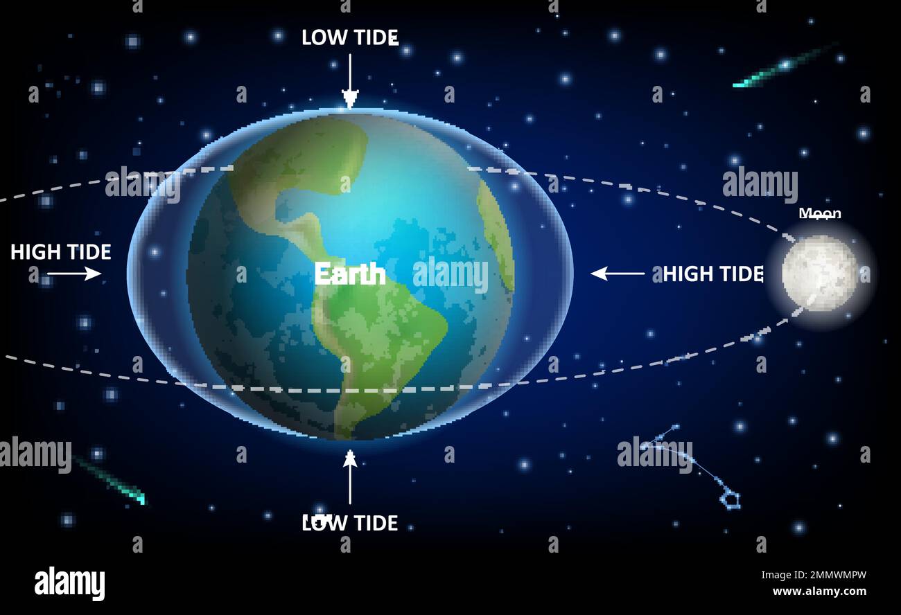
Maine features a semi-diurnal tide cycle, meaning most coastal locations experience two high tides and two low tides every lunar day, roughly every 12 hours and 25 minutes. Because the Earth rotates through two tidal bulges created by the gravitational pull of the moon and the sun, coastal water levels rise and fall in a predictable sine wave pattern.
Several geographic factors amplify these movements along the Maine coast:
- The Gulf of Maine Basin: The shape and depth of the Gulf of Maine create a natural resonant basin. Water sloshes back and forth in sync with the lunar cycle, magnifying the tidal range as it moves north toward New Brunswick.
- Topography and Estuaries: Narrow bays, river mouths, and rocky archipelagos funnel immense volumes of water into tight spaces, creating swift currents and extreme height differentials between high and low water.
- Spring and Neap Tides: Twice a month, during new and full moons, the gravitational forces of the sun and moon align to create spring tides with higher highs and lower lows. During quarter moons, neap tides produce minimal variation.
Reading USHarbors Data Effectively
Platforms like USHarbors aggregate data from official NOAA Tides & Currents stations, translating raw scientific data into accessible daily tables. When you look up a specific harbor or coastal town, you need to look beyond the basic high and low times.
Key Metrics to Track
- Time Corrections: Reference stations provide exact data, but smaller harbors require applying time offsets. Always check whether the listed time accounts for your exact cove or river inlet.
- Height Differentials: The number listed next to high tide represents the water height above Mean Lower Low Water (MLLW). Subtracting the low tide height from the high tide height gives you the total tidal range for that cycle.
- Current Slack Water: Tidal currents don't turn at the exact moment of high or low water. In narrow thoroughfares like reversing falls or narrow gut entrances, slack water can lag behind high/low tide by up to two hours.
Practical Applications for Mariners and Anglers
Knowing the tide schedule changes how you approach coastal activities in Maine.
Safe Navigation in Rocky Waters
Maine's coastline is famous for submerged ledges, hidden rocks, and shallow reversing channels. Navigating unfamiliar coves at low tide requires keeping a close eye on your depth sounder and chart plotter. Plan your transits through shallow thoroughfares within two hours of high water to ensure adequate clearance.
Fishing and Tidal Movement
Game fish like striped bass, bluefish, and atlantic salmon feed heavily where tidal currents push baitfish through bottlenecks. Incoming and outgoing tides create eddies and rip currents around rocky points. Anglers fish these transition zones during moving water, when predators wait downstream to ambush disoriented prey.
Coastal Hiking and Beachcombing
Tidal flats and island sandbars—such as the famous bar connecting Bar Island to Bar Harbor—are accessible only during low tide. Crossing too late can strand you on an island for hours. Always check the local tide chart, build in a 45-minute safety buffer on either side of low tide, and carry a reliable timepiece.
Common Mistakes to Avoid
Even experienced boaters occasionally run into trouble by misjudging local conditions.
- Ignoring Meteorological Tides: High winds and low atmospheric pressure create storm surges that push water levels well above predicted tide tables. A strong onshore gale can make a high tide two feet higher than expected, flooding low-lying docks and coastal roads.
- Confusing Current Speed with Height: A large tidal range doesn't automatically mean a fast current. Wide bays experience massive height changes with gentle water movement, while narrow river mouths generate dangerous rapids from modest height differences.
- Failing to Account for Daylight Saving Time: Always verify whether tide tables are adjusted for local time or coordinated universal time (UTC) to avoid missing your window on the water.
Frequently Asked Questions
Why do Maine tides change by about 50 minutes each day?
The Earth rotates through the moon's gravitational bulge in 24 hours, but the moon also orbits the Earth in the same direction. It takes Earth an extra 50 minutes to catch up to the moon's new position, shifting the daily high and low tide times forward.
What is the difference between MLLW and Mean High Water?
Mean Lower Low Water (MLLW) serves as the baseline (zero depth) on nautical charts. Mean High Water represents the average height of all high tides over a 19-year recording cycle, helping mariners estimate vertical clearance under bridges and docks.
How do I find tide data for remote Maine islands?
While major ports like Portland and Eastport have primary NOAA recording stations, smaller islands rely on secondary harmonic stations. Websites like USHarbors calculate these secondary stations automatically by applying mathematical offsets to primary station data.
Can wind really change predicted tide heights?
Yes. Strong offshore winds push water away from the coast, resulting in lower low tides and diminished high tides. Conversely, prolonged onshore storms trap water against the shore, creating unpredicted flooding regardless of the lunar cycle.