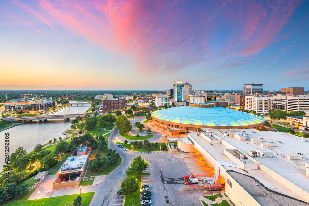
Wichita, Kansas functions as the state's largest urban center, spanning roughly 162 square miles with a population nearing 400,000 residents. Understanding the city's underlying population layout requires looking past municipal boundaries into how individual postal zones capture stark economic, cultural, and structural divides. From the commercial core of downtown to the expanding residential edges, Wichita’s layout reflects distinct historical migration, industrial shifts in aviation manufacturing, and shifting neighborhood affluence.
Postal boundaries in Sedgwick County don't just route mail; they map out micro-economies. Core urban zones like 67202 feature higher commercial density, rental-heavy housing stocks, and dynamic shifts in daytime populations, while peripheral areas like the outer 67235 or eastern sectors showcase lower density, higher median household incomes, and sprawling single-family developments.
The Geography of Wichita Zip Codes
Wichita's postal delivery routes span more than two dozen active zip codes, each capturing a distinct piece of the metropolitan puzzle. The numbering system radiates outward from historical transport lines and central commercial hubs, creating distinct geographic quadrants that define local identity.
Urban core sectors such as 67202 and 67203 anchor the historic heart of the city. These zones include downtown revitalization projects, older arts districts, and immediate surrounding neighborhoods. Housing stock here leans heavily toward historic builds, multi-family conversions, and smaller footprints built before the mid-century suburban boom. To explore the bigger picture, check out the recent article by The New York Times.
Moving outward, zones like 67207 to the east and 67212 to the west capture post-war expansion. These neighborhoods are defined by mid-century ranch homes, grid street layouts, and mature commercial strips along major thoroughfares like Central Avenue and Kellogg Street. Further out, suburban-style zip codes like 67226 and 67235 represent newer master-planned communities, larger lot sizes, and rapid residential development driven by families seeking newer construction and highly rated school feeder patterns.
Income Disparities and Economic Patterns
Economic distribution across Wichita's postal zones reveals a classic American urban pattern: concentrated wealth on the suburban periphery alongside transitional median-income stability and pockets of urban core economic strain.
Median household incomes across the city hover around $66,000, but individual zip codes deviate sharply from this baseline. Urban core and inner-ring zip codes—such as 67211 and 67214—frequently record median household earnings significantly lower than the metro average, driven by higher concentrations of renters, single-person households, and aging housing stock requiring capital investment.
Conversely, eastern and far-western postal codes report median household incomes stretching well past the $85,000 to $100,000 thresholds. These high-earning zones correspond with professional-class migration, proximity to major medical centers, and corporate executive housing tied to the aerospace and manufacturing sectors that anchor the local economy, often dubbed the Air Capital of the World. According to the U.S. Census Bureau, economic mobility heavily mirrors housing tenure, where owner-occupied rates in outer zones exceed 75 percent, compared to heavy renter majorities near the center.
Demographic Diversity and Cultural Enclaves
Wichita is more diverse than its regional reputation suggests, with demographic shifts playing out unevenly across different neighborhoods. The city's overall population is roughly 60% non-Hispanic White, with Hispanic residents making up roughly 18% to 20% of the total population, and Black, Asian, and multi-racial residents comprising the remaining balance.
This diversity is geographically clustered. Hispanic populations have historically maintained strong roots in north and northeast Wichita zip codes, contributing to vibrant commercial corridors, local markets, and community institutions. Asian American communities, including significant Vietnamese populations, have established deep roots in specific central and south-side neighborhoods, reflected in local dining and cultural infrastructure.
Age distribution also varies by zip code. Inner-city and college-adjacent postal codes show higher concentrations of younger adults aged 20 to 34, drawn by rental affordability and proximity to institutions like Wichita State University. In contrast, inner-ring suburban zones skew older, with stable cohorts of long-term homeowners aging in place.
Housing Stock, Age, and Urban Renewal
The physical age of housing across Wichita's zip codes tells the story of the city's economic expansions. Construction waves followed major aviation booms during and after World War II, followed by massive westward and eastward pushes in the 1970s and 1980s.
- Pre-1950 Housing: Concentrated in core zip codes, featuring classic craftsman designs, pier-and-beam foundations, and walkable urban grids.
- 1950–1980 Expansion: Found widely in mid-city sectors, characterized by split-levels, brick ranch homes, and wider suburban streets.
- Post-2000 Construction: Dominated by outer-ring zip codes, featuring modern subdivisions, HOA-governed communities, and multi-car garage footprints.
Urban renewal efforts heavily target the older core, where municipal City of Wichita initiatives aim to rehabilitate aging infrastructure, incentivize downtown loft living, and bridge the gap between historic neighborhoods and modern economic demands.
Frequently Asked Questions
Which Wichita zip code has the highest population?
High-density residential zip codes on the west and east sides—such as 67212 and 67226—consistently rank among the most populated due to extensive residential subdivisions and apartment complexes built over the last three decades.
How does the cost of living vary by zip code in Wichita?
Housing costs drive the primary variance. Inner-core zip codes generally feature lower median home values and lower rents, though some areas face higher maintenance costs due to home age. Outer suburban zip codes feature higher home values balanced by newer construction and energy-efficient builds.
Where are the main commercial zones located?
Major commercial activity is concentrated along arterial corridors like Rock Road on the east side, Maize Road on the west side, and the downtown central business district, which serves as the hub for professional services and government offices.
Is Wichita's population growing or declining?
Wichita's population has experienced steady, modest growth overall, driven primarily by suburban expansion in Sedgwick County while the urban core undergoes structural transformation and targeted revitalization.