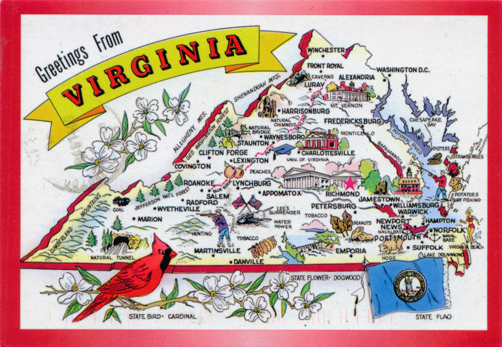
Where is Virginia located in the United States? The Commonwealth of Virginia sits right on the East Coast, straddling the boundary between the Mid-Atlantic and Southeastern regions. If you trace your finger down the eastern seaboard of the country, you'll find it positioned midway between New York and Florida, sharing a border with the nation's capital, Washington, D.C.
This exact placement has shaped its history, economy, and transit corridors since colonial days. Let's look closer at its physical boundaries, regional identity, and how its coordinates influence modern transit.
Exact Boundaries and Neighbors
Virginia's borders touch five distinct states, the District of Columbia, and major marine waterways. To understand its layout, look at how it wraps around its neighbors:
- North and Northeast: Maryland and Washington, D.C. frame the northern edge, separated in many places by the Potomac River.
- Southeast: The Atlantic Ocean and the mouth of the Chesapeake Bay define the eastern coastline.
- South: North Carolina and a small slice of Tennessee form the southern border.
- West and Northwest: Kentucky and West Virginia wrap around the western mountain ranges.
According to data from the U.S. Census Bureau, the state spans roughly 42,775 square miles, making it the 35th largest state by area, yet it punches well above its weight class due to its strategic position on major shipping routes.
The Five Geographic Regions
You can't talk about where Virginia is without looking at how the land changes from east to west. The state drops from rugged mountain ridges down to sea-level marshes.
The Tidewater and Coastal Plain
The easternmost edge features flat terrain, tidal rivers, and deep-water ports. This includes the Hampton Roads harbor, one of the world's largest natural anchorages. Cities like Norfolk and Virginia Beach anchor this coastal strip, which relies heavily on maritime trade and naval defense.
The Piedmont
Moving west, you hit the Piedmont, a rolling upland area that covers a huge chunk of the state's central territory. Richmond, the state capital, sits right on the fall line where the rivers drop down to the coastal plain.
The Blue Ridge Mountains
Further inland, the Blue Ridge rises sharply, offering dramatic elevations like peaks along the National Park Service Skyline Drive. These mountains act as a natural spine separating eastern Virginia from the interior valleys.
The Valley and Ridge Province
West of the Blue Ridge lies the Great Appalachian Valley, a fertile agricultural corridor rich in limestone caves and rolling pastures.
The Appalachian Plateau
The far southwestern tip of the state drops into the rugged, coal-rich terrain of the Appalachian Plateau, bordering Kentucky and West Virginia.
Strategic Economic and Political Position
Virginia's location gives it a unique geopolitical advantage. Because it directly borders Washington, D.C., Northern Virginia functions as an economic engine driven by federal agencies, defense contractors, and massive tech infrastructure.
The state also sits at a vital crossroads for freight. Major interstate highways like I-95 run straight through the state, connecting the entire American East Coast from Maine to Florida. Rail lines operated by major carriers link the midwestern ports and coal fields directly to Hampton Roads terminals.
Frequently Asked Questions
Is Virginia considered a Northern or Southern state?
Culturally and historically, Virginia is part of the South—it served as the capital of the Confederacy during the Civil War. However, its modern northern suburbs share more in common with Mid-Atlantic urban centers.
What time zone is Virginia in?
Virginia sits entirely within the Eastern Time Zone and observes Daylight Saving Time.
Does Virginia have ocean coastline?
Yes. While much of its eastern border is shielded by the Chesapeake Bay, the southeastern corner faces the open Atlantic Ocean at Virginia Beach.
How close is Virginia to the capital of the United States?
Northern Virginia actually touches Washington, D.C. directly across the Potomac River, meaning parts of the state are just a few miles from the White House and Capitol building.



