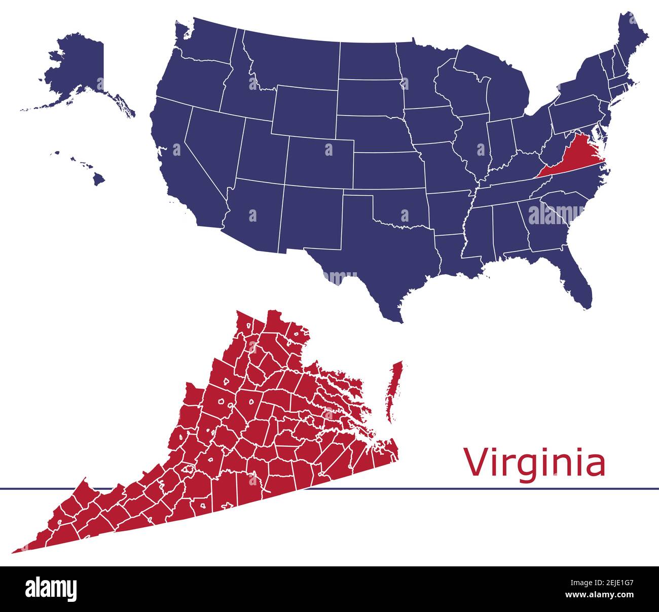
Virginia sits on the mid-Atlantic coast of the United States, bordered by Maryland and Washington, D.C. to the north and northeast, the Atlantic Ocean to the east, North Carolina and Tennessee to the south, and Kentucky and West Virginia to the west. This position places the state at a natural crossroads between the American Northeast and the Southeast, shaping its climate, economy, and historical significance since colonial settlement.
Understanding where Virginia is located requires looking beyond simple coordinates. The state spans roughly 42,774 square miles, making it the 35th largest state by area, yet its varied terrain stretches from the sandy coastal plains of the Tidewater region up to the rugged ridges of the Appalachian Mountains. This unique geography gives the Commonwealth distinct regional divisions that influence everything from local industries to population distribution.
Geographic Boundaries and Neighboring States
Virginia shares its borders with five states and the nation's capital, creating a deeply interconnected regional footprint.
- North and Northeast: Maryland and Washington, D.C. share the northern border, separated in large parts by the Potomac River. This proximity makes Northern Virginia an integral part of the Washington metropolitan area.
- East: The Atlantic Ocean and the Chesapeake Bay define the eastern boundary, providing extensive coastline and major maritime access.
- South: North Carolina and Tennessee sit to the south, anchoring Virginia firmly within the American South.
- West and Northwest: West Virginia and Kentucky lie to the west, separated largely by the rugged ridges of the Appalachian mountain chain.
These borders place Virginia in a prime transit corridor. Major interstate highways like I-95 and I-81 run directly through the state, connecting Maine to Florida and the Northeast to the Midwest.
The Five Distinct Geographic Regions
Virginia's landscape transitions dramatically from east to west. Geographers typically divide the state into five distinct physiographic provinces:
Tidewater and Coastal Plain
Bordering the Atlantic Ocean and the Chesapeake Bay, the Coastal Plain is a low-lying region characterized by marshes, peninsulas, and deep-water ports. This area includes the Hampton Roads metro area, home to one of the world's largest natural harbors and crucial naval installations.
Piedmont
Moving west, the Piedmont features rolling hills and deep, fertile soils. It is the largest region in the state, stretching from the fall line—where rivers drop sharply to the coastal plain—up to the base of the mountains. Major cities like Richmond and Charlottesville sit within this zone.
Blue Ridge Mountains
This narrow band of steep, forested mountains includes peaks like Mount Rogers, the highest point in Virginia at 5,729 feet. The Blue Ridge acts as a dramatic physical divider between eastern and western Virginia.
Valley and Ridge
West of the Blue Ridge lies the Great Appalachian Valley, a wide expanse of fertile agricultural land interspersed with parallel ridges. The Shenandoah Valley dominates this region, known for its rich farming heritage and limestone caves.
Appalachian Plateau
In the far southwestern corner of Virginia, the terrain rises into a rugged, coal-rich plateau characterized by steep slopes and narrow valleys. This area has historically driven the state's energy and mining sectors.
Strategic Economic and Military Significance
Virginia's location on the East Coast has made it a cornerstone of national defense and global commerce. The Hampton Roads region houses the world's largest concentration of U.S. Navy facilities, including Naval Station Norfolk. This positioning allows for rapid deployment to the Atlantic and the Mediterranean.
Beyond defense, the Port of Virginia serves as a major gateway for international trade on the East Coast. Its deep-water channels and extensive rail connections make it a vital logistics hub. Meanwhile, Northern Virginia's proximity to Washington, D.C., has transformed it into a global center for government contracting, telecommunications, and cloud computing infrastructure, housing the largest concentration of data centers in the world.
Common Misconceptions About Virginia's Location
People unfamiliar with U.S. geography often misunderstand where Virginia sits relative to other major hubs.
- North vs. South: While Virginia joined the Confederacy during the Civil War and is culturally tied to the South, its northern tier functions economically and socially as part of the Mid-Atlantic and Northeast corridor.
- Coastal Access: Many assume the entire state touches the ocean, but the Atlantic coastline is restricted to the extreme eastern edge, primarily the Eastern Shore and Hampton Roads. The vast majority of the state relies on rivers flowing into the Chesapeake Bay.
- Mountain Barrier: Travelers driving east-to-west frequently underestimate the barrier posed by the Blue Ridge and Appalachian ranges, which historically limited inland expansion until pioneers found gaps like the Cumberland Gap further south.
Frequently Asked Questions
What time zone is Virginia in?
Virginia operates in the Eastern Time Zone and observes Daylight Saving Time, shifting clocks forward in March and back in November.
Is Virginia considered a Southern state?
Culturally and historically, Virginia is classified as a Southern state and served as the capital of the Confederacy. However, rapid population growth in Northern Virginia has brought distinct mid-Atlantic and cosmopolitan influences to that region.
How close is Virginia to Washington, D.C.?
Northern Virginia borders Washington, D.C. directly. Areas like Arlington and Alexandria sit right across the Potomac River, making them core suburbs of the nation's capital.
What body of water forms Virginia's eastern border?
The Atlantic Ocean borders Virginia to the east, while the Chesapeake Bay cuts deeply into the state's coastal plain, dividing the mainland from the Eastern Shore.



