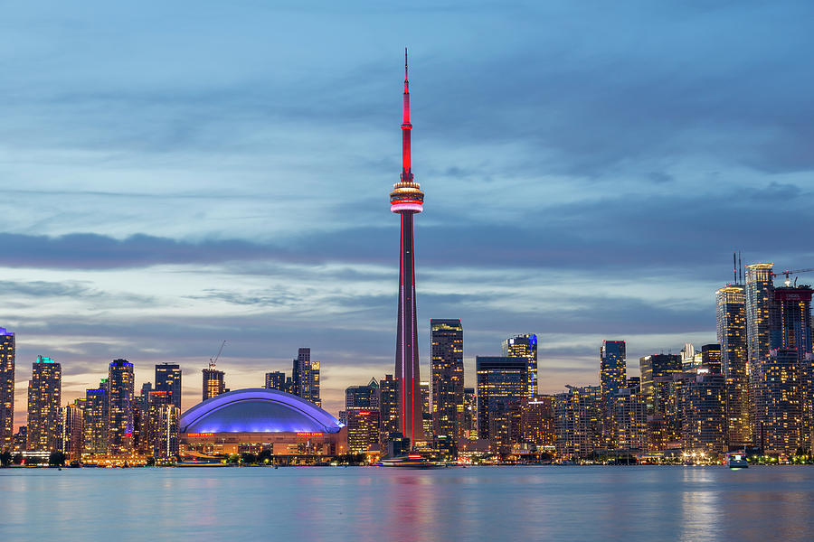
Toronto sits on the northwestern shore of Lake Ontario in southeastern Canada. It functions as the capital city of the province of Ontario and stands as the most populous municipality in the country. If you're looking at a North American map, it rests roughly halfway up the eastern seaboard's northern extension, positioning itself just north of the United States border states like New York and Pennsylvania.
Finding the exact spot of Canada's financial hub takes more than just a quick glance at a continental map. Let's break down its precise coordinates, regional context, and how it fits into the broader geography of North America.
Geographical Coordinates and Position
Toronto's precise coordinates sit at approximately 43.6532 degrees North latitude and 79.3832 degrees West longitude. It occupies a sloping plateau interspersed with rivers and ravines, most notably the Humber River on the west side and the Don River to the east.
- Country: Canada
- Province: Ontario
- Region: Southern Ontario
- Body of Water: Northwestern shore of Lake Ontario
Because it sits right on the water, the lake heavily influences local weather patterns, creating lake breezes that moderate summer heat and occasionally dump heavy lake-effect snow squalls in the winter months.
Relation to Major North American Cities
People often wonder how close Toronto is to major US hubs. It's a key travel and trade nexus, sitting within a day's drive of a massive portion of the North American population.
- New York City: Roughly a 550-mile drive east, taking about 7 to 8 hours by car depending on border crossings at Buffalo or Niagara Falls.
- Chicago: About 500 miles west, or a standard 8-hour drive through Michigan and Ontario.
- Montreal: Roughly 330 miles northeast, connected via the bustling Highway 401 corridor.
- Ottawa: Canada's federal capital sits about 250 miles northeast of Toronto.
These distances make the city an accessible midpoint for cross-border shipping, corporate headquarters, and international tourism. You can check the City of Toronto Official Site for local municipal details and regional planning maps.
The Greater Toronto Area Context
When locals talk about Toronto, they usually mean a much larger footprint than just the downtown core. The city is the anchor of the Greater Toronto Area, commonly abbreviated as the GTA.
The GTA includes Toronto proper alongside four surrounding regional municipalities:
- Durham Region to the east
- Peel Region to the west (home to Mississauga and Brampton)
- York Region to the north (including Markham and Vaughan)
- Halton Region to the southwest (including Oakville and Burlington)
This entire cluster forms the western edge of the Greater Golden Horseshoe, an urban agglomeration that houses a massive share of Ontario's total population and industrial output.
Transportation and Accessibility
Getting to Toronto is straightforward because it serves as Canada's primary transportation gateway.
- Air Travel: Toronto Pearson International Airport handles the vast majority of international and domestic flights, operating as the country's largest aviation hub. Billy Bishop Toronto City Airport sits right on the island downtown for regional turboprop flights.
- Rail: Via Rail connects Toronto to Montreal, Ottawa, and Windsor, while Amtrak links it directly to New York City via the Maple Leaf train.
- Highways: Highway 401 cuts right through the northern part of the city, holding the title of one of the busiest highways in North America.
Frequently Asked Questions
Is Toronto the capital of Canada?
No. Toronto is the capital of the province of Ontario. Ottawa is the capital city of Canada.
What US state is closest to Toronto?
New York State is directly across the Niagara River and Lake Ontario. You can drive from Toronto to the US border at Niagara Falls in about 90 minutes.
Is Toronto considered part of Western or Eastern Canada?
Culturally and geographically, it's part of Central Canada, though it sits in the eastern half of the country. Canadians refer to Ontario and Quebec as Central Canada.
How big is the city proper?
Toronto covers an area of roughly 630 square kilometers, stretching from Lake Ontario north to Steeles Avenue, and from Etobicoke Creek in the west to the Rouge River in the east.



