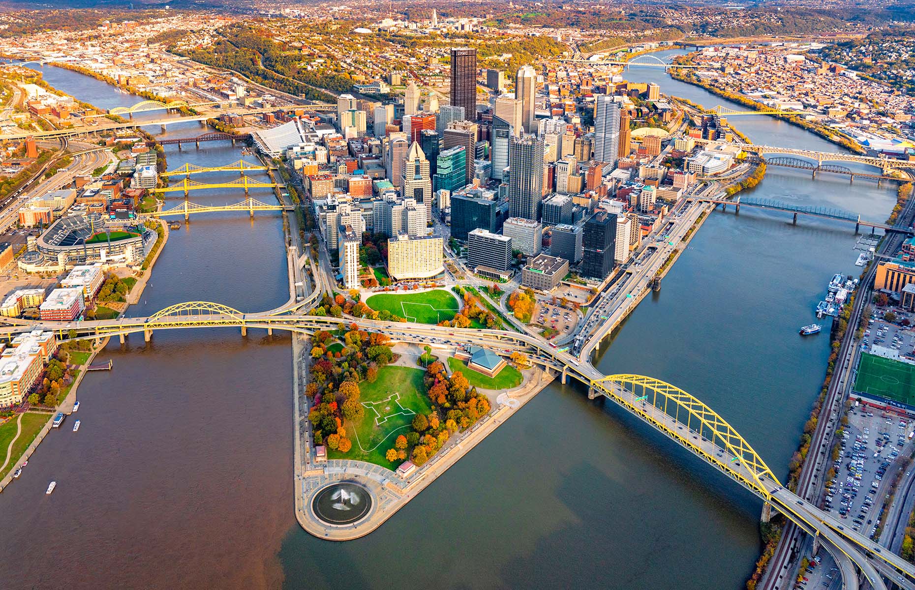
Where is Pittsburgh? Pittsburgh sits squarely in the southwestern corner of Pennsylvania, serving as the economic and cultural anchor of the state's western half. Positioned at the exact point where the Allegheny and Monongahela rivers converge to form the Ohio River, the city occupies a rugged terrain of steep hills, deep valleys, and numerous bridges. This unique geographic placement made it a historical gateway to the American West and shapes how neighborhoods, roads, and communities function today.
Understanding the layout of western Pennsylvania requires looking past simple state maps. Pittsburgh isn't just a single municipality; it's the center of a dense metropolitan county surrounded by distinct regional pockets like the Laurel Highlands and the Mon Valley. Whether you're planning a trip, studying regional topography, or researching relocation, grasping where this city sits within the broader Mid-Atlantic and Appalachian landscapes clarifies why it holds such a strategic position.
Geographic Coordinates and Regional Positioning
Pittsburgh lies at approximately 40.4406° N latitude and 79.9959° W longitude. The 80th meridian west longitude line cuts right through the downtown district. Geographically, it sits about 300 miles west of Philadelphia, anchoring the opposite end of the state.
- Distance to major hubs: Roughly a 4-hour drive northwest of Washington, D.C., 5 hours west of New York City, and 2 hours southeast of Cleveland, Ohio.
- State positioning: It functions as the seat of Allegheny County and sits within the Pittsburgh tri-state area, which includes parts of neighboring Ohio and West Virginia.
- Appalachian context: The city sits within the foothills of the Allegheny Plateau, giving it a topography defined by dramatic elevation changes rather than flat grids.
For official boundary maps and regional data, check out the U.S. Census Bureau.
The Three Rivers and the Golden Triangle
You can't talk about Pittsburgh's location without talking about water. The entire urban layout is dictated by three major waterways.
The Allegheny River flows down from the north, while the Monongahela River flows up from the south. They meet at Point State Park to form the Ohio River, which then travels west toward the Mississippi River. This exact meeting point is known as the Golden Triangle, which forms the downtown central business district.
Because of these rivers, the city features hundreds of bridges—earning it the nickname "The City of Bridges." Navigating the area means constantly crossing spans to move from the North Side to the South Side, or from downtown eastward into Oakland and the East End.
Navigating Western Pennsylvania's Terrain
Driving around western Pennsylvania surprises many newcomers because the landscape lacks standard grid systems. Instead, roads wind along riverbanks or climb steep hillsides to reach residential neighborhoods perched on high ground.
- The Valleys: Major industrial roots grew along the narrow flatlands flanking the rivers where mills and railroads fit.
- The Slopes: Neighborhoods like the South Side Slopes and Mount Washington rise hundreds of feet above the rivers, offering sweeping views accessible via historic inclines like the Duquesne Incline.
- The Plateau: Moving away from the rivers reveals rolling hills and wooded plateaus that stretch across western counties toward Lake Erie and the Ohio border.
Cultural and Economic Impact on the Region
Pittsburgh acts as the undisputed capital of western Pennsylvania, drawing commuters, students, and patients from dozens of surrounding rural and suburban counties. Institutions like the University of Pittsburgh and Carnegie Mellon University anchor the East End, while healthcare networks like UPMC define the modern regional economy.
Historically, iron and steel production powered the local economy because the surrounding hills contained rich deposits of coal, iron ore, and limestone, while the rivers provided cheap freight transport. Today, technology, robotics, and finance have replaced heavy manufacturing, yet the identity of western Pennsylvania remains closely tied to its blue-collar heritage and rugged terrain.
Frequently Asked Questions
Is Pittsburgh considered part of the Midwest or the East Coast?
Culturally and geographically, Pittsburgh is a transition zone. While it belongs to a Mid-Atlantic state, its proximity to the Great Lakes and the Ohio River gives it heavy Midwestern characteristics, alongside deep cultural ties to Appalachia. Locals often view western Pennsylvania as its own distinct region separate from both eastern Pennsylvania and the core Midwest.
How many rivers meet in Pittsburgh?
Three main rivers shape the city. The Allegheny and Monongahela converge to create the Ohio River at the tip of downtown.
Why does Pittsburgh have so many bridges?
The city's topography consists of steep hills, deep ravines, and two major rivers dividing the landmass. To connect neighborhoods separated by these natural barriers, civil engineers built over 400 bridges within Allegheny County.
What states border western Pennsylvania?
Western Pennsylvania shares its western border with Ohio and its southwestern border with West Virginia, making Pittsburgh a central hub for the tri-state area.



