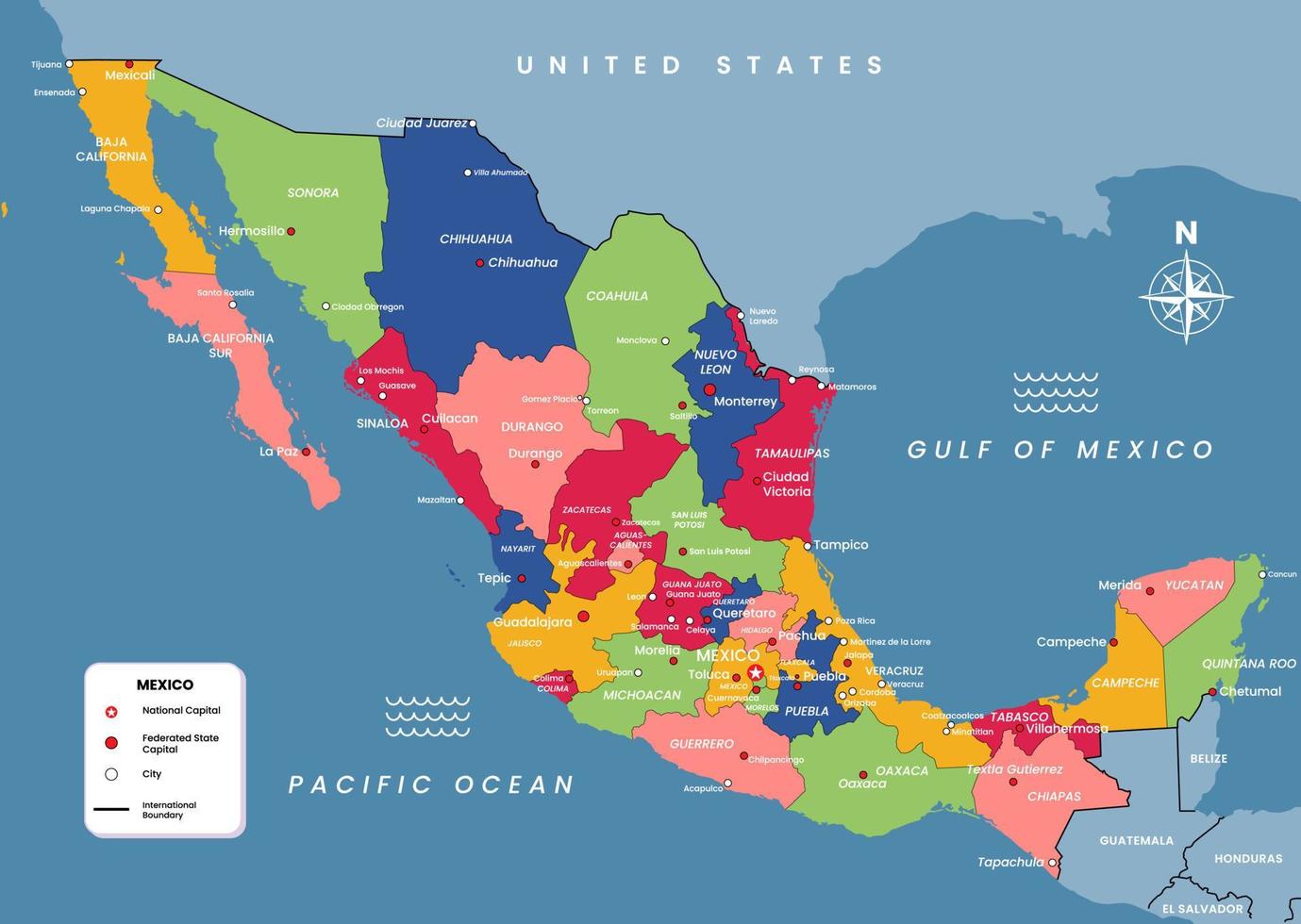
Mexico occupies the southern portion of the North American continent, serving as a massive geographic bridge between Anglo-America and Central America. If you're looking for exact placement, it spans roughly between latitudes 14° and 33° N and longitudes 86° and 118° W. It covers nearly 1.96 million square kilometers, making it the thirteenth-largest country globally by land area and the third-largest in Latin America.
The country is bounded by the United States to the north, the Pacific Ocean to the west and south, the Gulf of Mexico and the Caribbean Sea to the east, and Guatemala and Belize to the southeast. This unique placement creates a strategic nexus for international commerce, maritime shipping lanes, and cultural exchange across the Western Hemisphere.
The Continental and Regional Positioning
Geopolitically and physiographically, Mexico sits squarely within North America, sharing the continental landmass with Canada and the United States. However, its southern states—such as Chiapas and Tabasco—share ecological and cultural traits with Central America.
This transitional zone means Mexico experiences a blending of temperate northern environments and tropical southern ecosystems. The country's narrowest point is the Isthmus of Tehuantepec in the southeast, where only about 200 kilometers separate the Gulf of Mexico from the Pacific Ocean. This narrow corridor has historically functioned as a vital logistical and commercial bottleneck.
Detailed Breakdown of Mexico's Borders
Mexico's terrestrial and maritime boundaries shape its geopolitical reality. The layout of these borders dictates migration patterns, trade flows, and diplomatic ties.
- Northern Border: Shares a 3,145-kilometer land boundary with the United States, stretching from San Diego/Tijuana on the west coast to the Gulf of Mexico on the east. It ranks as one of the most frequently crossed international borders in the world. The border touches four U.S. states: California, Arizona, New Mexico, and Texas.
- Southeastern Borders: Shares a 958-kilometer border with Guatemala and a 250-kilometer border with Belize. These borders feature dense tropical rainforests, rivers like the Usumacinta, and mountainous terrain.
- Maritime Boundaries: Features more than 9,300 kilometers of coastline along the Pacific Ocean and the Gulf of California to the west, and roughly 2,800 kilometers along the Gulf of Mexico and the Caribbean Sea to the east.
Topographical Features and Internal Geography
The interior of Mexico is dominated by rugged mountain ranges, high plateaus, and coastal lowlands. The Sierra Madre mountain system is the backbone of the country's topography, consisting of three main ranges:
- Sierra Madre Occidental: Runs parallel to the western coast down toward the central plateau, creating deep canyons like the Copper Canyon system.
- Sierra Madre Oriental: Runs down the eastern side of the country, dropping sharply toward the Gulf of Mexico coastal plain.
- Eje Volcánico Transversal (Trans-Mexican Volcanic Belt): Crosses central Mexico from west to east. This zone contains high volcanic peaks, including Pico de Orizaba, Popocatépetl, and Iztaccíhuatl.
Between the eastern and western mountain ranges lies the Mexican Altiplano (Central Plateau), an elevated basin where a significant portion of the population lives. Mexico City sits in the Valley of Mexico, an enclosed basin within this southern section of the plateau at an elevation of roughly 2,240 meters.
Economic and Strategic Significance
Mexico's physical positioning gives it distinct commercial advantages. With direct access to both the Pacific and Atlantic basins (via the Gulf of Mexico), the country plugs directly into maritime routes connecting Asia, Europe, and the Americas.
Its land connection to the United States under trade agreements like the United States-Mexico-Canada Agreement (USMCA) facilitates cross-border supply chains. Manufacturing hubs in northern and central states move goods rapidly via highway and rail corridors straight into the North American consumer market.
Frequently Asked Questions
Is Mexico considered part of North America or Central America?
Mexico is geographically and politically part of North America. While its southernmost states border Central American nations, the country as a whole belongs to the North American continent alongside Canada and the United States.
What oceans and seas surround Mexico?
Mexico is bounded by the Pacific Ocean to the west and south (including the Gulf of California) and by the Atlantic basin's Gulf of Mexico and Caribbean Sea to the east.
How long is the border between Mexico and the United States?
The boundary spans approximately 3,145 kilometers (1,954 miles) from the Pacific Coast to the Gulf of Mexico, bordered by four U.S. states and six Mexican states.
Why is Mexico's geographic location important for trade?
Its position acts as a literal land bridge between North and South America while offering dual-ocean access for shipping. Combined with its direct border with the world's largest economy, it functions as an ideal logistics hub for global manufacturing and distribution.



