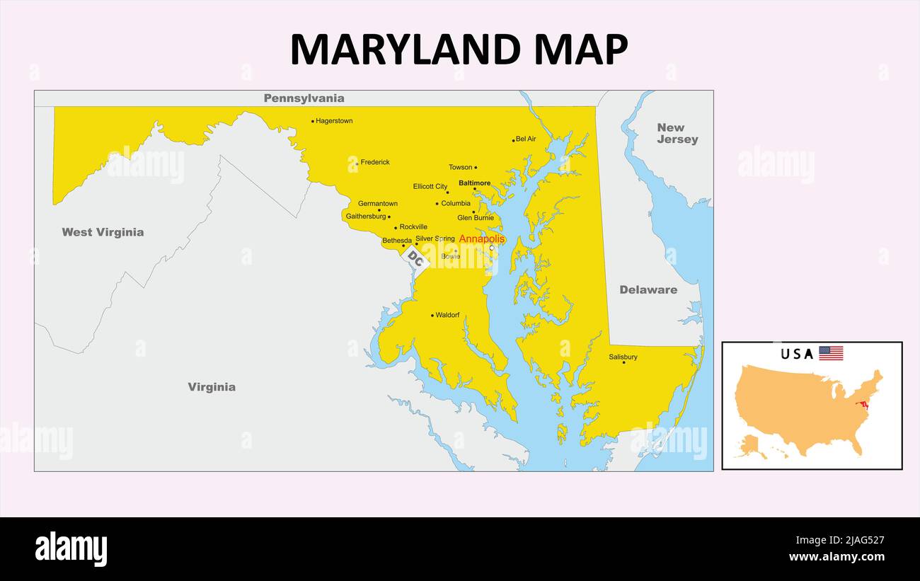
Maryland sits squarely in the Mid-Atlantic region of the United States, serving as a critical geographic and cultural bridge between the American North and South. Positioned on the country's Eastern Seaboard, the state features a compact yet exceptionally diverse layout that packs coastal plains, rolling hills, and rugged mountain ridges into just over 12,400 square miles. If you're tracing the state on a standard political map, it's defined by unique boundaries shaped by historical compromises, major rivers, and the massive estuary that dictates its internal geography.
Understanding where Maryland lies requires looking past simple cardinal directions. The state touches several major jurisdictions, wraps completely around the nation's capital on multiple sides, and boasts a coastline that creates thousands of miles of tidal shoreline.
Bordering States and Physical Boundaries
Maryland's borders are defined heavily by natural waterways and historic surveying lines. To the north, the state is separated from Pennsylvania by the famous Mason-Dixon Line, a landmark boundary surveyed in the 1760s that historically came to represent the dividing line between free and slave states before the Civil War.
On the east, Maryland shares a straight-line border with Delaware across the Delmarva Peninsula, terminating at the Atlantic Ocean. The southern and western boundaries are heavily shaped by water:
- The Potomac River: This major river forms almost the entirety of the southern and southwestern border, separating Maryland from Virginia and West Virginia.
- The Western Panhandle: West Virginia also wraps along Maryland's northwestern edge, creating a narrow geographic neck where the state pinches down to just a few miles wide near Hancock before expanding into the Appalachian mountains.
- The District of Columbia: Carved largely out of original Maryland territory (along with a portion from Virginia that was later retroceded), D.C. sits along Maryland's southern border, surrounded on three sides by Montgomery and Prince George's counties.
You can review official geographic state data directly through the U.S. Census Bureau.
The Chesapeake Bay: Maryland's Defining Feature
You can't discuss Maryland's location or layout without examining the Chesapeake Bay, the largest estuary in the United States. The bay cuts directly north through the middle of the state, slicing Maryland into two distinct cultural and geographic halves: the Eastern Shore and the Western Shore.
- The Eastern Shore: Generally flat, rural, and agriculturally rich, this region sits low on the coastal plain and relies heavily on the seafood and poultry industries.
- The Western Shore: More heavily populated, this side houses major urban centers like Baltimore and Annapolis, along with the sprawling suburban communities surrounding Washington, D.C.
Because the Chesapeake Bay and its countless tidal tributaries weave deep inland, Maryland possesses roughly 3,200 miles of shoreline, making water access a central theme of its economy, transportation networks, and daily lifestyle.
Latitude, Longitude, and Climate Positioning
Latitudinally, Maryland spans between roughly 38°N and 40°N, placing it in a temperate climate zone with four distinct seasons. Its longitude stretches from about 75°W on the Atlantic coast to 80°W in the rugged mountains of the western panhandle.
This variation in longitude and elevation creates stark regional differences within a relatively small area:
- Coastal Plain: Low-lying, sandy soils near the ocean and bay experience milder winters influenced by marine air.
- Piedmont Plateau: Rolling hills characterize the central corridor where Baltimore and the state capital of Annapolis sit.
- Appalachian Region: The far western edge rises significantly, culminating at Hoye Crest on Backbone Mountain, the state's highest point at 3,360 feet above sea level. Winters here are notably colder and feature heavier snowfall than the rest of the state.
Strategic Economic and Political Position
Maryland's location has made it a vital hub for trade and defense since the colonial era. The Port of Baltimore provides a deep-water shipping gateway directly into the industrial interior of the Mid-Atlantic. Furthermore, the state's proximity to the federal government in Washington, D.C., heavily shapes its economy, housing market, and workforce.
Many federal agencies, military installations—such as Fort Meade and Aberdeen Proving Ground—and defense contractors choose to base operations in Maryland due to this strategic geographic placement.
Frequently Asked Questions
Is Maryland considered part of the Northeast or the South?
Maryland is officially classified by the U.S. Census Bureau as part of the South region (specifically the South Atlantic division), but culturally and economically, it is most commonly viewed as a Mid-Atlantic state that bridges Northeastern and Southern characteristics.
What is the capital of Maryland?
The capital is Annapolis, located on the Severn River along the western shore of the Chesapeake Bay. Annapolis is famous for housing the United States Naval Academy.
Does Maryland touch the Atlantic Ocean?
Yes. While the majority of Maryland's eastern border is blocked by Delaware, the state owns a small stretch of Atlantic coastline at Ocean City on the southeastern tip of the Delmarva Peninsula.
Why is Maryland shaped so strangely on a map?
Maryland's unique and irregular borders stem from 17th-century royal land grants, historical disputes with Pennsylvania that required the Mason-Dixon Line, and the later ceding of land to form Washington, D.C.



