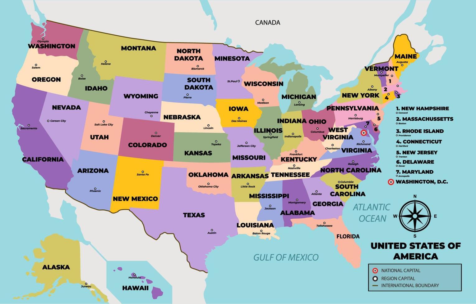
Where is Las Vegas located? Las Vegas sits in the southeastern corner of Nevada, nestled within a broad arid basin known as the Las Vegas Valley. Positioned right in the heart of the Mojave Desert, the city serves as the seat of Clark County and stands as an urban oasis surrounded by rugged mountain ranges.
Understanding where Las Vegas is located requires looking beyond state borders and deep into the unique topography of the American Southwest. The city isn't just a random neon mirage; its exact geographic placement dictated its growth, climate, and water supply.
Geographic Coordinates and Regional Placement
Las Vegas sits at roughly 36 degrees north latitude and 115 degrees west longitude. On a broader map of the United States, the city occupies the western region, positioned roughly 300 miles northeast of Los Angeles and about 450 miles southeast of San Francisco.
Within Nevada, the city clings to the southern tip of the state. This placement puts it close to major geographic boundaries:
- California Border: Roughly 40 miles to the southwest via Interstate 15.
- Arizona Border: Approximately 25 miles to the east, across the Colorado River.
- Utah Border: Roughly 120 miles to the northeast.
This strategic location along major regional corridors made it an essential stopover long before mega-resorts ever lined the boulevard.
The Mojave Desert and Valley Topography
The city's environment is defined by its position in the Mojave Desert, a transitional desert spanning southeastern California, southern Nevada, southwestern Utah, and northwestern Arizona. Unlike the sandy dunes of the Sahara, the Mojave is characterized by basin-and-range topography, meaning jagged mountain ranges alternate with wide, dry valleys.
The Las Vegas Valley sits at an elevation of about 2,000 feet above sea level. It's ringed by several distinct mountain formations:
- The Spring Mountains: Rising to the west, featuring Charleston Peak at nearly 12,000 feet.
- The Sheep Mountains and Las Vegas Range: Framing the northern and eastern edges of the valley.
- The Black Mountains: Stretching toward the southeast near the Colorado River.
These enclosing peaks create a rain shadow effect, blocking most incoming moisture from the Pacific Ocean and resulting in an arid, hot desert climate with minimal annual rainfall. According to the U.S. National Park Service, this rugged isolation shaped the unique flora of the region, including hardy creosote bushes and native Joshua trees.
The Myth of the Strip: Geography vs. Municipality
A common geographic misconception involves the famous Las Vegas Strip. Millions of visitors walk the Strip every year, assuming they're inside the official city limits of Las Vegas. In reality, most of the iconic mega-resorts and casinos don't sit in Las Vegas at all.
The municipal boundaries of Las Vegas cover downtown and the historic Fremont Street area, but the 4.2-mile stretch of the Las Vegas Strip actually runs through unincorporated Clark County towns named Paradise and Winchester.
- Downtown Las Vegas: The historical core, home to City of Las Vegas municipal offices and older casino properties.
- The Las Vegas Strip: Technically located in Paradise, Nevada, managed by Clark County rather than city officials.
- Surrounding Suburbs: Municipalities like Henderson, North Las Vegas, and Enterprise absorb the rest of the sprawling metropolitan population.
Climate and Water Realities in an Arid Basin
Living in a desert basin brings extreme weather patterns. Summer temperatures routinely soar past 100 degrees Fahrenheit, while winters remain mild with occasional chilly nights. Because the valley floor traps heat, urban heat island effects amplify summer temperatures even further.
Water security remains the primary geographic challenge for the region. Natural precipitation averages only about four inches per year. To sustain a major metropolitan population and millions of tourists, the city relies heavily on the Colorado River system, primarily stored upstream in Lake Mead. According to the U.S. Bureau of Reclamation, managing this vital water source is critical for the long-term viability of the entire desert settlement.
Frequently Asked Questions
Is Las Vegas part of Death Valley?
No, Las Vegas is separate from Death Valley, though they share the same overarching desert ecosystem. Death Valley National Park sits about 100 miles west of Las Vegas across the state line in California.
Why was Las Vegas built in the middle of a desert?
Early settlement started because of natural artesian springs in the valley floor, which provided water for travelers and Native American tribes crossing the Mojave. Later, the construction of the San Pedro, Los Angeles and Salt Lake Railroad turned the spot into a vital refueling and maintenance stop.
Does it ever snow in Las Vegas?
Yes, snowfall does occur occasionally in the valley during winter months, though it's rare and rarely sticks for long. However, the surrounding mountains, especially Mount Charleston, receive heavy winter snowpacks.
What county is Las Vegas in?
Las Vegas is located entirely within Clark County, Nevada, which encompasses the entire southern tip of the state and holds the vast majority of Nevada's total population.



