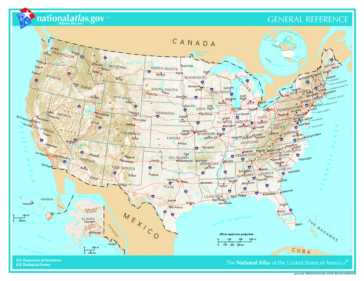
Where is Boston? It's situated on the coast of eastern Massachusetts along Massachusetts Bay, an arm of the Atlantic Ocean. As the capital of the Commonwealth of Massachusetts and the largest city in the six-state New England region, Boston anchors the northeastern corridor of the United States. Geographically, it sits at approximately 42.3601 degrees north latitude and 71.0589 degrees west longitude, positioned roughly 215 miles northeast of New York City and 100 miles south of Portland, Maine.
Understanding where Boston is requires looking beyond simple coordinates. The city's identity is tied to its coastal geography, its evolution from a tiny tidal peninsula into a major metropolis, and its role as the economic and cultural engine of New England. Whether you're tracking its position on a map or exploring its revolutionary roots, this guide breaks down everything you need to know about its physical layout, regional context, and historical significance.
Regional Geography: Where Boston Sits Within New England
New England comprises six states: Maine, New Hampshire, Vermont, Massachusetts, Rhode Island, and Connecticut. Boston serves as the undisputed cultural and economic capital of this northeastern pocket.
Positioned in eastern Massachusetts, the city forms the core of the Greater Boston metropolitan statistical area, which houses nearly five million residents. It's bound by the Atlantic Ocean to the east through Boston Harbor, flanked by Cambridge and Somerville to the north and west, and bordered by suburban communities like Quincy to the south.
The region's topography is shaped by the Boston Basin, an ecoregion characterized by low rolling hills, coastal estuaries, and tidal rivers like the Charles and the Mystic. This coastal positioning made it an ideal harbor for colonial shipping, setting the stage for its growth into a dominant trading port. You can learn more about regional planning and data through the U.S. Census Bureau.
From Shawmut Peninsula to Modern Metropolis
When English Puritans arrived in 1630, they didn't settle on the sprawling mainland seen today. They chose the Shawmut Peninsula, a narrow, hilly landmass connected to Roxbury by a thin strip of land called a neck.
Over the centuries, Boston outgrew its natural boundaries. Through massive land reclamation projects in the 19th century, the city filled in surrounding coves, tidal flats, and marshes with earth hauled down from hills like Beacon Hill. Neighborhoods like the Back Bay and the South End rest entirely on engineered land, transforming a cramped colonial outpost into a cohesive modern city.
Despite these physical expansions, Boston remains remarkably compact compared to other major American metropolises. Walking across the city center reveals narrow, winding streets that often follow old colonial cow paths rather than a rigid modern grid.
Navigating Boston: Key Landmarks and Layout
Because Boston's layout evolved organically over four centuries, traditional navigation can test newcomers. Yet its historic core is entirely pedestrian-friendly.
The Freedom Trail offers a 2.5-mile red-brick walking route that links sixteen nationally significant historic sites, including the Old State House, Faneuil Hall, and the USS Constitution.
- Downtown and the Financial District: Anchored around state government buildings and modern high-rises, blending colonial brick with contemporary glass.
- The North End: Boston's oldest residential neighborhood, famous for its Italian bakeries, historic narrow alleys, and the Paul Revere House.
- Back Bay: Known for grand Victorian brownstones, upscale shopping along Newbury Street, and institutional landmarks like the Boston Public Library.
- Beacon Hill: Characterized by gas lamps, brick sidewalks, and Federal-style row houses ascending toward the Massachusetts State House.
Common Misconceptions About Boston's Geography
Travelers and map-readers frequently encounter a few persistent mix-ups when studying Boston and its surroundings:
- Boston vs. Cambridge: Many assume Harvard University and the Massachusetts Institute of Technology (MIT) sit inside Boston proper. In reality, both elite institutions occupy neighboring Cambridge, located just across the Charles River.
- The Scale of the City: Visitors often expect a sprawling grid like Chicago or Los Angeles. Boston proper covers a relatively small land area of roughly 48 square miles, making it easy to traverse neighborhoods on foot or via the local transit system, known locally as "the T".
- New England State Borders: People frequently mistake Boston's metropolitan reach for state lines. While Greater Boston bleeds into southern New Hampshire and parts of Rhode Island economically, the city itself sits squarely within Suffolk County, Massachusetts.
Frequently Asked Questions
What time zone is Boston in?
Boston operates in the Eastern Time Zone (ET), observing Eastern Standard Time (UTC-5) during winter and Eastern Daylight Time (UTC-4) from mid-March to early November.
Is Boston considered part of the Northeast megalopolis?
Yes. Boston sits at the northern terminus of the BosWash corridor, a massive urban megalopolis spanning from Boston down through New York City, Philadelphia, and Baltimore to Washington, D.C.
How far is Boston from other major New England hubs?
Boston sits roughly 50 miles north of Providence, Rhode Island, 100 miles southwest of Portland, Maine, and about 90 miles east of Worcester, Massachusetts.
Why is Boston called "The Hub"?
Oliver Wendell Holmes Sr. famously dubbed Boston "the hub of the solar system" in 1858, suggesting it was the intellectual center of the universe. Over time, the moniker was shortened to "The Hub," reflecting its status as the commercial and cultural center of New England.



