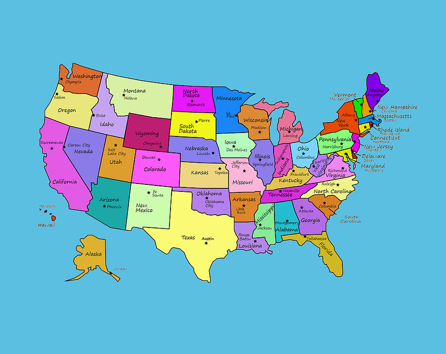
When people see the postal abbreviation MD, they're looking at Maryland, one of the original thirteen states that formed the United States. Located in the Mid-Atlantic region, Maryland sits just north of Washington, D.C., and shares borders with Pennsylvania, Delaware, West Virginia, and Virginia. If you're trying to figure out where mail is heading or trying to place the state on a blank map, understanding its distinct geographic footprint helps clear up the confusion.
Maryland occupies a unique position in American geography and history. It spans from the rolling Appalachian Mountains in the west to the low-lying coastal plains and the massive Chesapeake Bay in the east. Because of its irregular shape and central location along the East Coast, it functions as both a bridge between the American North and South and a powerhouse of early colonial and federal history.
Geographic Profile and Regional Location
Maryland belongs to the Mid-Atlantic region of the United States. Its borders touch several key jurisdictions, shaping both its economy and its culture:
- North: Pennsylvania, separated largely by the historic Mason-Dixon line.
- East: Delaware and the Atlantic Ocean.
- South and West: Virginia and West Virginia, largely delineated by the winding course of the Potomac River.
The state's most defining geographic feature is the Chesapeake Bay, which splits Maryland into two distinct landmasses known as the Eastern Shore and the Western Shore. This massive estuary creates thousands of miles of shoreline, making the state's economy and lifestyle deeply tied to maritime trades, seafood, and shipping.
Early History and Foundation
Maryland's origin story starts in the early 17th century. King Charles I of England granted a charter for the territory to George Calvert, the first Lord Baltimore, as a haven for persecuted English Catholics. Though George Calvert died before the charter was officially signed, his son Cecil Calvert, the second Lord Baltimore, carried out the vision.
In 1634, the first settlers arrived on the ships Ark and Dove, establishing the settlement of St. Mary's City. Unlike purely commercial ventures further north, Maryland experimented early with religious toleration, passing the Maryland Toleration Act of 1649, which was an early milestone in the legal protection of freedom of worship for trinitarian Christians.
During the American Revolution, Maryland earned the nickname The Old Line State from General George Washington, who praised the bravery of Maryland troops—specifically the "Maryland 400"—for holding off British forces at the Battle of Long Island in 1776, allowing the rest of the Continental Army to escape. Later, parts of Maryland were carved out to help form the federal capital district of Washington, D.C.
Culture, Economy, and Modern Identity
Today, Maryland boasts a population of over six million people and features a diverse economy. The state's proximity to the federal government means a large portion of the workforce engages in public administration, defense, aerospace, and advanced biotechnology. Institutions like the National Institutes of Health and Johns Hopkins University anchor the region as a hub for scientific research.
Culturally, Maryland is famous for several regional staples:
- Blue Crabs: Harvested directly from the Chesapeake Bay and heavily seasoned with traditional spice blends.
- The State Flag: One of the most recognizable and distinct heraldic flags in the world, combining the banners of the Calvert and Crossland families.
- Maritime Heritage: Sailing, boat building, and commercial fishing remain central to towns along the Eastern Shore.
Common Misconceptions About MD
People frequently confuse Maryland with other geographic markers or abbreviations. Here are a few clarifications:
- MD vs. Medical Doctor: While "MD" stands for Maryland in postal addresses, it also stands to designate a medical doctor in professional settings. Context always clarifies the meaning.
- Annapolis vs. Baltimore: Many assume Baltimore is the capital because of its size, but the state capital is Annapolis, home to the United States Naval Academy.
- Mason-Dixon Line: People often treat this line as a pure cultural boundary, but it specifically marks the legal border surveyed between Maryland and Pennsylvania in the 1760s to settle a land dispute.
Frequently Asked Questions
What time zone is Maryland in?
Maryland operates on Eastern Standard Time (EST) and observes Eastern Daylight Time (EDT) during the spring and summer months.
Is Maryland considered a Southern or Northern state?
Officially, the U.S. Census Bureau classifies Maryland in the South region. However, culturally and economically, it bridges the Mid-Atlantic, blending northern urban influences with southern historical roots.
What is the largest city in Maryland?
Baltimore is the largest city and economic center in the state, famous for its historic Inner Harbor, arts scene, and major port facilities.
Why is Maryland shaped so strangely on the map?
The boundaries stem from historic 17th-century royal land grants, protracted border disputes with William Penn's Pennsylvania colony, and the later ceding of land to create Washington, D.C.



