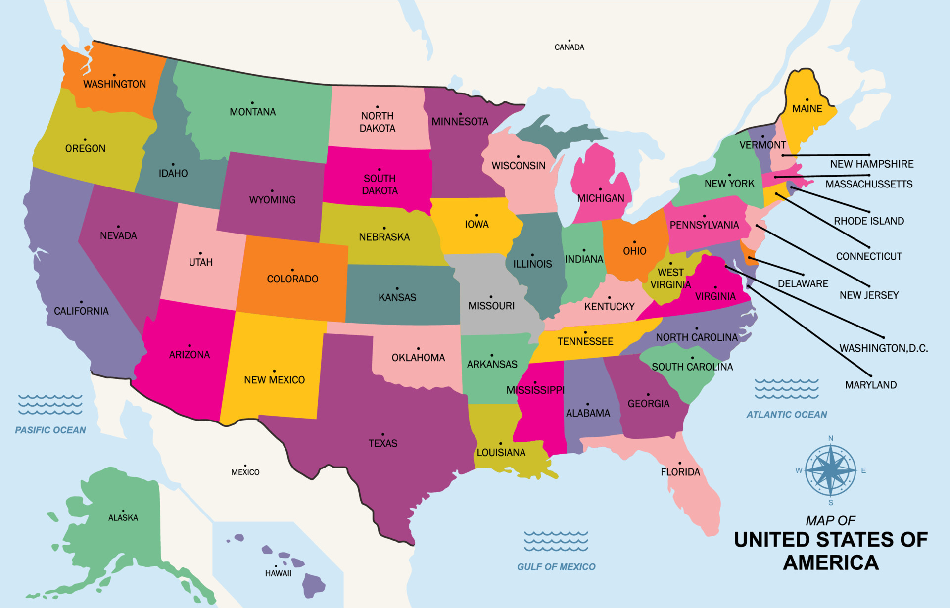
Tracing the political geography of the American East Coast reveals an intricate network of states, boundaries, and historical corridors. Stretching from the rugged northern shores of Maine down to the subtropical wetlands of Florida, the Atlantic Seaboard shapes a massive portion of the nation's political, economic, and cultural identity. Understanding how these state lines map out requires looking past simple outlines to see how geography dictates governance, demographics, and regional power.
The Eastern Seaboard contains fourteen states with direct Atlantic coastlines, alongside deeply integrated interior neighbors like Pennsylvania and Vermont. This territory holds over 125 million residents, making it one of the most densely populated and politically influential corridors in the world.
Defining the Atlantic Seaboard States
Geographers and political scientists divide the East Coast into distinct sub-regions. Each sub-region shares historical roots and economic drivers that influence state-level politics.
New England
The northern anchor of the Atlantic Seaboard consists of six states, five of which touch the ocean:
- Maine: Known for its long jagged coastline and expansive northern forests bordering Canada.
- New Hampshire: Features a brief coastal strip along the Atlantic coupled with heavy mountainous terrain.
- Vermont: Completely landlocked yet culturally and economically tied into the New England political grid.
- Massachusetts: Anchored by Boston, serving as the historical and political heart of the northern seaboard.
- Rhode Island: The smallest state by area, dominated by Narragansett Bay and maritime borders.
- Connecticut: Blends coastal access on Long Island Sound with dense suburban corridors linked to New York.
The Mid-Atlantic
Moving south, the Mid-Atlantic corridor serves as the political and financial engine of the country. This zone includes:
- New York: Combines a massive upstate region with the global financial powerhouse of New York City.
- New Jersey: The most densely populated state in the country, sandwiched between two major metropolitan giants.
- Pennsylvania: Mostly landlocked but maintains a vital maritime gateway via the Delaware River ports.
- Delaware: A small coastal state with a massive corporate legal footprint along the Atlantic drainage basin.
- Maryland: Encircles the Chesapeake Bay and shares the federal district of Washington, D.C.
The South Atlantic
The southern stretch of the seaboard transitions into warmer climates, expansive agricultural tracts, and rapidly growing urban centers:
- Virginia: Features a complex coastal geography defined by the Chesapeake Bay and Hampton Roads.
- North Carolina: Spans from the Outer Banks barrier islands across the Piedmont to the Appalachian Mountains.
- South Carolina: Known for historic coastal ports like Charleston and a low-country geography.
- Georgia: Reaches the Atlantic via a compact coastal fringe bordered by barrier islands and salt marshes.
- Florida: Forms the southern terminus of the East Coast, featuring extensive coastlines along both the Atlantic Ocean and the Gulf of Mexico.
Political Geography and State Boundaries
Unlike the geometric, straight-line boundaries found in the western United States, East Coast state lines trace natural features, colonial land grants, and historical compromises. Rivers, mountain ridges, and coastal bays dictated where early colonial charters ended and modern states began.
For instance, the Mason-Dixon line historically separated Pennsylvania from Maryland, establishing a cultural and political divide between the North and South. Similarly, the course of the Hudson River and the Delaware River shaped the precise territorial limits of New York, New Jersey, and Pennsylvania. Because these boundaries were drawn long before modern surveying technology, they often follow winding river thalwegs or arbitrary royal decrees from the British Crown.
Federal representation on the East Coast reflects centuries of shifting populations. While northern states like New York and Massachusetts have experienced slower relative population growth, southern Atlantic states like Florida, Georgia, and North Carolina routinely gain congressional seats following decennial census updates.
Economic Corridors and Urban Sprawl
The political geography of the Atlantic Seaboard is heavily defined by the Northeast Megalopolis, a continuous chain of metropolitan areas running from Boston down through New York, Philadelphia, and Baltimore to Washington, D.C. Sociologist Jean Gottmann termed this integrated zone "Megalopolis" in the 1960s, noting how overlapping state jurisdictions must cooperate on massive infrastructure projects.
Interstate compacts manage shared resources across these borders. The Port Authority of New York and New Jersey bridges state lines to handle regional commerce, while agencies like the Amtrak rail corridor tie multiple state political systems into a single operational artery. Tax policies, environmental regulations on coastal erosion, and commercial shipping laws vary wildly from state to state, creating a patchwork of local governance along a shared body of water.
Common Cartographic and Geographic Misconceptions
When analyzing East Coast maps, several common errors often confuse researchers and students:
- Confusing Region with Coastline: Not every state included in regional definitions touches the ocean. Pennsylvania and Vermont are integral parts of the northeastern political network despite lacking direct Atlantic access.
- Overlooking Estuaries: Major water bodies like the Chesapeake Bay divide state landmasses politically while uniting them economically, leading to complex multi-state environmental management agreements.
- Assuming Uniform Density: While the corridor from Washington to Boston is hyper-urbanized, northern Maine and southern Georgia feature vast rural tracts with distinct political priorities.
According to geographic data from the U.S. Census Bureau, regional shifts continue to alter how federal funds and political influence are distributed across the Atlantic seaboard. For deeper cartographic details, reference official resources like the Library of Congress Geography and Map Division.
Frequently Asked Questions
How many states make up the US East Coast?
Fourteen states have direct coastlines along the Atlantic Ocean. When including closely linked interior states within the broader regional definition, the number extends to sixteen.
Why do East Coast state borders look irregular compared to Western states?
East Coast boundaries were established during the colonial era based on royal charters, river paths, and natural topography, whereas western states were mapped later using standardized latitude and longitude grids.
Is Pennsylvania considered an East Coast state?
Yes. Even though its direct ocean access is limited to the Delaware River estuary rather than the open Atlantic coast, it is culturally, historically, and economically classified as part of the Eastern Seaboard region.
Which is the largest East Coast state by land area?
Florida is the largest state geographically among those bordering the Atlantic Seaboard, followed closely by Georgia and New York.



