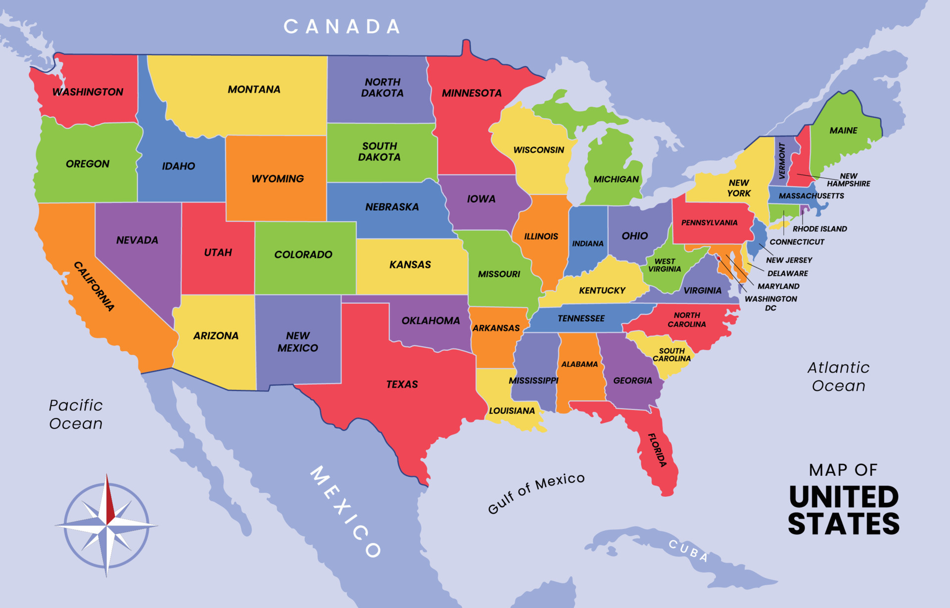
When you look at a standard political map of North America, the international boundary separating the United States and Mexico appears as a simple black line stretching nearly 2,000 miles from the Pacific Ocean to the Gulf of Mexico. Yet this line masks a complex, dynamic transcontinental region defined by shared river basins, vast deserts, and interconnected metropolitan areas. Understanding the geography of the US-Mexico border requires looking past simple state lines to examine the physical terrain, major binational hubs, and ecological zones that shape daily life across both countries.
The boundary spans 1,954 miles (3,145 kilometers), crossing four U.S. states—California, Arizona, New Mexico, and Texas—and six Mexican states—Baja California, Sonora, Chihuahua, Coahuila, Nuevo León, and Tamaulipas. Roughly half of this boundary is defined by a natural watercourse: the Rio Grande (known as Río Bravo in Mexico) handles the eastern portion from El Paso to the Gulf. The western portion cuts entirely across arid desert terrain, rolling plains, and mountainous patches like the Sonoran and Chihuahuan Deserts.
The Four U.S. Border States and Their Mexican Counterparts
Geography dictates that each border sector possesses distinct economic, climatic, and demographic traits. Mapping the border zone involves pairing specific U.S. regions with their immediate Mexican neighbors, where cross-border trade and migration flow continuously.
California and Baja California
At the westernmost terminus, the border meets the Pacific Ocean just south of San Diego and Tijuana. This coastal and Mediterranean climate zone represents one of the busiest land border crossings on earth, specifically at the San Ysidro Port of Entry. The topography here shifts rapidly from coastal mesas to the Cuyamaca Mountains before dropping into the Imperial Valley, an intensive agricultural region dependent on the Colorado River watershed.
Arizona and Sonora
Arizona shares a 373-mile border with the sprawling Mexican state of Sonora. This stretch is dominated by the Sonoran Desert, characterized by extreme summer temperatures and fragile ecosystems. Major binational corridors here include Nogales and San Luis. The terrain features rugged mountain ranges, known locally as sky islands, which rise abruptly from the desert floor.
New Mexico and Chihuahua
New Mexico shares a modest 180-mile border with the state of Chihuahua, anchored by the Columbus port of entry and the bustling urban pairing of El Paso (Texas) and Ciudad Juárez (Chihuahua), which sits immediately adjacent to the New Mexico state corner. This area sits within the high-elevation Chihuahuan Desert, framed by the Franklin Mountains and the broader Rio Grande rift valley.
Texas and Northern Mexico
Texas accounts for the largest share of the international boundary—roughly 1,254 miles—following the winding path of the Rio Grande. It borders four Mexican states: Chihuahua, Coahuila, Nuevo León, and Tamaulipas. The landscape varies dramatically from the rugged Big Bend region in West Texas, where deep limestone canyons flank the river, to the flat brushlands of the South Texas plains leading down to Brownsville and Matamoros at the Gulf of Mexico.
The Role of Natural Water Systems
Cartographers and hydrologists view the border through the lens of watersheds rather than just political lines. Water scarcity and management define the region's geopolitical layout.
The Colorado River is vital to the far western desert. By the time the river reaches the international boundary south of Yuma, its flow has been heavily depleted by agricultural and municipal use in both nations. Under international treaties managed by the International Boundary and Water Commission (IBWC), structured water allocations dictate how both countries share the remaining flow before the river historically trickled into its dry delta in Sonora and Baja California.
Farther east, the Rio Grande serves as the primary surface water source for millions of residents and vast tracts of farmland. Reservoirs like Elephant Butte in New Mexico and Lake Amistad along the Texas-Coahuila border regulate the river's erratic flow. Heavy seasonal rains can cause rapid flooding, while multi-year droughts shrink the river to a narrow stream, creating unique logistical hurdles for regional planners and environmental scientists.
Urban Pairs and Binational Economies
Maps of the border region often highlight "binational sister cities." These urban areas function economically and culturally as single integrated metropolitan zones, even though they are separated by international fences, ports of entry, and distinct legal jurisdictions.
- San Diego and Tijuana: A hub for technology, manufacturing, and cultural exchange, supported by multiple high-capacity border crossings.
- El Paso and Ciudad Juárez: A historic manufacturing powerhouse where supply chains for automotive and electronics industries cross back and forth multiple times during production.
- Laredo and Nuevo Laredo: The single largest inland port of entry for freight rail and commercial trucking between the two nations, moving billions of dollars in international cargo annually.
- McAllen and Reynosa: A booming center for agribusiness, energy, and assembly plants, anchored by the Rio Grande Valley's dense population network.
Examining these pairs reveals why traditional cartography falls short. Economic integration relies on synchronized infrastructure, shared freight corridors, and coordinated customs operations governed by frameworks like the United States-Mexico-Canada Agreement (USMCA).
Common Mistakes When Studying the Border Region
When analyzing maps of the US-Mexico border, students and researchers frequently fall into several conceptual traps:
- Treating the border as a flat, uniform strip: The terrain actually varies from sea-level coastal estuaries and scorching arid deserts to rugged mountain ranges exceeding 7,000 feet in elevation.
- Ignoring river shifts: Because the Rio Grande is a shifting alluvial river, historical treaties had to resolve how natural changes to the river channel impact national sovereignty, such as the famous Chamizal dispute in El Paso.
- Overlooking indigenous lands: Several sovereign tribal nations, including the Tohono O'odham Nation in Arizona, hold ancestral lands that straddle the international boundary, adding unique jurisdictional layers to map analysis.
Frequently Asked Questions
How long is the border between the United States and Mexico?
The official boundary stretches for 1,954 miles (3,145 kilometers) from the Pacific coast near San Diego to the mouth of the Rio Grande on the Gulf of Mexico.
Which U.S. state has the longest border with Mexico?
Texas has the longest shared border, accounting for approximately 1,254 miles of the total 1,954-mile boundary, entirely defined by the path of the Rio Grande.
Why is the Rio Grande used as a natural border?
Following the Treaty of Guadalupe Hidalgo in 1848 and the subsequent Gadsden Purchase, the meandering deep-water channel of the Rio Grande was chosen as a clear, pre-existing geographic marker to divide territorial sovereignty between the two expanding republics.
How many official ports of entry exist along the boundary?
Dozens of official land, rail, and sea-air ports of entry operate along the border, ranging from small rural crossings to massive multi-lane commercial hubs like Laredo and San Ysidro.



