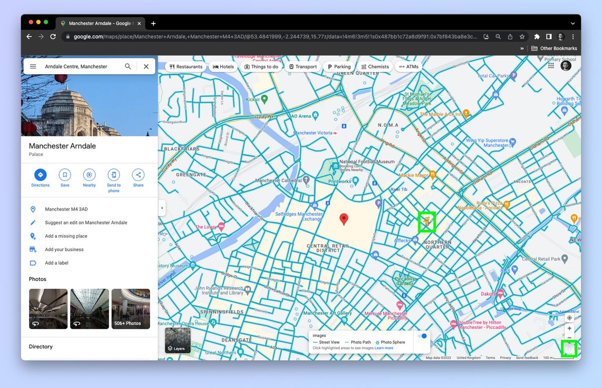
Modern mapping systems don't just point you from A to B; they actively reshape how metropolitan areas function, shifting billions of daily commuters through complex transit networks. If you're looking at how digital routing, sensor fusion, and real-time telemetry merge to control traffic, you're looking at the core of contemporary urban mobility.
Traditional paper maps gave static snapshots of geography, but today's navigation software processes millions of telemetry updates per second. Municipalities and logistics fleets rely on this data to cut down idle times, ease gridlock, and plan sustainable transit infrastructure. Let's look at how modern routing platforms operate under the hood, why city planners depend on them, and where the technology is heading next.
The Architecture of Real-Time Navigation Engines
Modern mapping platforms combine global positioning satellite constellations, device sensor arrays, and crowdsourced telemetry to calculate optimal routes. When you input a destination, the system doesn't just check distance; it runs pathfinding algorithms over live graphs where edges represent road segments and weights represent real-time congestion delays.
- Sensor Fusion: Mobile devices feed accelerometer and gyroscope data to help software determine whether a user is walking, cycling, driving, or riding public transit.
- Telemetry Feeds: Millions of active app users passively transmit anonymous speed and location data, creating a live heat map of traffic velocity.
- Predictive Modeling: Machine learning models analyze historical traffic patterns by day and hour to forecast bottlenecks before they form.
Indoor positioning systems represent another leap forward. Standard satellite signals can't penetrate large structures like transit hubs, airports, or subterranean shopping centers. To solve this, mapping providers use Bluetooth beacons, Wi-Fi fingerprinting, and device barometers to track vertical floor changes with high accuracy. According to research from the National Institute of Standards and Technology, indoor location accuracy has improved significantly, enabling seamless transitions from outdoor highway driving to precise indoor terminal navigation.
How City Planners Leverage Congestion Data
Urban planners no longer rely solely on manual traffic counts or decennial census surveys. They partner with mapping data providers to analyze anonymized movement trends across entire metropolitan grids. This shift from reactive to proactive infrastructure planning changes how cities manage streetscapes.
Municipalities use aggregate routing data to identify specific pain points:
- Bottleneck Identification: Pinpointing intersections where vehicle queues back up during specific peak windows.
- Signal Retiming: Adjusting traffic light phases dynamically to clear high-volume corridors faster.
- Transit Priority: Evaluating bus lane performance against general traffic speeds to justify dedicated transit corridors.
- Micromobility Planning: Mapping bicycle and scooter trip origins and destinations to install protected lanes where demand is highest.
For example, cities implementing adaptive traffic control systems have cut average commuter delays by noticeable margins. By feeding real-time vehicle density metrics directly into centralized municipal servers, traffic lights adjust cycle lengths on the fly, preventing gridlock from cascading through adjacent neighborhoods.
Logistics, Fleet Routing, and Economic Impacts
The commercial sector adopted advanced routing long before everyday drivers realized its full scope. Last-mile delivery fleets operate on tight margins where shaving seconds off individual stops yields massive annual savings in fuel and labor costs.
Enterprise routing engines factor in constraints that standard consumer apps often ignore, including vehicle weight ratings, overhead clearance limits, hazardous material restrictions, and delivery time windows.
- Left-Turn Minimization: Major delivery networks prioritize right-hand turns (in right-side driving countries) to reduce idle time at intersections and lower collision risks.
- Dynamic Re-sequencing: If a delivery driver encounters a road closure, the onboard dispatch system recalculates the remaining stop sequence instantly.
- Carbon Accounting: Fleets track fuel burn per route to meet corporate sustainability benchmarks and comply with municipal low-emission zone mandates.
These optimizations translate into lower operational expenses and reduced wear on municipal asphalt. Fewer idling trucks mean cleaner air for dense urban centers.
Environmental Benefits and Eco-Routing
Navigation apps now feature eco-routing algorithms designed to lower carbon emissions rather than simply minimize travel time or distance. These systems evaluate road grade, stop frequency, and vehicle acceleration profiles to suggest paths that burn less fuel.
Stopping and starting in heavy traffic burns significantly more fuel than maintaining a steady cruising speed on a slightly longer ring road. Eco-routing algorithms calculate these trade-offs, sometimes directing drivers down arterial roads with fewer traffic lights instead of congested short-cuts through residential streets.
The U.S. Department of Transportation highlights that smoothing traffic flow through intelligent routing can reduce individual vehicle emissions by noticeable percentages, contributing to broader climate goals without requiring immediate vehicle fleet electrification.
Privacy Concerns and Algorithmic Bias
As navigation platforms capture more granular movement data, privacy and equity concerns have grown. The constant collection of location telemetry creates detailed behavioral profiles of everyday citizens.
- Data Anonymization Limits: Studies show that anonymized location datasets can often be re-identified by cross-referencing timestamps with public records like home and work addresses.
- Algorithmic Redlining: When navigation apps route heavy commuter traffic through secondary residential streets to bypass highway congestion, they shift noise, pollution, and safety risks onto lower-income neighborhoods that lack traffic-calming infrastructure.
- Digital Divide: Communities with poor cellular coverage or residents without smartphones miss out on real-time transit alerts and micro-navigation tools.
Regulatory frameworks like the European Union's GDPR have forced companies to implement stricter data minimization practices, but balancing commercial mapping utility with individual privacy remains a complex challenge.
Frequently Asked Questions
How do navigation apps predict traffic before I hit a jam?
Apps combine real-time speed reports from active users with historical traffic databases. If historical data shows that a specific highway segment slows down every weekday at 5:00 PM, the app factors that pattern into your estimated arrival time even before congestion builds up.
Why do navigation apps sometimes send cars down residential side streets?
Routing algorithms prioritize minimizing travel time for individual users. When main arteries clog up, the software scans parallel side streets to find a faster path, often routing hundreds of vehicles through residential zones until those side streets also become congested.
What is eco-routing and how does it save fuel?
Eco-routing calculates paths based on fuel efficiency rather than distance or speed alone. It avoids steep hills, frequent stop-and-go intersections, and heavy congestion where engines burn excess fuel during acceleration.
Can GPS navigation work without a cellular connection?
Yes. Modern smartphones store base map data locally in cache memory. While live traffic updates require an internet connection, the GPS chip in your phone calculates your geographic coordinates directly from satellite signals without needing cellular data.


