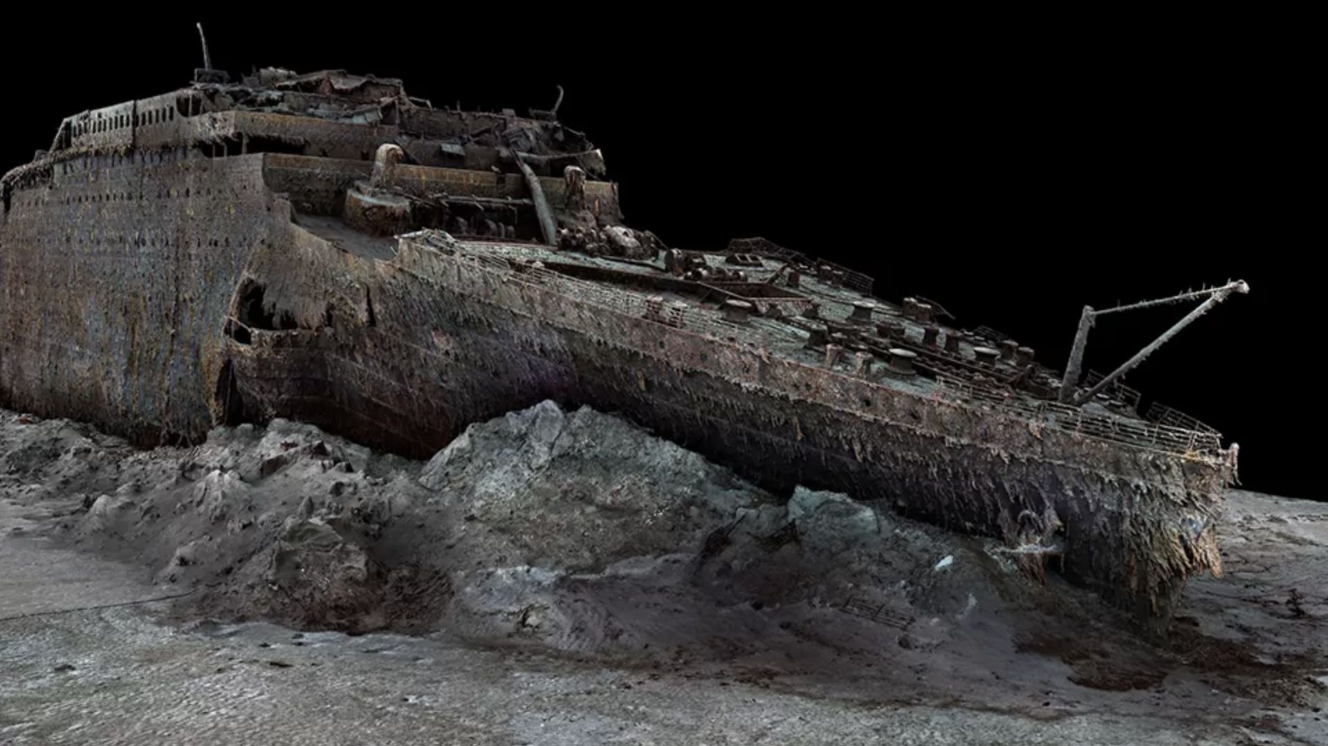
The RMS Titanic rests in two primary sections roughly 400 nautical miles off the coast of Newfoundland, Canada, trapped in total darkness at a depth of 12,500 feet. Located at coordinates 41°43'32"N, 49°56'49"W, the ship sits on the rolling terrain of the Grand Banks of the North Atlantic. Decades of sonar scans, robotic submersibles, and revolutionary 3D digital mapping have revealed the exact physical geography of this legendary underwater grave.
Finding the vessel required overcoming immense logistical hurdles posed by bone-chilling temperatures, corrosive salt water, and crushing pressure exceeding 6,000 pounds per square inch. Modern oceanography has transformed our understanding of how the ship broke apart and where its thousands of artifacts settled across the seabed.
The Journey to the Bottom: How the Ship Settled
When the Titanic struck an iceberg on the night of April 14, 1912, it took roughly two hours and forty minutes to slip beneath the waves. As the bow filled with water, the immense weight caused structural failure near the third and fourth funnels. The ship snapped in two near the surface.
The heavy forward section plunged nearly vertically, slamming into the sediment at a speed that embedded its nose deep into the mud. The bow remains remarkably intact, preserving details like anchor cranes, brass telegraphs, and portholes.
The stern suffered a catastrophic structural implosion due to trapped air pockets as it spiraled down. It hit the seabed about 2,000 feet away from the bow, crumpling into an unrecognizable mass of twisted steel, machinery, and fragmented decks. A massive debris field spanning several square miles connects the two main hull pieces, scattered with coal, porcelain, suitcases, and personal belongings.
Mapping the Abyss: From Sonar Blips to Full Digital Twins
For 73 years, the exact resting place of the liner eluded treasure hunters and oceanographers. Early sonar technology lacked the resolution to pinpoint targets at such extreme depths. Everything changed on September 1, 1985, when a joint French-American expedition led by Jean-Louis Michel and Dr. Robert Ballard discovered the wreck. Rather than searching blindly for the hull, Ballard tracked the wide trail of heavier debris—such as heavy boilers—which led them straight to the main wreckage.
Technological advances have revolutionized how researchers map the site. In 2023, Magellan Ltd. and Atlantic Productions captured over 700,000 sonar images to construct the first full-sized 3D digital scan of the Titanic.
- Submersible Photography: Early crewed submersibles like DSV Alvin and robotic ROVs like Jason Jr. gave humanity its first close-up view of the rust-covered decks.
- Side-Scan Sonar: High-frequency acoustic mapping allows scientists to chart the contours of the ocean floor without disturbing fragile artifacts.
- Photogrammetry: Millions of overlapping high-resolution photos are stitched together by computers to create interactive digital twins that reveal structural decay down to the millimeter.
The Physical and Biological Realities of the Wreck Site
The environment surrounding the wreck is hostile to human life and destructive to steel. The water temperature hovers just above freezing at roughly 33 degrees Fahrenheit (1 degree Celsius). Heavy deep-sea currents sweep across the Grand Banks, slowly shifting sediment and stressing weakened bulkheads.
Biological decay is happening faster than mechanical rust alone. A unique extremophile bacterium named Halomonas titanicae consumes the iron hull, creating hanging orange formations known as rusticles. Scientists estimate that these microorganisms will eventually consume the remaining structural steel, reducing the ship to a streak of rust on the ocean floor within the coming decades.
Protecting Deep Sea Heritage
Because the site serves as an underwater graveyard for more than 1,500 victims, international regulations govern who can visit or salvage artifacts. The United Nations Educational, Scientific and Cultural Organization (UNESCO) protects the wreck under the Convention on the Protection of the Underwater Cultural Heritage.
Salvage operations are legally restricted to non-destructive historical recovery. Expeditions must balance scientific documentation with respectful preservation. To learn more about maritime protection laws, visit UNESCO Underwater Heritage. For official documentation on maritime history and archives, consult the National Archives.
Frequently Asked Questions
Can you visit the Titanic wreck as a tourist?
Visiting the wreck requires specialized deep-diving submersibles capable of withstanding extreme pressure. While rare commercial expeditions have taken select researchers and passengers to the site, trips are prohibitively expensive, logistically complex, and heavily regulated by international maritime laws.
Is the interior of the Titanic accessible?
Most interior spaces are collapsed, filled with silt, or blocked by fallen bulkheads. While remote vehicles explored certain accessible rooms in the decades following discovery, ongoing structural decay makes entering the hull extremely dangerous and prone to cave-ins.
Why hasn't the Titanic been raised to the surface?
Engineering studies quickly proved that raising the ship is impossible. After more than a century in salt water, the metal is thoroughly compromised by bacterial corrosion and rust. Attempting to lift the hull would cause the fragile structure to disintegrate completely.
Who legally owns the artifacts recovered from the wreck?
RMS Titanic, Inc. holds exclusive salvage rights granted by a U.S. federal court, allowing them to recover and curate objects from the debris field. However, company agreements and international treaties dictate that human remains must be respected and artifacts cannot be sold into private collections.



