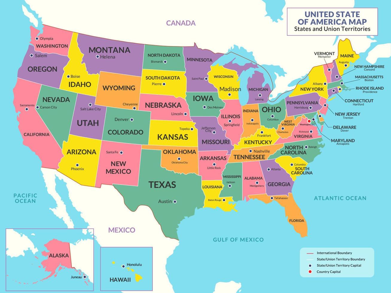
Louisiana anchors the northern edge of the Gulf of Mexico, sharing land borders with three distinct neighbors: Arkansas to the north, Mississippi to the east, and Texas to the west. While maps show neat lines dividing these jurisdictions, the reality on the ground is a fluid network of shared river basins, overlapping energy grids, and intertwined cultural lineages. Understanding how these adjacent territories interact explains much of the political and economic posture of the modern Gulf South.
Geography dictates these relationships long before politics intervene. The Mississippi River forms a major portion of the eastern boundary with Mississippi, while the Sabine River carves out the western frontier with Texas. To the north, the 33rd parallel north marks the flat, timber-rich transition into Arkansas. These physical parameters created early transit corridors that today support massive interstate commerce, pipeline networks, and shipping lanes vital to the entire country.
Texas: The Western Economic Heavyweight
Texas looms large over Louisiana's western flank, exerting a massive economic and demographic pull. The Sabine River acts as a political divider, but cross-border integration between Houston and cities like Lake Charles and Beaumont is absolute.
Energy infrastructure ties the two states together. The Texas-Louisiana corridor represents the beating heart of American petrochemical refining. Crude oil extracted offshore or imported via Gulf ports moves seamlessly across state lines through extensive pipeline grids owned by major operators documented by the U.S. Energy Information Administration. Workers commute across the state line daily, drawn by industrial plants, shipyards, and engineering firms.
Culturally, the boundary blurs in the Sabine region. East Texas shares deep historical ties with western Louisiana, blending Texan cowboy traditions with Cajun and Creole influences. Yet, political dynamics diverge sharply. While Texas operates under a distinct political and fiscal framework with rapid population growth, Louisiana faces different demographic shifts, creating a fascinating study in contrast between two neighboring energy powerhouses.
Arkansas: The Northern Timber and River Link
To the north, Arkansas shares a quieter, deeply rural land border with Louisiana. This frontier is defined less by heavy industrial corridors and more by shared river systems, agricultural valleys, and vast timberlands.
The Ouachita and Red rivers flow south out of Arkansas into Louisiana, carrying silt that built the fertile alluvial plains of northern parishes. Economically, timber and agriculture dominate this border zone. Forestry operations span both sides of the state line, feeding paper mills and lumber yards that supply national construction markets.
Demographically, northern Louisiana shares strong social ties with southern Arkansas. Small towns along the border rely on regional hubs in both states for healthcare, higher education, and retail. Politically, this northern tier shares conservative voting patterns and rural economic priorities that contrast with the more urbanized southern coast of Louisiana.
Mississippi: The Cultural and Historical Mirror
Across the Mississippi River to the east, Mississippi shares the deepest historical roots with Louisiana. The boundary follows the river in many places, though shifting channels and historical treaties have occasionally sparked legal disputes over water rights and island jurisdictions.
The connection between the two states is profoundly cultural. The Mississippi Delta region bleeds across the state line, giving birth to shared musical heritages, particularly blues and gospel. Cities like Natchez and Vicksburg sit as historical sentinels overlooking the river highway that unites communities on both banks.
In terms of commerce, agricultural trade and gaming tourism drive cross-border traffic. Interstate 10 connects New Orleans and Baton Rouge directly to the Mississippi Gulf Coast, creating a continuous tourism and seafood corridor. Despite these close ties, distinct legal traditions separate them; Louisiana retains its unique civil law system derived from French and Spanish colonial codes, while Mississippi follows traditional English common law.
The Gulf South Crossroads: Trade, Climate, and Infrastructure
The collective weight of these four states forms the Gulf South economic engine. Maritime shipping dominates the region, with the Port of South Louisiana and the Port of Houston handling massive shares of U.S. international tonnage. Barges move agricultural goods down the Mississippi River system from interior states like Illinois and Iowa, passing through Arkansas and past Mississippi before heading out to global markets through Louisiana ports.
Climate vulnerability unites these neighbors just as strongly as commerce. Coastal erosion, severe tropical storms, and rising sea levels affect Louisiana, Texas, and Mississippi alike. Intergovernmental bodies and regional planning groups coordinate on levee construction, wetland restoration, and disaster response strategies to protect vital energy and shipping infrastructure.
Common Misconceptions About Louisiana's Borders
- The Mississippi River boundary: Many assume the Mississippi River is the exact eastern border for the entire state, but the river actually flows entirely within Louisiana's borders in its lower stretches, while the state boundary with Mississippi runs through the middle of the river further north and down the main channel.
- Uniform culture: Observers often treat the Gulf South as culturally homogenous, ignoring the sharp contrast between the industrial Texas border, the timber-heavy Arkansas border, and the deep plantation history of the Mississippi border.
- Isolation: Far from being isolated by its swamps and bayous, Louisiana sits at the nexus of the nation's most active freight and energy corridors.
Frequently Asked Questions
Which states share a land border with Louisiana?
Louisiana is bordered by Texas to the west, Arkansas to the north, and Mississippi to the east. The Gulf of Mexico defines its southern boundary.
Why does Louisiana have parishes instead of counties?
When the territory was colonized by the French and Spanish, local governance was organized around Catholic church parishes. The naming convention stuck after statehood, making Louisiana the only U.S. state with parishes instead of counties.
How does Louisiana's legal system differ from its neighbors?
Unlike Texas, Arkansas, and Mississippi, which rely entirely on English common law, Louisiana's civil law system is rooted in the French Napoleonic Code and Spanish law, affecting property rights, contracts, and inheritance rules.
What is the primary economic link between Texas and Louisiana?
The cross-border energy corridor is the strongest economic link, featuring shared petrochemical refining complexes, extensive crude oil pipelines, and interdependent port facilities along the Gulf Coast.



