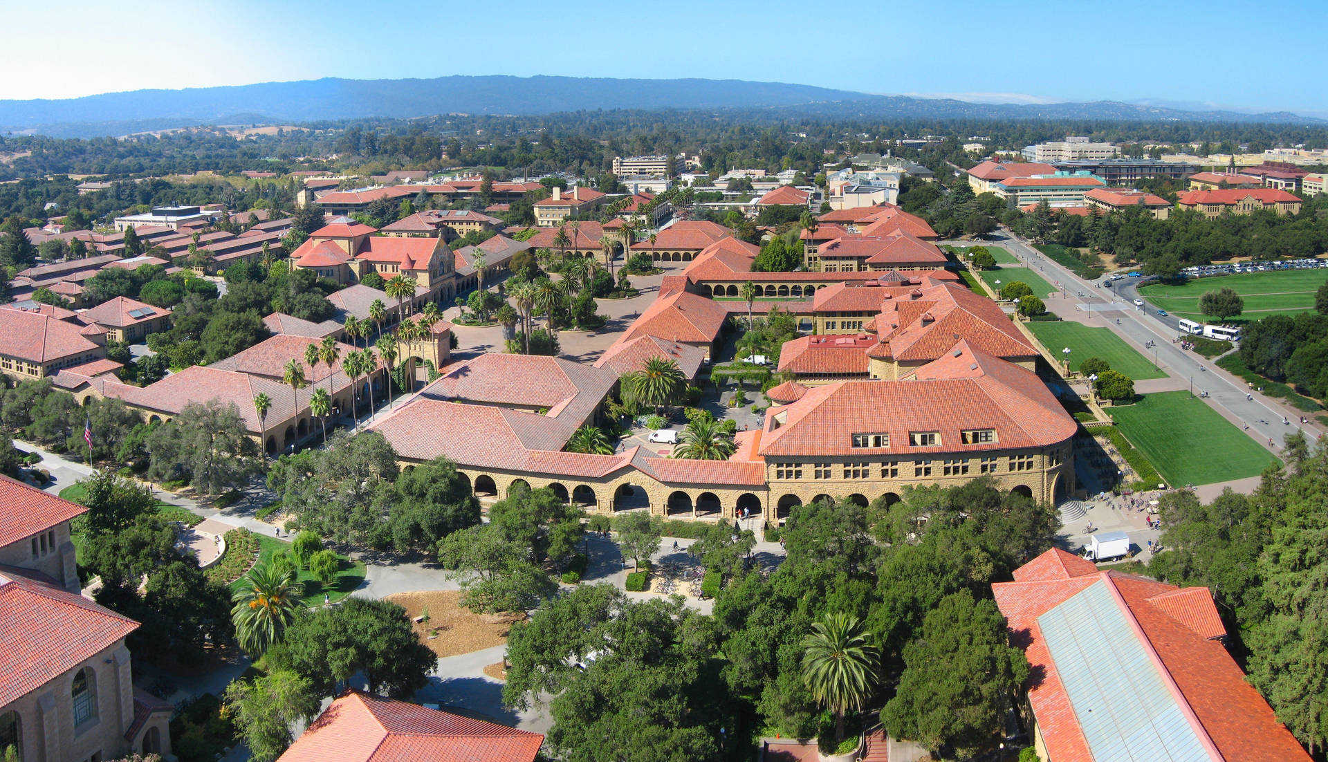
Navigating Stanford University requires understanding its massive footprint right in the heart of Silicon Valley. Spanning over 8,000 acres, the campus sits in Stanford, California, an unincorporated area adjacent to Palo Alto. If you're planning a visit for a campus tour, a conference, or a look at its famous landmarks, knowing where to go and how to get around saves you from wasting hours walking in circles.
Getting your bearings starts before you step foot on the grounds. The campus is bounded by major thoroughfares including El Camino Real, Stanford Avenue, Junipero Serra Boulevard, and Sand Hill Road. Central landmarks like the Main Quad, Memorial Church, and Hoover Tower anchor the historic core, while modern science and engineering labs stretch out toward the periphery.
Reaching the Campus and Regional Transit
Arriving from San Francisco International Airport (SFO) or San Jose International Airport (SJC) takes about 30 to 40 minutes by car, depending on traffic along US-101 or Interstate 280. If you prefer public transit, you can take Caltrain to the Palo Alto Station, which sits directly adjacent to the northern edge of the campus.
From the Palo Alto Caltrain Station, you can catch the free campus shuttle known as the Marguerite. This shuttle system loops through the academic core, student housing areas, and shopping districts on weekdays. You won't need a pass or a ticket to board the public Marguerite routes.
Parking Strategies and Visitor Permits
Driving to campus means dealing with regulated parking zones. Visitor parking spaces require payment via ParkMobile, which operates entirely through smartphone apps, web checkouts, or phone payments.
When setting your GPS, entering a central spot like the Tresidder Union parking lot helps you land near the middle of the action.
- Download the ParkMobile app before you arrive to save time on spotty cellular connections.
- Note your specific parking zone number from the signs posted in the lot.
- Pay for daily or hourly rates immediately upon parking, as enforcement officers patrol regularly.
- Avoid spaces marked for "A" or "C" permit holders unless you possess the proper university credentials, as these are strictly reserved for faculty, staff, and students.
Exploring Key Architectural and Academic Districts
The campus layout blends Spanish-colonial revival architecture with modern brutalism and contemporary glass designs. Walking down Palm Drive—a mile-long stretch flanked by hundreds of palm trees—brings you directly to the Oval and the historic Main Quad.
The Main Quad houses sandstone archways, red-tiled roofs, and the striking mosaic facade of Memorial Church. Just a short walk away, Hoover Tower offers an observation deck with panoramic views across Silicon Valley. Clear days let you spot the Santa Cruz Mountains to the west and the southern tip of the San Francisco Bay to the east.
Beyond the historic core, the campus separates into distinct zones:
- The Arts District: Located near Palm Drive and Museum Way, this area features the Cantor Arts Center—home to a massive collection of Auguste Rodin bronze sculptures—alongside the Anderson Collection.
- The Science and Engineering Quad: Situated on the western side of the central campus, this zone hosts cutting-edge laboratories, computing hubs, and collaborative spaces.
- The Athletics District: Located toward the southeast, housing Maples Pavilion, Stanford Stadium, and various aquatics and track facilities.
Common Mistakes Visitors Make
First-time visitors often underestimate the sheer physical scale of the grounds. Walking from the train station to the far side of the science buildings can easily take over forty minutes. Wearing comfortable walking shoes matters far more than matching a professional dress code.
Another frequent error involves ignoring parking restrictions on weekdays. Parking enforcement operates year-round, even when classes aren't in session. Assuming weekend rules apply on a Tuesday results in costly citations. Additionally, relying solely on cellular data can be frustrating inside thick concrete lecture halls, so downloading offline campus maps beforehand keeps you on track.
Frequently Asked Questions
Can anyone walk around the Stanford campus freely?
Yes, the outdoor grounds are open to the public for self-guided walking tours. While interior access to academic buildings, libraries, and residence halls is restricted to students and staff with ID cards, major landmarks like the Memorial Church and the Cantor Arts Center welcome everyday visitors.
Is photography allowed inside the Main Quad?
Casual photography for personal use is permitted anywhere outdoors on campus. Commercial shoots, drone flying, or tripod setups in high-traffic academic zones often require prior university permits.
How do I find the closest charging station for an electric vehicle?
Stanford features numerous electric vehicle charging ports across various parking garages and surface lots. You can view real-time station availability using the official Stanford Searchable Map by filtering for transportation layers.
Are dogs allowed on the campus grounds?
Leashed dogs are allowed on exterior walkways and open public spaces, but they aren't permitted inside university buildings, libraries, or dining halls. Owners must clean up after pets at all times.



