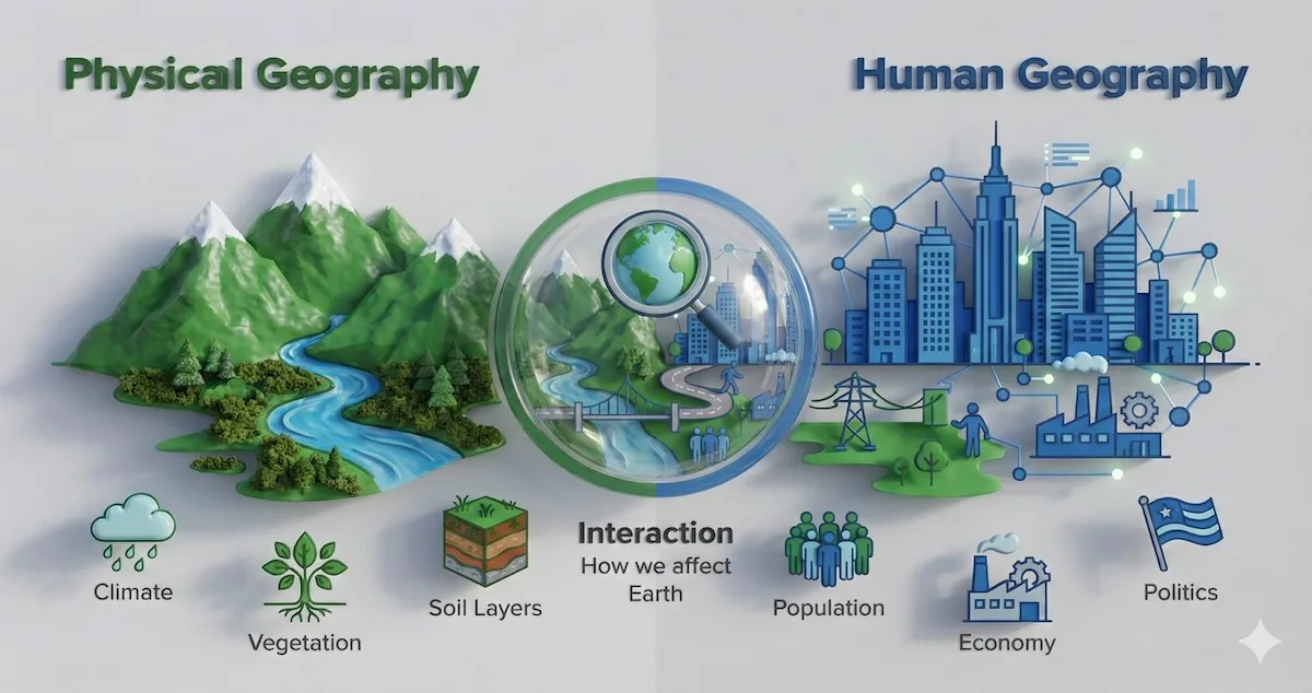
Spatial analysis sits at the intersection of human behavior and physical earth systems, revealing how invisible currents shape modern civilization. While traditional classrooms focus on rote memorization of country capitals and physical boundaries, modern geographic study examines the underlying mechanics driving urbanization, resource allocation, and regional connectivity.
Understanding these spatial dynamics helps policy makers, urban planners, and logistics professionals anticipate structural shifts before they manifest in economic or social data. By tracking how proximity, topography, and climate dictate human settlement, we gain a clearer picture of why certain regions thrive while others face persistent structural barriers.
The Core Foundations of Spatial Distribution
Every human activity leaves a geographical footprint. Whether analyzing the clustering of technology hubs or the dispersion of agricultural yields, spatial distribution follows predictable economic and environmental logic. Distance decay dictates that interactions between locations decrease as the distance between them increases, though modern transit and digital networks continuously reshape these friction coefficients.
Centering analysis on spatial patterns requires examining three core dimensions:
- Density: The frequency with which an object or activity occurs within a given geographic unit.
- Concentration: The spread of a feature over space, distinguishing between clustered configurations and dispersed arrangements.
- Pattern: The geometric arrangement of objects across the landscape, such as linear corridors along rivers or grid systems in planned urban centers.
For example, commercial retail placement relies heavily on central place theory, which predicts how service centers distribute themselves based on threshold population and market reach. Recognizing these patterns allows analysts to forecast retail viability or pinpoint gaps in regional healthcare access.
Human and Physical Systems Integration
Human geography cannot be separated from physical environments. Climate zones, river basins, and soil compositions dictate agricultural capacity, which historically determined population centers. Even in a digitized economy, physical topography shapes infrastructure corridors, port locations, and supply chain networks.
When rivers flood or coastlines erode, human populations shift in response. Climate migration represents a powerful contemporary example of this feedback loop. As regions experience prolonged droughts or extreme weather events, agricultural yields drop, pushing rural populations toward urban centers and generating new demographic pressures.
Geographers utilize systematic frameworks to measure these changes:
- Evaluating resource availability against local consumption rates.
- Mapping vulnerability indexes for coastal and riverine settlements.
- Tracking land-use conversions from forest or arable land to industrial zones.
Studies published by the U.S. Geological Survey track these landscape transformations over multi-decadal timeframes, providing empirical baselines for resource management.
Modern Geospatial Technology and GIS
The shift from analog paper maps to digital platforms transformed geography into a data-driven discipline. Geographic Information Systems (GIS) integrate spatial layers—such as elevation, zoning laws, traffic density, and demographic data—into unified, interactive analytical models.
Urban planners use GIS to optimize public transit routes by layering commuter density maps over existing bus networks. Similarly, disaster response teams rely on real-time remote sensing data from organizations like NASA's Earth Observing System Data and Information System to track wildfires and coordinate evacuation zones.
[Raw Satellite Data] ---> [GIS Layer Integration] ---> [Predictive Spatial Model] ---> [Actionable Urban Policy]
This technological integration removes guesswork from spatial planning. Instead of relying on intuition, decision-makers test scenarios virtually, evaluating how a new highway interchange or industrial zoning permit alters local traffic flow and environmental quality.
Geopolitics and Territorial Control
Territory remains a primary currency of global power. Geopolitics examines how physical geography influences international relations, state security, and trade security. Chokepoints like the Strait of Malacca or the Suez Canal demonstrate how physical geography concentrates global shipping lanes, making international commerce vulnerable to regional instability.
Resource scarcity adds another layer of complexity to geopolitical mapping. Access to freshwater basins, rare earth elements, and arable land often dictates regional friction points. States positioned along shared river basins frequently negotiate complex treaties to manage upstream dam construction and downstream water security.
Key geopolitical variables include:
- Strategic Depth: The physical distance between a state's borders and its vital core areas.
- Resource Sovereignty: Domestic control over critical minerals, energy supplies, and food production.
- Connectivity Indices: Access to deep-water ports, navigable rivers, and international trade corridors.
Common Mistakes in Spatial Analysis
Interpreting geographic data requires methodological rigor. Analysts frequently fall into analytical traps that distort findings and lead to poor policy decisions.
- The Ecological Fallacy: Drawing conclusions about individuals based solely on aggregate data from a geographic region. Assuming every resident in a high-income census tract shares that exact income level ignores internal economic inequality.
- Modifiable Areal Unit Problem (MAUP): Allowing the arbitrary boundaries of mapping units, such as county lines or postal codes, to influence statistical results. Changing the scale of aggregation can completely alter apparent spatial correlations.
- Ignoring Temporal Dynamics: Treating maps as static snapshots rather than frames in a continuous motion picture. Geographic patterns evolve constantly alongside economic and environmental shifts.
Frequently Asked Questions
What is the difference between physical and human geography?
Physical geography focuses on natural earth processes, including climate, landforms, ecosystems, and hydrology. Human geography examines spatial patterns of human societies, encompassing cultural traits, economic systems, political organization, and urban development.
How does GIS differ from traditional cartography?
Traditional cartography focuses on creating static maps for visual reference. GIS is an analytical database system that stores, queries, and manipulates spatial data, allowing users to run complex spatial models and visualize multiple data layers simultaneously.
Why is spatial scale important in geographic studies?
Spatial scale determines the resolution of analysis. A pattern visible at a global scale—such as worldwide precipitation belts—often looks entirely different at a local scale, where microclimates and topography alter local conditions.
How do supply chains rely on geographic principles?
Global logistics networks depend heavily on nodal geography, cost-distance calculations, and transport route optimization to minimize transit times and fuel consumption between production facilities and consumer markets.



