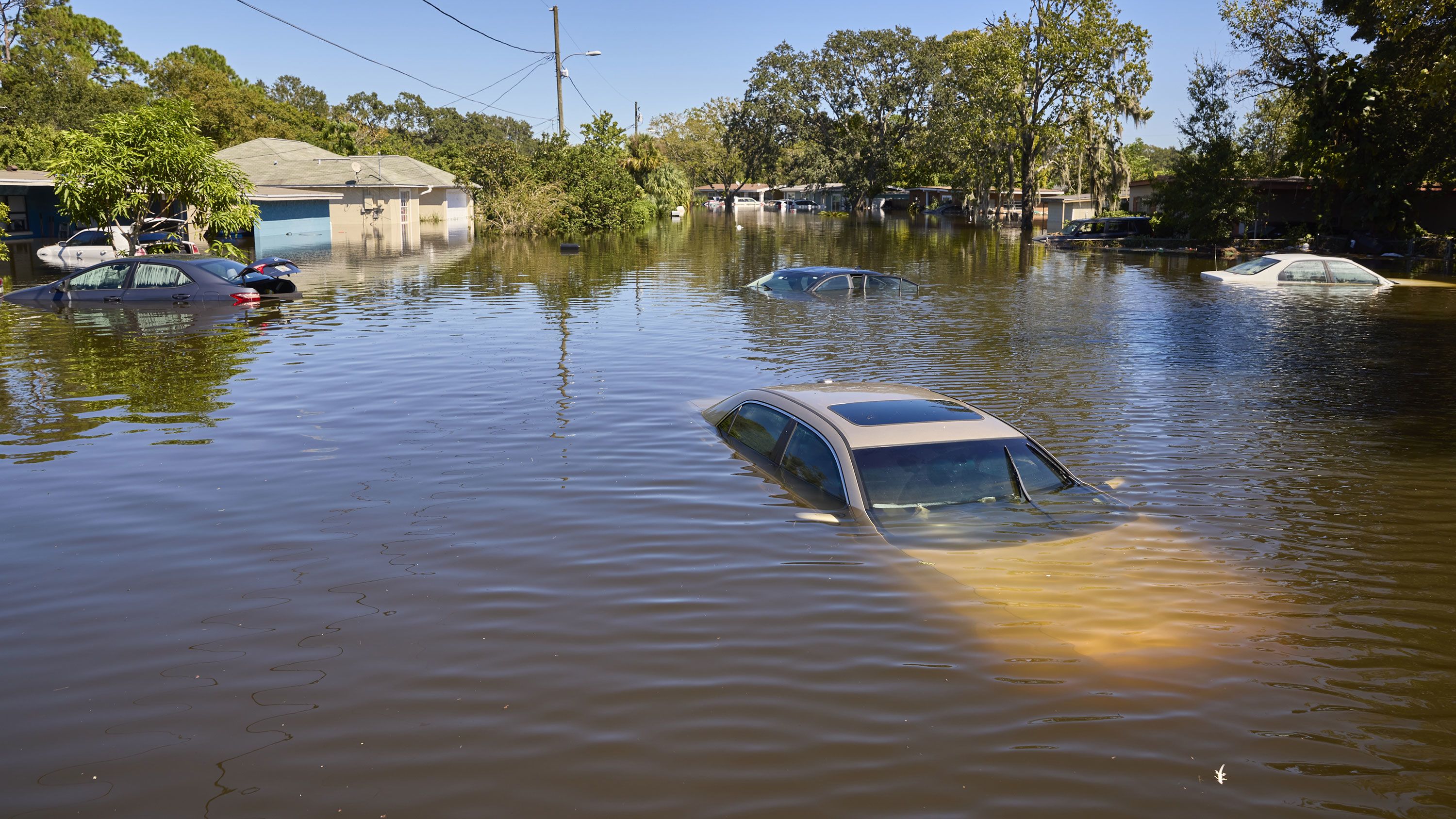
River levels don't wait for business hours. When heavy rainfall or rapid snowmelt pushes local watersheds past their banks, residents have minutes—not hours—to protect their homes and secure evacuation routes. Relying on traditional news broadcasts during an active weather emergency often leaves you blind to hyper-local water displacement, rising creeks, and sudden infrastructure failures.
Modern real-time flood monitoring platforms bridge this gap by aggregating live satellite feeds, river gauge sensors, and regional meteorological data into instant smartphone notifications. Knowing how to access, interpret, and act on these live updates transforms panic into an organized response, giving your family the vital buffer needed to stay safe.
Understanding Real-Time Flood Tracking Infrastructure
Traditional flood forecasting relied heavily on historical averages and delayed reporting from regional hydrological stations. Today's early warning architecture operates on a continuous loop of automated data collection. Understanding how these systems work helps you separate standard weather advisories from critical, life-saving warnings.
How Hydrological Sensors Feed Live Dashboards
At the heart of any modern flood tracking network are automated stream gauges and groundwater sensors anchored along vulnerable riverbanks and urban drainage channels. These devices measure water velocity, stage height, and volumetric flow rate every few minutes.
- Stage Gauges: Ultrasonic and radar sensors mounted above bridges or riverbanks calculate the exact vertical distance to the water surface, transmitting real-time elevation metrics via cellular or satellite telemetry.
- Precipitation Radar: Doppler radar networks track rainfall accumulation across upper watersheds, allowing predictive models to estimate how much runoff will hit lower-elevation communities hours before cresting occurs.
- Groundwater Saturation: Soil moisture probes measure how much water the surrounding earth can absorb, predicting flash-flood thresholds during prolonged storm cycles.
The Shift from Broad Advisories to Hyper-Local Alerts
Broad weather alerts covering an entire county or district often fail to reflect neighborhood-specific risks. A river might flood low-lying agricultural flats miles upstream while leaving residential urban pockets dry, or vice versa.
Real-time notification platforms solve this by offering location-based targeting. By inputting your precise residential or workplace coordinates into an official municipal tracking portal or emergency app, you receive push notifications triggered strictly by the sensors monitoring your immediate watershed basin. This targeted filtering prevents alert fatigue and ensures you only mobilize when your specific sector faces imminent water intrusion.
Evaluating Flood Warning Channels and Notification Types
When an emergency strikes, relying on a single communication channel is dangerous. Power outages can knock out local Wi-Fi routers, and cellular towers can become congested during peak evacuation windows. Diversifying your alert sources ensures you receive warnings regardless of infrastructure stress.
Multi-Tiered Alert Distribution
Emergency management agencies and digital monitoring platforms typically broadcast warnings through three primary channels:
- Mobile Push Notifications: Delivered via dedicated municipal emergency applications or national weather service apps. These provide rapid, location-specific warnings with high visibility on locked screens.
- SMS and Text Broadcasts: Cellular-based alerts that bypass internet dependencies. Even if your data connection drops, text messages can often push through congested voice towers during emergency events.
- Automated Phone Trees and Sirens: Traditional community warning systems used primarily for mandatory evacuation orders in high-risk rural valleys or coastal zones.
Interpreting Alert Severity Levels
Knowing the difference between a flood watch, a flood advisory, and a flash flood warning dictates your physical response.
- Flood Watch: Conditions are favorable for flooding in a specified region. It's time to review your emergency plan, clear exterior storm drains, and check backup battery supplies.
- Flood Advisory: Minor flooding is occurring or imminent in urban or low-lying areas. It's not immediately life-threatening, but low-water crossings and basements may experience localized pooling.
- Flash Flood Warning: Life-threatening flooding is occurring or imminent. Move to higher ground immediately. This requires instant action, as flash floods can sweep away vehicles and structural foundations within minutes.
Practical Steps for Household Flood Preparedness
Waiting for an alert to sound before gathering supplies guarantees chaos. Integrating a structured preparation routine into your seasonal household management protects your property before the first drop falls.
1. Map Your Local Flood Zone
Consult official municipal zoning maps or provincial/state GIS databases to determine your property's elevation relative to nearby waterways. Identify whether your home sits within a 50-year or 100-year flood plain, and locate the nearest elevated safe ground accessible on foot or by vehicle.
2. Build a Mobile-Connected Emergency Kit
Assemble a portable kit containing essential gear, keeping digital communication tools in mind:
- Hand-crank or solar-powered NOAA weather radio with multi-band tuning.
- Fully charged external power banks for your smartphones and communication devices.
- Waterproof document bags containing insurance policies, property deeds, and identification.
- Non-perishable food and bottled water supply lasting a minimum of 72 hours.
3. Establish a Communication Protocol
Designate an out-of-town family contact point. During major regional flooding events, local cellular networks often experience routing bottlenecks, making local calls difficult while long-distance text messaging remains functional. Ensure every household member memorizes this contact number.
4. Secure Vulnerable Infrastructure
If your property is prone to seasonal high waters, install backwater valves on sewer lines to prevent municipal runoff from backing up into basement floor drains. Keep sump pumps clear of debris and test their float switches regularly before the rainy season begins.
Common Mistakes to Avoid During Flood Events
Misjudging the velocity and depth of floodwaters leads to thousands of preventable rescues and vehicle losses every year. Avoiding these critical errors keeps you and emergency responders out of danger zones.
- Driving Through Standing Water: Just six inches of moving water can knock an adult off their feet, and two feet of rushing water can sweep away most automobiles, including full-sized SUVs and trucks. Never drive around barricades or across flooded roadways.
- Ignoring Sump Pump Maintenance: Relying on a standard plug-in sump pump without a battery backup is a major gamble. Severe storms frequently trigger power outages just when groundwater infiltration peaks. Always maintain a secondary battery-operated or water-powered backup pump.
- Delaying Evacuation: Waiting for water to reach your front porch before leaving often traps vehicles in rapidly rising street currents. Obey evacuation advisories early while escape routes remain clear and dry.
- Returning Home Too Soon: Entering a flooded home before municipal inspectors clear the structure exposes residents to downed electrical lines, contaminated standing water, structural foundation shifts, and localized gas leaks.
Frequently Asked Questions
How accurate are real-time flood monitoring apps?
Modern flood apps rely on live telemetry from government hydrometric stations and satellite radar feeds, offering high accuracy for river stage heights. However, hyper-local flash flooding caused by sudden urban cloudbursts can develop faster than sensor networks can log, making visual observation and local weather radar crucial supplements.
What should I do if my home begins taking on water?
Immediately shut off the main electrical breaker to your home if safe to do so without standing in water. Move valuables and electrical appliances to upper floors, and evacuate to higher ground if water levels continue to rise. Never enter a flooded basement where submerged electrical outlets pose electrocution risks.
Are municipal flood alerts free to use?
Yes. Most local governments, regional districts, and national meteorological services provide public alert systems, mobile apps, and email subscription services free of charge to ensure broad community safety.
How can I protect my basement from sewer backup during heavy rains?
Installing a professional backwater valve prevents municipal sewage lines from reversing flow into your home during extreme storm surges. Additionally, ensure your property's exterior grading slopes away from the foundation walls to direct surface runoff away from window wells.
What is the difference between a river flood and a flash flood?
River floods occur when persistent rainfall or snowmelt causes rivers and streams to slowly overflow their banks over a period of days. Flash floods develop within minutes or hours of intense rainfall, dam failures, or ice jams, characterized by rushing walls of water that offer little time for preparation.



