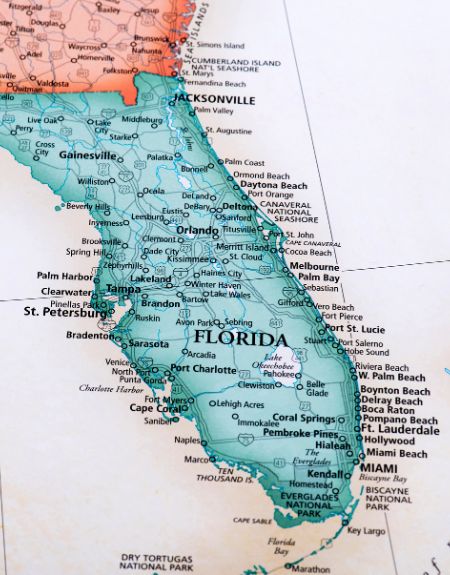
Navigating Port St. Lucie requires looking past standard map boundaries. Spanning roughly 120 square miles across St. Lucie County, this municipality functions less like a traditional dense city and more like a vast grid of master-planned subdivisions, residential pockets, and natural preserves. Understanding its layout means recognizing how explosive population growth continues to reshape its borders, pushing commercial hubs westward toward Interstate 95 while preserving pockets of wild Florida along the North Fork of the St. Lucie River.
Growth statistics tell part of the story, as the area ranks among the fastest-expanding small cities in the nation. Yet a simple GPS route often fails to capture the distinct character of individual neighborhoods. From the historic eastern corridors near US-1 to master-planned giants like Tradition and PGA Verano in the west, this guide breaks down how to read the local landscape, identify its hidden natural assets, and navigate ongoing development without getting lost in a sea of lookalike suburban blocks.
Decoding the Port St. Lucie Grid and Layout
Port St. Lucie doesn't feature a single, historic downtown core. Instead, the city's urban planning history dates back to the mid-20th century, creating a massive grid system divided into distinct sections. If you're looking at a standard map app, you'll notice major thoroughfares like Port St. Lucie Boulevard, Gatlin Boulevard, and Becker Road slicing east-to-west, connecting the Florida Turnpike to US-1 and the Indian River Lagoon.
The city recognizes 32 official neighborhood planning areas, but residents and real estate agents generally group the municipality into distinct regional zones: To see the complete picture, check out the recent article by Condé Nast Traveler.
- The East and North Corridors: Encompassing zip codes like 34952 and parts of 34983, these older neighborhoods sit closest to the North Fork of the St. Lucie River. Properties here feature mature trees, larger lots, and an absence of restrictive homeowner associations. Neighborhoods like Floresta Gardens and Bayshore Heights offer direct historical character.
- St. Lucie West: Developed heavily from the 1990s onward, this central-west corridor along I-95 acts as an early model of master-planned integration. It houses Clover Park (spring training home of the New York Mets), commercial plazas, golf courses, and diverse residential pockets.
- Tradition and the Western Expansion: Located west of I-95, Tradition represents the epicenter of modern urban growth. Designed as a massive master-planned community, it features its own town square, commercial medical centers, and sprawling residential expansions like PGA Verano and Riverland.
Recognizing these zones prevents long, frustrating commutes. Because the city spans such a wide east-west footprint, traveling from the eastern riverbanks to the western edge near the turnpike can take upwards of 30 minutes depending on traffic signals and arterial congestion.
Urban Expansion and the Westward Shift
The defining characteristic of modern Port St. Lucie is rapid, continuous transformation. Recent census and economic data place the city near the top nationally for population growth, driven by families and retirees relocating from South Florida and out-of-state metros looking for space.
This expansion follows a distinct westward trajectory. For decades, the city's core infrastructure hugged the eastern boundary near US-1. As available land filled up, developers turned their attention west of I-95. Large tracts of pine flatwoods and ranch land transformed into master-planned communities featuring interconnected lakes, walking paths, and commercial hubs designed to keep residents within their immediate neighborhoods.
City planners face the challenge of balancing this private residential boom with public infrastructure. Projects like the master planning around the municipal civic center and waterfront districts aim to anchor a civic focal point, giving the sprawling suburban layout a shared gathering space. For visitors and newcomers, tracking this expansion means realizing that a map printed five years ago misses entire commercial centers, residential villages, and road expansions near Becker Road and Southwest Port St. Lucie Boulevard.
Hidden Natural Gems Off the Main Map
While suburban developments dominate much of the map, Port St. Lucie and surrounding St. Lucie County protect surprising expanses of native Florida ecosystems. If you only look at commercial strips, you miss the rich network of public preserves maintained by county and state agencies.
Savannas Preserve State Park
Stretching more than 10 miles along the eastern edge of the city, this massive state park protects over 6,000 acres of freshwater marsh, wet prairie, and pristine scrub. It represents the largest remaining portion of Florida's historic east coast savannas. Visitors can hike, paddle, or bicycle through a landscape that looks entirely untouched by modern suburban growth.
Oxbow Eco-Center
Situated directly on the North Fork of the St. Lucie River, the Oxbow Eco-Center functions as both an environmental learning facility and a public nature preserve. Elevated boardwalks and winding dirt trails guide visitors through pine flatwoods, floodplain forests, and wetland habitats. It's an ideal starting point for anyone wanting to understand local flora, spot wading birds, or learn about the river's ecological history.
McCarty Ranch Preserve
Located on the far western edge of the municipality, McCarty Ranch offers a completely different vibe. Spanning thousands of acres, this former cattle ranch features lakes stocked for catch-and-release fishing, primitive campsites, mountain bike trails, and kayak launches. It highlights the vast, open spaces hiding just beyond the western residential developments.
The Port District and Botanical Gardens
Closer to the river near the eastern neighborhoods, the Port District and the adjacent Port St. Lucie Botanical Gardens provide a gentler outdoor experience. Featuring paved paths, butterfly gardens, and river overlooks, these spaces connect public greenways with the water, reminding visitors of the municipality's strong ties to the St. Lucie River.
Practical Navigation Tips for Locals and Visitors
Getting around a city built on a vast grid requires a few practical strategies to avoid common navigation pitfalls.
- Master the Mile Markers and Street Naming Conventions: The city's street naming system can be notoriously repetitive. Pay close attention to directional prefixes and suffixes (such as SW, SE, W, or E). A street name repeated in the eastern sector often has an entirely different counterpart west of the turnpike.
- Account for School and Commute Traffic: Arterial roads like Port St. Lucie Boulevard experience heavy congestion during morning and afternoon school commuting hours. If you're heading from western communities like Tradition toward I-95 or the eastern river crossings, build extra time into your schedule.
- Check Trail Conditions Before Visiting Preserves: Many local nature preserves feature natural sand, shell, or grass trails that can flood or become muddy during Florida's summer wet season. Always check official county or state park updates before planning a long hike or paddle.
- Leverage Official Mapping Resources: For deep dives into property boundaries, zoning, or neighborhood improvement districts, consult the City of Port St. Lucie Official Website rather than relying solely on generic consumer mapping apps, which frequently mislabel private subdivisions or missing service roads. You can also explore county-specific environmental protections through the St. Lucie County Parks and Recreation Department.
Frequently Asked Questions
Is Port St. Lucie considered part of the Miami metropolitan area?
Port St. Lucie is a principal city within its own designated metropolitan statistical area covering St. Lucie and Martin counties. However, it also sits within the broader Miami-Fort Lauderdale-Port St. Lucie combined statistical area, reflecting economic and commuter ties to South Florida, though it retains a distinct Treasure Coast identity.
Why do streets in Port St. Lucie repeat across different neighborhoods?
The city's original master design divided the municipality into massive multi-block sections. Because of the sheer scale of the initial platting, street names and numbering patterns were replicated across different sections before modern comprehensive planning unified the addressing system, making GPS navigation essential for first-time visitors.
Are there public beaches directly inside Port St. Lucie?
Port St. Lucie itself is primarily a mainland municipality bounded by the North Fork of the St. Lucie River rather than the open Atlantic Ocean. However, public ocean beaches on Hutchinson Island are a short drive east across the county bridges in neighboring Jensen Beach or Fort Pierce.
Where can I find homes with no homeowner associations (HOAs)?
Most properties lacking an HOA are located in the older, eastern sections of the city (such as zip code 34952 and eastern 34983), where lots were platted independently decades ago. Conversely, newer master-planned communities in the west almost universally feature HOAs or community CDDs.



