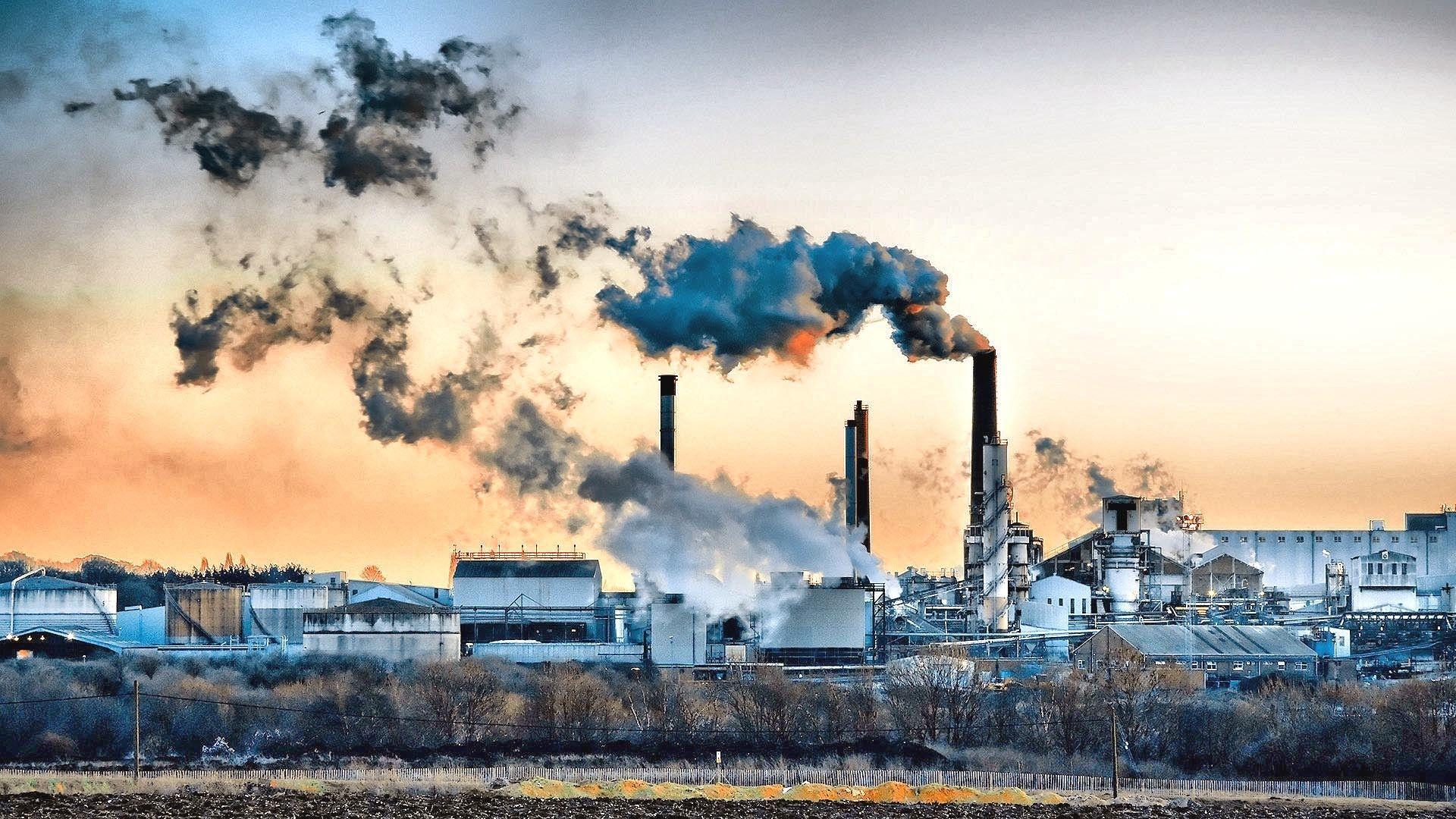
Pollution doesn't spread evenly across the earth like a thin mist. It pools, collects, and intensifies in specific geographic corridors driven by industrial zoning, wind patterns, and river hydrogeology. These localized zones of concentrated environmental degradation are known as pollution hot spots. Understanding how these toxic areas form requires looking past simple satellite maps and examining the physical, economic, and political forces that anchor contamination to specific coordinates.
Where heavy industry, dense transportation networks, and natural barriers intersect, toxins accumulate to levels that severely threaten local ecosystems and human populations. Recognizing why certain regions absorb disproportionate amounts of industrial waste helps urban planners, scientists, and communities target remediation efforts where they matter most.
How Physical Geography Shapes Toxic Accumulation
The layout of the land dictates where pollutants settle. Valleys, river basins, and coastal deltas act as natural traps for airborne and waterborne contaminants. When industrial emissions or agricultural runoff enter these topographically constrained environments, the physical geography prevents quick dispersion.
For example, mountain ranges and valley walls frequently trigger thermal inversions. Cold air blankets the valley floor, trapping warm air and vehicle or factory exhaust underneath. This atmospheric lid causes particulate matter and nitrogen oxides to concentrate at breathing height. Cities built in basin configurations often experience persistent smog layers that linger for days, turning entire urban sectors into chronic air pollution hot spots.
Hydrology plays an equally powerful role. Rivers act as conveyor belts for industrial discharge and agricultural fertilizers. As water flows downstream, it accumulates heavy metals, nitrates, and synthetic chemicals from multiple municipal sources. When the river reaches a delta or a slow-moving estuary, the current drops its sediment load—along with the heavy metals and chemical residues bound to soil particles—creating severe aquatic and sediment hot spots.
Major Categories of Environmental Hot Spots
Contamination manifests differently depending on the source activity. Different industries and land-use patterns create unique spatial footprints of toxicity.
Industrial Legacy Sites
Former manufacturing plants, gas works, and metal smelters leave behind deep chemical footprints. The soil and sediment beneath these abandoned operations often contain polycyclic aromatic hydrocarbons (PAHs), volatile organic compounds, and heavy metals at concentrations hundreds of times above natural background levels. Because industrial practices evolved over decades, the contamination is frequently stratified into distinct layers representing different manufacturing eras.
Agricultural Concentration Zones
Intensive farming regions are less visually dramatic than heavy industrial zones, but they function as major chemical hot spots. Heavy applications of synthetic fertilizers and pesticides lead to nitrate leaching and chemical accumulation in topsoil. Rainwater washes these compounds into local water tables and adjacent streams, creating expansive non-point source pollution zones that stretch across entire agricultural districts.
Mineral Extraction Corridors
Mining regions introduce severe environmental challenges through acid mine drainage and tailings dam failures. When sulfide-bearing minerals are exposed to air and water, they produce sulfuric acid, which leaches toxic metals like arsenic, lead, and cadmium into surrounding watersheds. A single structural failure at a mine tailings storage facility can redistribute fine-grained mineral waste across kilometers of river floodplain, embedding toxins into sediment layers that remain active for generations.
Socioeconomic Factors and Environmental Injustice
Geography does not operate in a vacuum; human choices dictate where pollution accumulates. Industrial zoning laws, property values, and municipal planning decisions historically direct heavy manufacturing, chemical processing plants, and major freight corridors toward low-income neighborhoods and marginalized communities.
This dynamic creates a clear pattern of environmental injustice. Communities with fewer political and financial resources often absorb the physical burdens of modern industrial society. Residents in these zones face higher cumulative exposure to multiple toxic chemicals simultaneously from nearby factories, diesel truck routes, and waste transfer stations.
The health consequences follow these geographic lines. Public health data consistently shows elevated rates of pediatric asthma, cardiovascular disease, and reduced life expectancy in neighborhoods adjacent to major transportation and industrial corridors. Addressing pollution hot spots requires more than technical cleanup; it demands correcting historical planning disparities that concentrate environmental risks among vulnerable populations.
Modern Tools for Mapping and Monitoring Toxic Zones
Tracking toxic zones has evolved past simple field sampling. Modern environmental scientists use advanced geographic information systems (GIS) and remote sensing technologies to map contamination across large areas.
Satellite sensors can detect atmospheric gas columns, thermal anomalies, and vegetation stress caused by soil toxicity. Combined with ground-based sensor networks that monitor real-time particulate matter and water quality, researchers can build high-resolution models of pollutant dispersion.
Organizations like the U.S. Environmental Protection Agency and international research groups utilize these spatial datasets to track chemical releases and evaluate cumulative community exposure risks. By pairing satellite observation with local demographic data, scientists can pinpoint where industrial emissions pose the greatest immediate danger to human populations.
Mitigation Strategies and Remediation Challenges
Cleaning up established pollution hot spots is technically complex and financially demanding. Traditional approaches include soil excavation, groundwater pump-and-treat systems, and capping landfills with impermeable membranes to stop leachate migration.
Biological solutions are also gaining traction. Phytoremediation uses specific plants, such as hybrid poplars or mustard greens, to absorb, accumulate, or break down contaminants in soil and groundwater. Microorganisms engineered or selected for specific chemical tolerances can degrade hydrocarbons and certain synthetic compounds directly in place.
However, remediation faces severe economic hurdles. Responsible parties often go bankrupt or dissolve over time, leaving local governments to shoulder the cost of orphaned industrial sites. Effective long-term management requires strict enforcement of environmental regulations, transparent industrial monitoring, and community-led oversight to ensure cleanup standards match actual health risks.
Frequently Asked Questions
What defines a pollution hot spot in geographic terms?
A pollution hot spot is a specific geographic location where natural or human-made factors cause contaminants to concentrate at levels significantly higher than the surrounding region, creating elevated risks for ecosystems and human health.
Why do urban areas often become air pollution traps?
Dense buildings create street canyons that restrict wind flow, while vehicular emissions and industrial activity add continuous particulate matter. When combined with thermal inversions that trap cold air near the surface, pollutants cannot disperse vertically, keeping toxic air trapped at breathing height.
How does water movement affect pollution distribution?
Rivers transport contaminants from upstream industrial, urban, and agricultural zones downward. As water velocity slows near estuaries and lakes, suspended sediments and bound heavy metals drop out of the current, creating concentrated zones of aquatic and sediment toxicity.
Can remediation completely restore a toxic hot spot?
Complete restoration is challenging. While remediation can remove the majority of toxic substances and make a site safe for restricted use, certain persistent chemicals and heavy metals may remain trapped deep in bedrock or sediment layers, requiring ongoing monitoring rather than total elimination.



