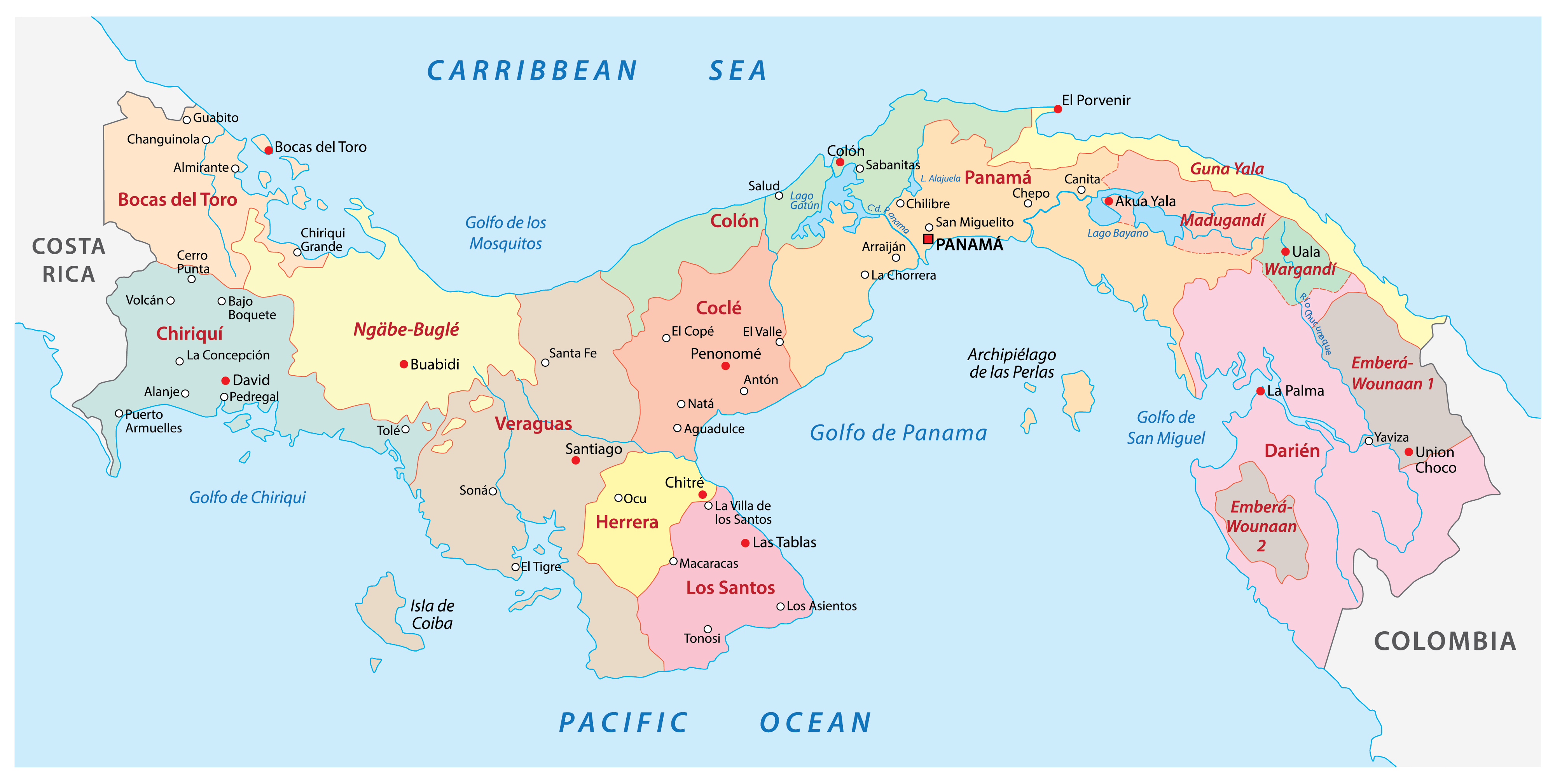
When you look at a world map, the Isthmus of Panama stands out as a narrow bridge of land separating two massive oceans. The Panama Canal cuts directly through this fifty-mile strip, serving as a man-made shortcut that alters how cargo moves across the planet. Without this waterway, ships traveling between the Atlantic and Pacific oceans would face a grueling detour around Cape Horn at the southern tip of South America, adding thousands of miles and weeks of transit time to every voyage.
Understanding the geography of this corridor requires looking past simple line drawings. The canal functions as an engineered ecosystem of locks, artificial lakes, and dredged channels that elevate vessels across the continental divide before lowering them back to sea level. This operational blueprint keeps global supply chains moving efficiently, connecting Asian manufacturing hubs directly to the eastern ports of North America and Europe.
Geographic Blueprint and Anatomy of the Waterway
The physical layout of the canal relies on a precise combination of geography and heavy engineering. Spanning roughly fifty-one miles from Colón on the Caribbean side to Balboa on the Pacific side, the route makes use of the Chagres River and Gatun Lake, an enormous artificial reservoir created during construction.
Vessels entering from the Atlantic pass through the Gatun Locks, which lift ships twenty-six meters up to the level of Gatun Lake. From there, ships cross the lake and navigate the Culebra Cut, a narrow trench carved through the spine of the continental divide. On the Pacific side, ships descend through the Pedro Miguel and Miraflores locks back to sea level. This stepped approach solves a fundamental geographical problem: the Pacific Ocean sits at a slightly different dynamic height and experiences different tidal ranges than the Caribbean Sea, requiring a locked system rather than a simple sea-level ditch.
Key Geographic Constraints
- Water Supply Dependency: The entire system relies on freshwater from Gatun Lake and Alajuela Lake, which fills the locks via gravity.
- The Culebra Cut: This rock excavation prone to landslides remains a frequent maintenance focus to keep large vessels safe.
- Width and Depth Limits: Natural valley topography and lock chamber dimensions set strict caps on ship sizes, known globally as Panamax and New Panamax standards.
The Economic Engine of Global Shipping Routes
The strategic value of the canal lies in sheer distance reduction. A container ship traveling from Shanghai to New York saves nearly seven thousand miles by choosing the Panama route instead of going past Africa or South America. These savings translate directly into lower fuel consumption, reduced crew costs, and faster inventory turnover for global retail and manufacturing brands.
Major trade routes depend heavily on this artery. The most prominent corridor links East Asia with the United States East Coast, carrying everything from electronics and auto parts to consumer goods. Another vital lane moves liquefied natural gas (LNG) and agricultural commodities like soybeans and corn from the U.S. Gulf Coast to Asian markets. According to data from the International Trade Administration, the passage accommodates diverse fleets including container ships, dry bulk carriers, and vehicle transport vessels, each requiring precise scheduling to avoid bottlenecks.
Operational Vulnerabilities and Climate Pressures
Despite its engineering brilliance, the waterway faces severe physical vulnerabilities. Because the locks operate using freshwater runoff from regional rainfall, severe droughts directly threaten daily transit capacity. El Niño weather patterns and shifting climate trends have periodically forced the Panama Canal Authority to restrict the maximum draft of passing ships and reduce daily booking slots.
When water levels drop in Gatun Lake, cargo ships must lighten their loads or reroute entirely, sending shockwaves through international shipping rates. These disruptions prove that global trade relies heavily on local weather conditions in Central America. Shipping companies increasingly factor these environmental variables into long-term logistics planning, sometimes splitting cargo across rail networks or alternative ocean lanes to mitigate risk.
Expansion and Adaptation for Modern Fleets
To keep pace with the massive scale of modern container ships, the canal underwent a historic multi-billion-dollar upgrade completed in 2016. This expansion added a new set of wider, deeper locks known as the Third Lane Project, running parallel to the original century-old structures.
These newer locks use water-saving basins that recycle sixty percent of the water used during each transit, easing environmental pressures on the watershed. The expansion introduced the New Panamax standard, allowing vessels carrying up to fourteen thousand twenty-foot equivalent units (TEUs) to pass through, compared to the older limit of roughly five thousand TEUs. This shift lowered per-unit shipping costs and secured the route's relevance against competing trans-oceanic concepts.
Frequently Asked Questions
How long does it take a ship to cross the Panama Canal?
The actual transit through the locks and channel takes between eight and ten hours. However, total time spent in the area often ranges from twenty-four to seventy-two hours when factoring in queueing, pilot boarding, and anchorage wait times.
Who owns and operates the Panama Canal?
The waterway is owned and operated by the Panama Canal Authority (Autoridad del Canal de Panamá), an autonomous legal entity of the Government of Panama, following the full transfer of control from the United States in 1999.
Why doesn't the canal flood the country since the oceans are at different levels?
The oceans are not connected by an open trench. Instead, a series of stepped water-filled chambers (locks) act as water elevators, raising and lowering ships to match the elevated freshwater lakes in the center of the country.
How do ships pay to use the canal?
Tolls are calculated based on vessel type, size, and cargo volume or passenger capacity. The Panama Canal Authority publishes detailed tariff schedules, with fees often running into hundreds of thousands of dollars per transit for large container ships.