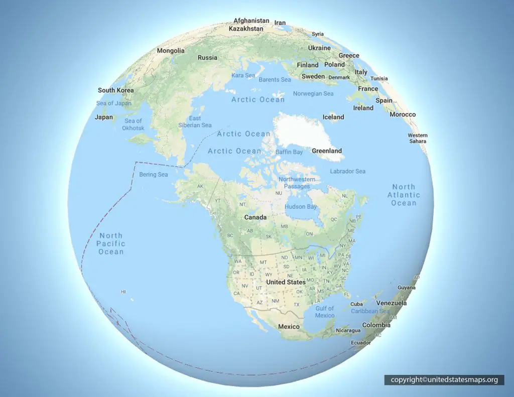
Mapping North America reveals a massive landmass stretching from frozen polar ice caps down to tropical Central American rainforests and ancient archaeological centers. This continent spans multiple climate zones, major tectonic plates, and thousands of years of human geography. Understanding how these regions connect requires looking past simple political borders to examine topographies, drainage basins, and historical trade routes.
The physical framework of North America relies on a diverse set of geological features. From the shield rocks of Canada to the arid deserts of the American Southwest and the volcanic ranges of Mexico, the continent's structural layout dictates its weather patterns, human settlement history, and modern economic corridors.
The Northern Tier: Tundras, Taiga, and the Canadian Shield
At the northern edge of the continent lies the vast expanse of the Arctic tundra and subarctic taiga. This region covers much of northern Canada and Alaska, characterized by permafrost, low-growing vegetation, and severe winters.
Beneath this surface lies the Canadian Shield, an exposed area of ancient Precambrian rock forming the geological core of the North American plate. Glacial activity during the last ice age scraped this region clean of deep soils, leaving behind thousands of freshwater lakes and exposed bedrock.
- Permafrost Dynamics: Frozen subsoil restricts deep root growth, shifting ecosystems toward mosses, lichens, and stunted conifers.
- Drainage Systems: Vast river networks like the Mackenzie and Churchill flow north and east into Hudson Bay and the Arctic Ocean, driven by the slope of the shield.
- Resource Basins: The subarctic taiga holds major mineral deposits, timber reserves, and hydroelectric potential that power southern population centers.
The Continental Spine: Cordilleras and Basins
Moving south, the terrain transforms into the North American Cordillera, a massive system of mountain ranges running parallel to the Pacific coast from Alaska down into Mexico.
The Rocky Mountains form the eastern backbone of this system, creating the Continental Divide that separates watersheds flowing toward the Pacific Ocean from those draining into the Atlantic and Arctic. West of the Rockies lie arid plateaus, the Great Basin, and the Sierra Nevada range, which traps moisture and creates rain shadows over interior deserts like the Mojave and Sonoran.
Tectonic activity defines the western edge. The San Andreas Fault in California and the trench systems off the coast represent active plate boundaries where the Pacific and North American plates grind past one another.
Mexico and the Transition to Mesoamerica
As the continent narrows southward, Mexico acts as a physical bridge and cultural crossroads. The country's topography is dominated by the Sierra Madre Occidental and Sierra Madre Oriental mountain ranges, which flank the high-elevation Mesa Central in the interior.
This terrain shaped historical civilizations. The high valleys provided fertile volcanic soil and temperate climates, supporting massive urban centers like Tenochtitlan long before European contact.
Moving further south toward the Yucatán Peninsula, the elevation drops into tropical lowlands. This region features porous limestone karst landscapes with underground river systems and cenotes rather than surface rivers, creating unique environmental conditions that supported ancient populations.
Mesoamerican Geography and Maya Settlements
The southern lowlands and highlands of Mexico, Guatemala, and Belize form the cradle of the ancient Maya civilization. Geography directly influenced how these societies built their cities, managed water, and traded goods.
Dense tropical rainforests presented severe logistical challenges for urban growth, yet the Maya engineered raised fields, terraced hillsides, and complex reservoirs to sustain millions of people.
- Trade Routes: Major river networks like the Usumacinta and coastal shipping lanes moved obsidian, jade, salt, and cacao across the region.
- Urban Centers: Cities like Tikal, Calakmul, and Palenque utilized limestone architecture, plazas, and monumental pyramids that aligned with astronomical observations.
- Environmental Pressures: Over-reliance on fragile rainforest ecosystems and extended droughts contributed to the shift of political power northward during the Terminal Classic period. You can explore official archaeological surveys through resources like the USGS to understand regional mapping techniques.
Frequently Asked Questions
What defines the geographic boundaries of North America?
The continent is bounded by the Arctic Ocean to the north, the Atlantic Ocean to the east, the Pacific Ocean to the west, and connects to South America via the Isthmus of Panama. Its tectonic plate also extends across parts of Siberia and the North Atlantic.
Why are there no major rivers crossing the Mexican plateau?
The steep drop-off of the Sierra Madre mountain ranges prevents large navigable rivers from forming in the interior high plateau, keeping interior waterways short and fast-flowing.
How did geography influence Maya city placement?
Maya cities were often built near reliable water sources like cenotes, rivers, or engineered reservoirs in the tropical lowlands, positioned to control key overland and river trade routes.
Where does the North American tectonic plate end?
The plate boundary runs from the Gakkel Ridge in the Arctic, down through western Alaska, along the Queen Charlotte Fault and San Andreas Fault, and into the Middle America Trench off the southern coast of Mexico.



