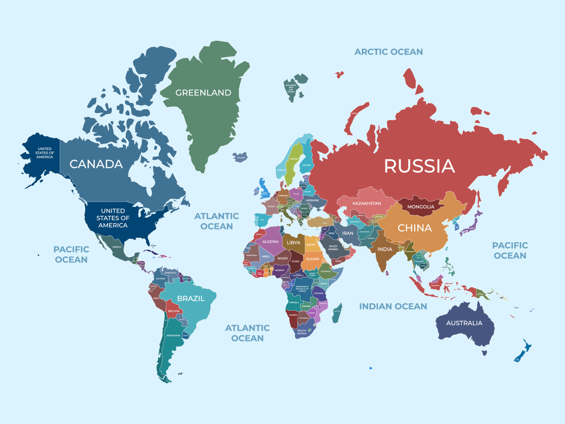
When you look at a map of the Western Hemisphere, you'll find that the North American continent spans from the icy archipelagos of the high Arctic down to the tropical forests of Central America and across the islands of the Caribbean. Geography classes usually teach that Canada, the United States, and Mexico make up the whole picture. That's only part of the story.
In total, the North American continent contains 23 sovereign countries alongside a collection of dependent territories and overseas departments. Understanding this breakdown requires looking beyond standard regional clichés to examine how these nations function politically, economically, and geographically.
Sub-Regions of North America
Geographers and international organizations divide the continent into distinct sub-regions. Each zone has unique cultural ties, political histories, and economic frameworks.
Northern America
This sub-region contains the largest landmasses on the continent. While the term sounds identical to the continent itself, Northern America specifically refers to Canada, the United States, Greenland, Bermuda, and Saint Pierre and Miquelon. Only Canada and the United States function as sovereign nations here, while Greenland is an autonomous territory of Denmark, Bermuda is a British Overseas Territory, and Saint Pierre and Miquelon is a self-governing territorial collectivity of France.
Central America
Stretching south from Mexico's southern border down to South America, the Central American isthmus consists of seven independent republics:
- Belize
- Costa Rica
- El Salvador
- Guatemala
- Honduras
- Nicaragua
- Panama
Every nation in this sub-region possesses a mainland coastline along either the Pacific Ocean, the Caribbean Sea, or both. They share dense tropical ecosystems, complex histories of Spanish colonization, and modern trade agreements that bind their economies together.
The Caribbean
The island nations of the Caribbean sit within the North American tectonic plate and cultural sphere. Thirteen sovereign island states make up this sub-region:
- Antigua and Barbuda
- The Bahamas
- Barbados
- Cuba
- Dominica
- Dominican Republic
- Grenada
- Haiti
- Jamaica
- Saint Kitts and Nevis
- Saint Lucia
- Saint Vincent and the Grenadines
- Trinidad and Tobago
These island nations range from archipelagos with hundreds of small cays, like the Bahamas, to larger islands split between two countries, such as Hispaniola, which houses Haiti and the Dominican Republic.
Full List of Sovereign Countries in North America
The 23 independent countries of the North American continent vary wildly in land area, population density, and governmental structure.
Canada stands as the largest country by total area, covering nearly 10 million square kilometers, while Saint Kitts and Nevis is the smallest sovereign state at roughly 261 square kilometers. Population numbers lean heavily toward the top three giants—the United States, Mexico, and Canada—which account for the vast majority of the continent's roughly 590 million residents.
According to geographic data from Worldometer, the full roster of sovereign states spans from major global economies to small island republics. Every single one of these countries maintains independent governance, writes its own laws, and manages its own foreign policy.
Territories, Dependencies, and Overseas Collectivities
Not every patch of land in North America belongs to an independent country. Several islands and regions maintain political or administrative links to European nations or the United States. These territories have varying degrees of self-rule.
United States Dependencies
- Puerto Rico: An unincorporated U.S. territory in the Caribbean with commonwealth status. Its residents are U.S. citizens, but they don't vote in federal presidential elections.
- U.S. Virgin Islands: Comprising St. Croix, St. John, and St. Thomas, this territory operates under an organized, unincorporated U.S. framework.
- Navassa Island: A small, uninhabited island claimed by the United States, though its sovereignty is disputed by Haiti.
British Overseas Territories
- Anguilla: A self-governing British territory in the eastern Caribbean.
- Bermuda: A self-governing British territory in the North Atlantic Ocean.
- British Virgin Islands: An archipelago controlled by the United Kingdom with internal self-governance.
- Cayman Islands: A prominent financial hub and British Overseas Territory in the western Caribbean.
- Montserrat: A volcanic island in the Lesser Antilles that functions as a British Overseas Territory.
- Turks and Caicos Islands: An island chain north of Hispaniola governed as a British territory.
French Overseas Departments and Collectivities
- Guadeloupe: An overseas department and region of France located in the Lesser Antilles.
- Martinique: An insular region and overseas department of France.
- Saint Barthélemy: A collectivity overseas of France situated in the Leeward Islands.
- Saint Martin: The northern half of the island of Saint Martin, operating as a French overseas collectivity.
- Saint Pierre and Miquelon: An archipelago off the southern coast of Newfoundland, functioning as a self-governing territorial collectivity of France.
Danish Autonomous Territories
- Greenland: The world's largest island, which operates as an autonomous territory within the Kingdom of Denmark.
Dutch Territories
- Aruba, Curaçao, and Sint Maarten: These islands function as constituent countries within the Kingdom of the Netherlands, maintaining internal autonomy while sharing foreign defense policies with Amsterdam.
- Caribbean Netherlands (Bonaire, Sint Eustatius, and Saba): Special municipalities that form direct public bodies within the country of the Netherlands proper.
Geopolitical Facts and Regional Dynamics
The geopolitical reality of North America goes far beyond simple borders. Trade agreements, migration patterns, and security pacts shape how these nations interact.
The United States-Mexico-Canada Agreement (USMCA) replaced the older North American Free Trade Agreement, governing billions of dollars in cross-border commerce between the three northern giants. Meanwhile, Central American nations cooperate through regional systems like the Central American Integration System (SICA), and Caribbean islands coordinate policy through CARICOM.
Language diversity is another defining trait of the continent. While English dominates in Canada and the United States, Spanish is the primary language of Mexico, Central America, and several Caribbean nations like Cuba and the Dominican Republic. French holds official status in Canada and remains widely spoken in Haiti and French overseas territories. Indigenous languages like Nahuatl, Maya, and Greenlandic hold official or recognized status in various pockets of the continent, preserving ancient cultural lineages.
Common Mistakes to Avoid
When studying or writing about North American geography, people often make a few recurring errors:
- Confusing the sub-region of Northern America with the entire North American continent.
- Treating Caribbean islands as if they belong to South America simply due to their proximity to the equator.
- Assuming dependent territories like Puerto Rico or Greenland are independent countries rather than political extensions of outside states.
- Forgetting that Central America is physically part of the North American landmass, rather than a separate continent.
Frequently Asked Questions
Is Mexico part of North America or Central America?
Mexico is physically and politically part of the North American continent. Some people mistakenly lump it into Central America due to its cultural ties and Spanish colonial history, but its geographic boundaries sit firmly in North America, sharing a massive northern border with the United States.
Why is Greenland considered part of North America?
Geologically and geographically, Greenland sits on the North American tectonic plate and lies much closer to the Canadian Arctic archipelago than to Europe. Even though its political ties link it directly to Denmark in Europe, geographers classify it as part of the North American continent.
How many countries share a land border in North America?
Canada and the United States share the world's longest international land border. The United States also shares a land border with Mexico. In Central America, countries like Guatemala, Belize, Honduras, El Salvador, Nicaragua, Costa Rica, and Panama share multiple complex land boundaries with one another and with Colombia in South America.
Are Caribbean islands considered North American?
Yes. Every island nation located in the Caribbean Sea—from Cuba down to Trinidad and Tobago—rests on the North American tectonic plate or its continental shelf margins, placing them squarely within the geographic boundaries of the North American continent.



