Nevada is located in the western region of the United States, positioned primarily within the Great Basin and the Mojave Desert. It shares land borders with five states: Oregon and Idaho to the north, Utah to the east, Arizona to the southeast, and California to the west and southwest. As a landlocked state spanning over 110,000 square miles, its geographic placement shapes everything from its arid climate to its modern transportation corridors.
Understanding where Nevada sits on the map requires looking beyond its state lines. It acts as a bridge between the Pacific Coast and the interior Mountain West. Its positioning places Las Vegas within a short drive of major southwestern economic hubs, while its northern expanses connect the Pacific Northwest to the greater intermountain transit network.
Exact Geographic Coordinates and Regional Classification
Geographically, Nevada extends from approximately 35° N to 42° N latitude and 114° 2′ W to 120° W longitude. It ranks as the seventh-largest state by total area in the United States, yet its population distribution remains heavily concentrated.
Within standard U.S. geographic classifications, Nevada belongs to the Western United States. It is frequently categorized further into two sub-regions:
- The Mountain West: Sharing cultural and topographical traits with states like Utah, Idaho, and Montana.
- The Southwestern United States: Sharing desert ecosystems, climate patterns, and historical influences with Arizona and California.
Most of the state operates on Pacific Standard Time, though West Wendover in the northeastern corner officially observes Mountain Time to align economically with neighboring Utah.
Bordering States and Regional Proximity
Nevada's immediate neighbors define its regional accessibility and interstate connectivity:
- California to the west: This border runs along the crest of the Sierra Nevada mountains down to the Colorado River. It provides a direct economic corridor between the San Francisco Bay Area, Sacramento, Los Angeles, and Nevada population centers like Reno and Las Vegas.
- Oregon and Idaho to the north: These rural boundaries anchor Nevada within the Pacific Northwest trading sphere, characterized by high desert plateaus and agricultural integration.
- Utah to the east: The straight-line eastern boundary connects Nevada to the Salt Lake City economic hub, facilitating major transcontinental freight via Interstate 80.
- Arizona to the southeast: Separated in part by the Colorado River and Lake Mead, this southern interface links Las Vegas directly to the Phoenix metropolitan area.
Topography and Landform Structure
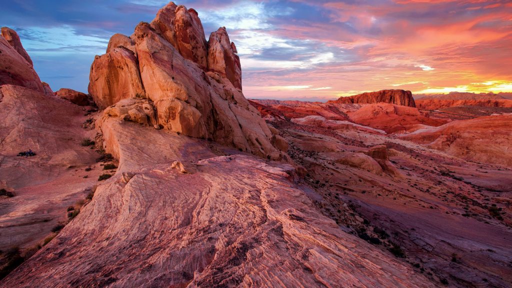
Nevada's internal landscape is defined by the Basin and Range Province. Instead of a uniform flat desert, the terrain features more than 300 north-south mountain ranges interspersed with arid valleys.
The state's elevation profile varies dramatically:
- Highest Point: Boundary Peak in the White Mountains reaches 13,147 feet near the California border.
- Lowest Point: The Colorado River at the southern tip of the state drops to 482 feet.
This rugged topography creates rain shadows that make Nevada the most arid state in the country. Water resources are scarce, relying heavily on the Humboldt River in the north and the Colorado River system along the southern boundary.
Strategic Economic and Logistical Position
Nevada's location historically fueled mining economies and today drives national logistics. Situated directly between major West Coast ports and the rest of the North American continent, the state functions as a primary distribution hub.
Companies leverage Nevada's tax structure and central location to place massive fulfillment centers in the Reno-Sparks area and the Las Vegas Valley. Goods arriving from overseas via California ports can reach the majority of the Western U.S. population within a single day's drive. Furthermore, major interstate highways—including Interstate 80 running east-west through the north and Interstate 15 cutting diagonally through the south toward Los Angeles—solidify the state's role as a transit backbone.
For official state demographic data and geographic resources, consult the Nevada Governor's Office of Economic Development or geographic overviews provided by the U.S. Geological Survey.
Common Misconceptions About Nevada's Geography
- Misconception 1: Nevada is entirely flat desert. In reality, Nevada is the second-most mountainous state in the U.S. after Alaska, featuring numerous alpine forests and peaks exceeding 10,000 feet.
- Misconception 2: Las Vegas is centrally located. Las Vegas sits in the extreme southern tip of the state within Clark County, hundreds of miles away from the state capital, Carson City, and northern hubs like Reno.
- Misconception 3: Nevada touches the ocean. Despite its heavy economic and cultural ties to coastal California, Nevada is entirely landlocked.
Frequently Asked Questions
What time zone is Nevada in?
Most of Nevada, including Las Vegas and Reno, is in the Pacific Time Zone. A small area in the northeastern corner, centered around West Wendover, observes Mountain Time.
What is the capital of Nevada?
The capital is Carson City, located in the western part of the state near Lake Tahoe and the California border. It operates as an independent city rather than part of any county.
Why is Nevada called the Silver State?
Nevada earned the official nickname "The Silver State" due to the massive mineral wealth generated by the Comstock Lode discovery in 1859, which played a critical role in the state's rapid settlement and entry into the Union in 1864.
How many states border Nevada?
Nevada shares its borders with five states: Oregon, Idaho, Utah, Arizona, and California.



