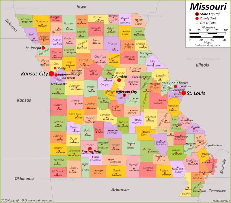
Missouri highway crash reports provide a clear look at state roadway safety, revealing the underlying causes of accidents across major routes like Interstate 70, Interstate 44, and US-54. When you parse official statistics from the Missouri State Highway Patrol, distinct patterns emerge regarding driver behavior, geographic hotspots, and environmental conditions. Understanding these reports helps drivers navigate high-risk corridors with greater awareness.
State traffic records show that overall safety trends depend heavily on driver compliance, speed management, and sobriety. While public perception often blames winter storms or poor weather for highway dangers, annual summaries from the Missouri Department of Transportation prove that the vast majority of severe collisions happen on dry pavement during clear daylight hours.
The Reality Behind Contributing Circumstances
Official collision reports track specific factors known as probable contributing circumstances. Speeding and impaired driving consistently rank as the top triggers for serious and fatal incidents on Missouri state highways.
- Excessive Speed: Speeding contributes to roughly thirty-nine percent of all fatal crashes statewide. High-speed corridors reduce reaction times and magnify the kinetic force of impact.
- Impaired Driving: Alcohol and drug involvement accounts for over twenty percent of fatal traffic events. These incidents spike during weekend night hours and holiday periods.
- Single-Vehicle Departures: Over half of fatal crashes involve only a single vehicle running off the road or striking a stationary roadside object.
Driver distraction also plays a major role, though it remains notoriously difficult to quantify accurately in standard police reports. Texting, dashboard navigation use, and fatigue degrade driver reaction times just as severely as minor impairment.
Geographic Hotspots and Corridor Risks
Traffic density correlates directly with total crash volumes. Urban centers and major freight corridors record the highest raw numbers of incidents, but rural two-lane highways often carry a higher fatality rate per vehicle mile traveled.
Interstate 70, which cuts east-west across the state through St. Louis, Columbia, and Kansas City, carries heavy commercial truck traffic alongside passenger vehicles. Interstate 44, running southwest from St. Louis toward Joplin, experiences similar freight congestion and hazardous winter weather pockets over the Ozark ridges.
Jackson County and St. Louis County consistently record the highest total numbers of traffic fatalities due to sheer population density and high commuter volumes. However, rural counties often see higher percentages of unbelted fatalities and delayed emergency response times.
Weather and Environmental Factors
A common misconception is that ice, snow, and heavy rain cause the most dangerous road conditions. State safety data tells a different story.
More than eighty percent of all reported traffic crashes in Missouri occur on dry pavement. Clear weather conditions give drivers a false sense of security, frequently leading to higher travel speeds, tailgating, and reduced attention spans. Inclement weather accounts for only a small fraction of total crashes, though storms naturally increase the severity of multi-vehicle pileups when they do occur.
How to Access and Interpret Public Crash Data
If you need to review specific incident logs or research local traffic trends, multiple public portals offer direct access to raw data.
- Visit the MSHP Public Portal: The Missouri State Highway Patrol maintains a searchable database categorized by troop division and date.
- Review Annual Statistical Compendiums: MoDOT and the Highway Patrol publish yearly comprehensive booklets detailing statewide safety trends, demographic breakdowns, and county-by-county rankings.
- Filter by Parameters: When analyzing reports, sort data by contributing circumstances, time of day, and road surface conditions to isolate specific safety trends.
Official reports require time to process, investigate, and finalize. Pending investigations may lack complete data regarding toxicology or final fault determinations.
Frequently Asked Questions
Where can I obtain an official copy of a Missouri crash report?
You can request formal collision reports directly through the Missouri State Highway Patrol records division or the local law enforcement agency that handled the specific investigation. Processing fees and waiting periods typically apply for official certified copies.
Are all Missouri car accidents included in public databases?
No. Minor fender-benders where property damage falls below state reporting thresholds and drivers exchange information privately are often not entered into the statewide public crash database.
What time of day sees the highest volume of crashes?
Crash volumes peak during afternoon rush hour periods, particularly between three and six o'clock, when heavy commuter traffic intersects with fatigue and fading daylight.
Why do single-vehicle crashes account for so many fatalities?
Single-vehicle accidents often involve high speeds on rural roads, resulting in secondary impacts with trees, embankments, or bridge abutments, combined with low seatbelt usage rates.



