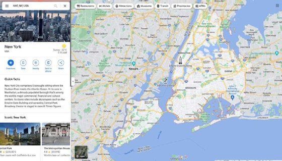
Mastering digital navigation means you stop staring blindly at a blue line and start anticipating how routing engines think. When you understand the underlying mechanics of map applications, you can bypass sudden gridlock, fix bad location data before you drive, and keep moving even when your cellular signal drops out entirely.
Modern navigation apps combine satellite constellations, historical speed metrics, and crowdsourced traffic pings to plot a route. Yet, algorithms optimize for mathematical averages, not your specific preferences. If you don't adjust your settings, you'll find yourself routed through tight residential alleys or stuck behind delivery trucks simply because it saved three seconds on paper.
Decoding Digital Routing Algorithms
Routing engines evaluate thousands of permutations in milliseconds. They balance distance, historical congestion trends, and live speed reports to designate a primary path. But these systems rely on rigid inputs.
- Vector Data Layers: Maps store roads as interconnected nodes with speed limits, turn restrictions, and lane counts. If municipal data is outdated, the app assumes a road is open when it isn't.
- Dynamic Feedback Loops: Every phone running a navigation app acts as a minor sensor. When thousands of drivers slow down in a specific corridor, the system flags a slowdown and pushes alternative options.
- Preference Weighting: Toggling options like "avoid highways" or "avoid tolls" forces the algorithm to reassign numerical costs to specific road segments, changing your path completely.
Knowing this engine helps you spot flaws. If an app suggests an abrupt turn onto a narrow side street during morning rush hour, look closer. The algorithm likely factored in a minor highway delay without accounting for school zones or unprotected left turns that bottleneck local traffic.
Preparing Your Route Before You Drive
Fumbling with a touchscreen while moving at highway speeds is the primary cause of navigation-induced errors. True route mastery starts in your driveway before your car ever moves.
- Verify the Pin Drop: Never rely solely on a business name or postal code. Search the destination visually on the satellite layer to ensure the destination pin sits on the correct side of the building or parking lot entrance.
- Inspect Intermediate Waypoints: If you are planning a multi-stop trip, add your stops manually in geographic order. Letting an automated app sequence four or five stops without manual review often results in inefficient backtracking.
- Download Offline Maps: Cellular dead zones happen in remote parks, rural highways, and dense concrete urban cores. Download regional vector maps over home Wi-Fi so turn-by-turn guidance and local search functions remain active offline.
- Scan Alternative Corridors: Tap through the secondary routes offered by your app. A route that adds two miles but stays on a multi-lane arterial road is often less stressful and more reliable than a shorter route winding through twelve traffic lights.
Handling Real-Time Traffic Surprises
Traffic conditions shift faster than algorithms can update. When you receive a mid-trip rerouting prompt, you need a mental framework to evaluate whether you should accept it.
Avoid accepting sudden reroutes that save less than two minutes unless you can see the bottleneck ahead. Short reroutes often dump you off a fast-moving highway into local congestion, where traffic lights and pedestrian crossings swallow your time savings.
When construction or an accident closes your lane, look for parallel secondary arteries rather than letting the app push you deep into neighborhood shortcuts. Arterial roads maintain higher speed limits and better traffic light synchronization, keeping your journey moving steadily.
For official updates on major transportation corridors and road safety standards, check resources like the Federal Highway Administration. To understand how mapping interfaces handle large-scale spatial data, review technical documentation from the U.S. Geological Survey.
Common Navigation Mistakes and How to Avoid Them
Even experienced drivers fall into predictable habits that degrade their navigation accuracy. Fixing these small errors transforms how smoothly you travel.
- Ignoring Lane Guidance: Waiting until the last five hundred feet to cross three lanes of heavy traffic creates dangerous friction. Pay attention to lane prompts announced a mile out, especially near complex highway interchanges.
- Trusting Estimated Arrival Times Blindly: ETAs assume you drive at exact speed limits without stopping for fuel, rest, or food. Add a ten percent buffer to long trips to keep your schedule realistic.
- Neglecting Audio Cues: Staring down at your dashboard screen pulls your eyes away from unpredictable road hazards. Set your voice prompts to alert you to upcoming maneuvers so you can keep your focus on the asphalt ahead.
Frequently Asked Questions
Why does my navigation app take me through residential neighborhoods?
Algorithms prioritize mathematical speed over driver comfort. If a main highway experiences a minor slowdown, the system will route you down side streets to shave seconds off your trip, even if those streets have multiple stop signs and speed bumps.
How can I stop my phone from losing GPS signal in tunnels or downtown canyons?
While pure GPS relies on satellite line-of-sight, modern phones use inertial sensors (accelerometers and gyroscopes) to dead-reckon your position short-term. If you frequently lose signal, ensure your phone is mounted near the windshield for a clear view of the sky rather than sitting flat on a center console.
What is the best way to handle multi-stop road trips?
Input your stops manually in logical clusters rather than relying on automated sorting. Group destinations by district or neighborhood so you don't zigzag back and forth across a metropolitan area.
Do offline maps provide real-time traffic updates?
No. Offline map packages store static vector data, street names, and basic routing logic. Real-time traffic feeds, accident reports, and dynamic rerouting require an active cellular data connection.


