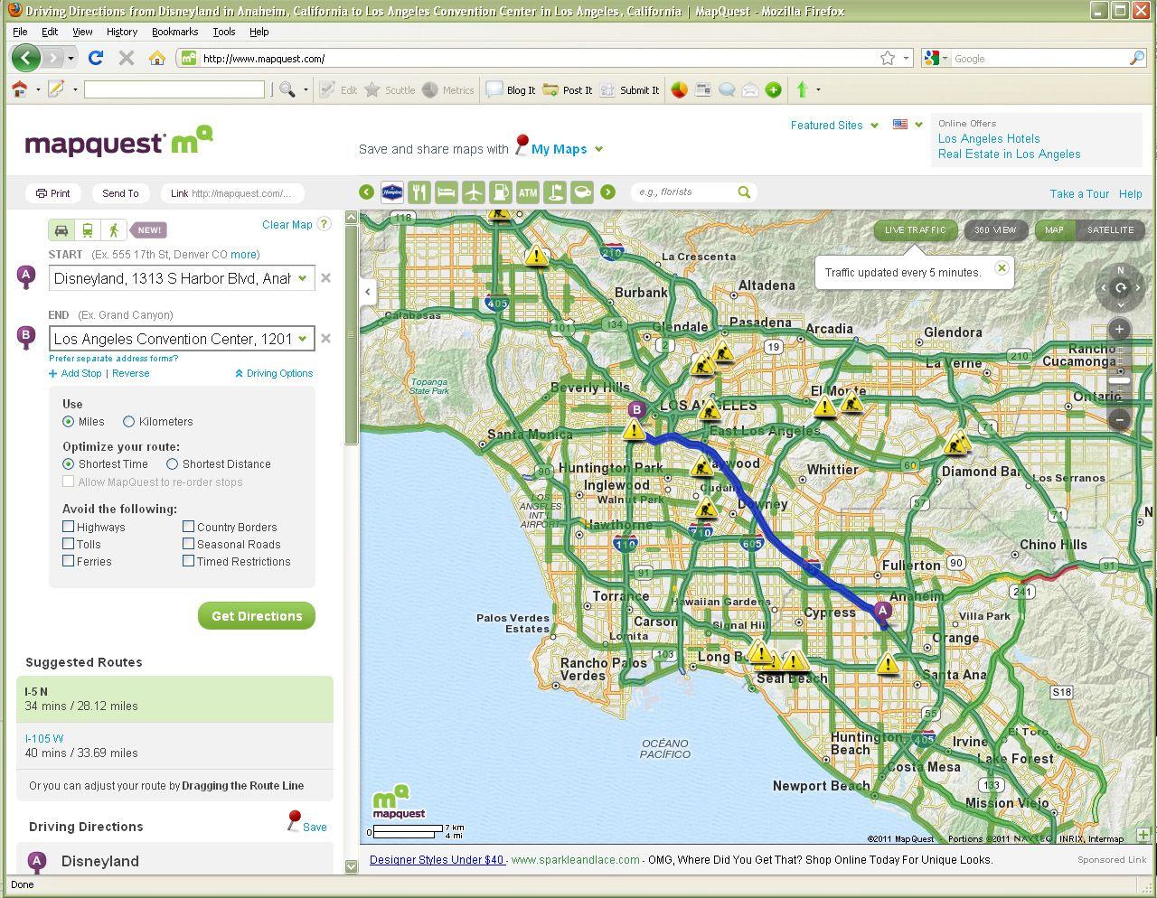
Long before smartphones tracked your every step, a web browser calculation changed how people traveled. Launched in 1996, MapQuest turned desktop computers into digital navigators, introducing millions to automated point-to-point pathfinding. Behind its printable blue-and-white driving directions lay a structured mathematical system that quietly established the foundation for modern digital cartography.
Understanding how legacy distance algorithms function requires looking past modern flashy interfaces. While today's apps rely on real-time satellite feeds and machine learning, the core machinery of computerized routing stems from graph theory principles formulated decades ago. This mechanism didn't just print maps; it proved that geographic space could be translated entirely into abstract nodes and weighted edges.
The Mathematical Engine Behind the Route
At its core, a mapping service doesn't "see" roads, rivers, or cities. It processes a massive network of interconnected points. This abstraction relies on graph theory, where road intersections become vertices and the asphalt connecting them becomes edges. Each edge carries a weight—usually measured in physical distance, speed limits, or historical travel time.
To find the shortest path between two distant points, early internet mapping architectures adapted foundational computer science concepts. The primary engine relied on variations of Edsger Dijkstra's 1959 pathfinding logic, paired with heuristic optimizations like the A* search algorithm.
- Nodes and Vertices: Every street corner or highway interchange is assigned a specific coordinate pair.
- Edge Weights: Values are assigned based on distance or estimated transit duration.
- Graph Reduction: Heuristic filters discard irrelevant road segments early to save processing power.
When you entered a start and end city in the late 1990s, the server initiated a graph traversal. It radiated outward from the origin vertex, evaluating neighboring edges step by step until it intersected the destination vertex. For cross-country queries, evaluating every single intersection on the continent would crash early web servers. Engineers had to implement hierarchical routing—solving coarse paths across interstate networks first, then refining local street connections at the boundaries.
Evolution from R.R. Donnelley to the Web
The lineage of digital routing stretches back further than most users realize. The technology originated within Cartographic Services, a division of printer R.R. Donnelley & Sons. In the mid-1980s, the division began computerizing map production to supply traditional publishers and gas station networks.
By 1994, this group spun off into GeoSystems Global Corporation. When they launched MapQuest in 1996, they introduced the world to the first commercial web mapping interface. Users accessed "TripQuest" for driving directions and the "Interactive Atlas" for browsing.
The service scaled rapidly during the dot-com boom, leading to an initial public offering in 1999 and an acquisition by America Online (AOL) for $1.1 billion in 2000. During these formative years, the technical challenge wasn't handling live traffic updates—which didn't exist in consumer web formats yet—but managing static vector data efficiently over dial-up internet connections. Every route calculation had to be lightweight enough to return text and simple line drawings across copper telephone wires.
Why Legacy Routing Still Matters Today
Consumers eventually migrated toward mobile-native platforms bundled directly into smartphone operating systems. Google Maps and Apple Maps integrated real-time GPS tracking, sensor data from millions of devices, and dynamic traffic rerouting. Yet, the underlying principles established by early web mapping persist in enterprise logistics.
Today, the MapQuest Platform operates largely behind the scenes. It supplies geocoding, spatial APIs, and routing matrices to thousands of business applications, fleet management systems, and delivery services. Commercial supply chains don't always need flashy smartphone UI elements; they require reliable, high-volume API calls that calculate matrix distances across thousands of delivery stops simultaneously.
Understanding this trajectory highlights a broader truth about software infrastructure. Core utilities often outlive their consumer-facing prominence, shifting from consumer portals into robust B2B engines.
Common Misconceptions About Digital Mapping
Many casual users misunderstand how online distance is computed, leading to recurring myths about navigation software.
- Straight-line versus road network: Early tools didn't just measure a crow-flies radius between zip codes; they matched coordinates against a vectorized road database to tally actual legal driving paths.
- Static versus dynamic data: Legacy web mapping relied entirely on pre-compiled geographic databases updated periodically, whereas modern architectures ingest live telemetry streams.
- The "shortest" versus "fastest" distinction: Early algorithms minimized absolute distance. Modern routing balances distance against traffic density, turn restrictions, and road classifications.
Recognizing these distinctions clarifies why older web directions sometimes routed drivers down bizarre rural shortcuts. Without real-time congestion weights, the algorithm optimized purely for mathematical brevity rather than practical driving flow.
Frequently Asked Questions
How did early web mapping calculate distance without GPS?
Early services used vectorized map databases licensed from geographic data providers. When a user requested a route, the software calculated the length of connected road segments stored in a structured spatial database rather than tracking live device signals.
Why did MapQuest lose market dominance to Google Maps?
Google introduced a browser-based mapping interface in 2005 that leveraged asynchronous JavaScript (AJAX), eliminating the need to reload entire web pages when panning or zooming. Combined with Android operating system distribution and aggressive mobile integration, this technical leap captured consumer mindshare.
Does MapQuest still exist as a functional service?
Yes. Beyond its consumer website, the brand operates the MapQuest Platform, providing enterprise routing, geocoding, and map APIs to commercial developers and logistics firms.
What is graph reduction in routing algorithms?
Graph reduction is an optimization technique that strips away redundant or minor road segments when calculating long-distance routes, allowing servers to compute paths across continents in milliseconds without exhausting system memory.



