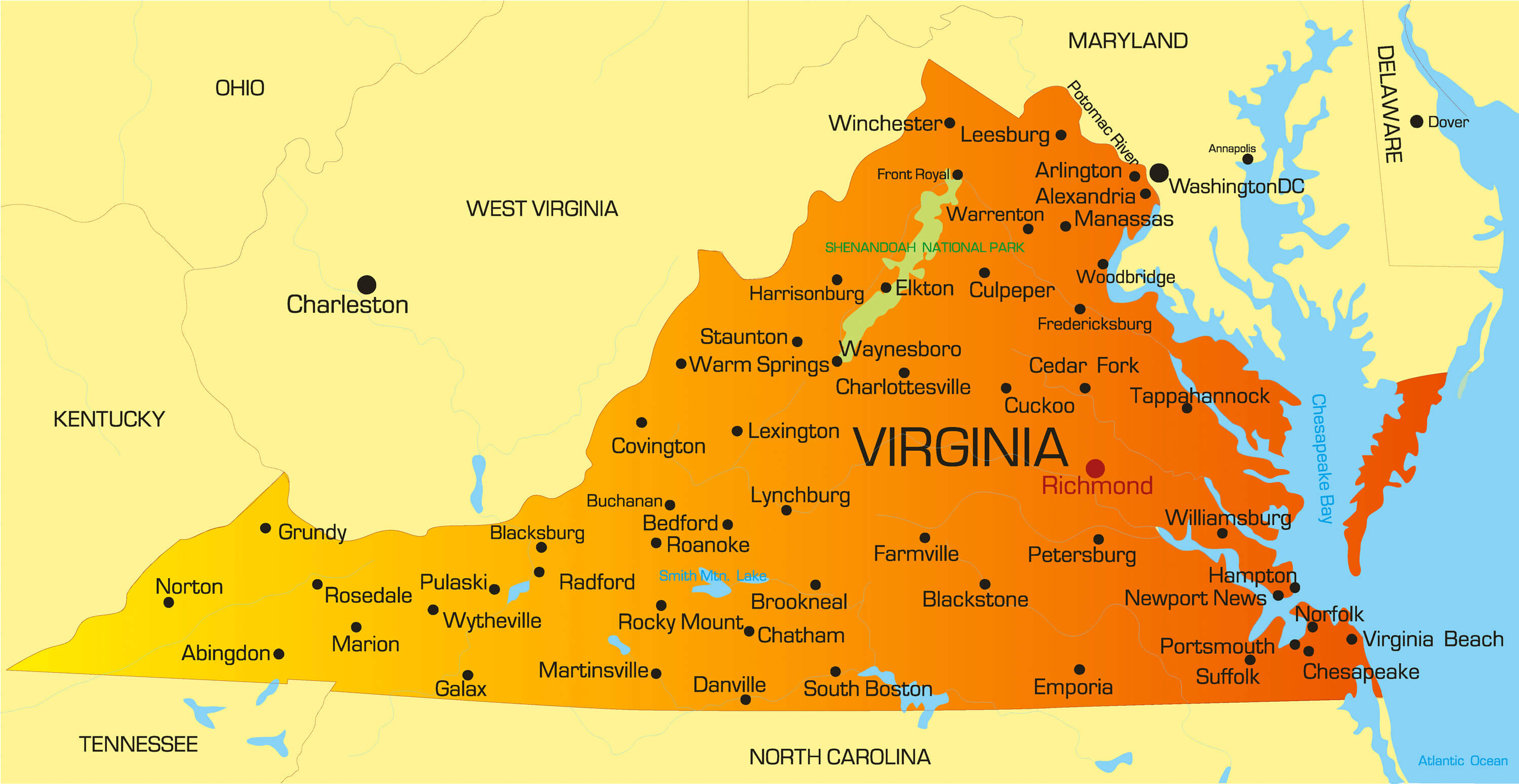
Mapping the geography and strategic location of the Old Dominion reveals how physical terrain directly shaped American history, modern commerce, and federal defense. Virginia sits on the East Coast of the United States within the South Atlantic region, acting as a natural corridor connecting the Northeast to the Deep South. Its borders stretch from the Atlantic shoreline and the Chesapeake Bay westward across the Piedmont and the Blue Ridge Mountains into the rugged Appalachian plateau, creating distinct topographic tiers that have defined human settlement for centuries.
The geographic footprint spans approximately 42,775 square miles, making it the 35th largest state by area. Yet its proximity to the nation's capital—Washington, D.C.—and its deep-water access via Hampton Roads give it an outsized geopolitical footprint. Understanding where Virginia lies requires looking past simple state lines to examine how its five distinct physical zones dictate modern infrastructure, population distribution, and historical migration patterns.
The Five Distinct Physiographic Regions
Virginia's landscape changes dramatically from east to west. Geographers divide the commonwealth into five unique physical zones, each with distinct soil composition, elevation, and economic utility.
- Atlantic Coastal Plain (Tidewater): Bordering the Atlantic Ocean and the Chesapeake Bay, this low-lying area features extensive salt marshes, swamps, and deep estuaries. Major rivers like the James, York, and Rappahannock carve through this plain, creating natural harbors.
- Piedmont: Moving inland, the land transitions into a rolling, fertile foothill region that sits east of the mountains. This central zone covers the largest percentage of the state's total area and historically supported extensive agriculture.
- Blue Ridge Mountains: This narrow, high-elevation barrier runs from southwest to northeast, featuring steep, forested ridges. It includes Mount Rogers, the state's highest point at 5,729 feet above sea level.
- Appalachian Ridge and Valley: West of the Blue Ridge lies a region defined by long, even ridges separated by fertile valleys, including the northern stretch of the broad Shenandoah Valley. Limestone caves, sinkholes, and ridges characterize this corridor.
- Appalachian Plateau: Occupying the extreme southwestern corner of the state, this rugged terrain features elevated tablelands sliced by narrow streams that ultimately drain into the Ohio River basin.
Strategic Location and Geopolitical Importance
The position of the Old Dominion on the mid-Atlantic seaboard has made it a focal point for national defense and trade since the colonial era. To the north, its border abuts Maryland and the District of Columbia, drawing massive federal employment and commuter populations into Northern Virginia. To the south and west, boundaries shared with North Carolina, Tennessee, Kentucky, and West Virginia link the state directly to the broader American interior and the Ohio River valley.
Water access remains the primary driver of the region's strategic value. The lower Chesapeake Bay forms one of the world's finest natural anchorages, allowing the development of massive maritime infrastructure. Naval Station Norfolk stands as the largest naval base on the planet, anchoring global military logistics. According to the Virginia Department of State, the state's ports handle billions of dollars in international cargo annually, cementing its role as a vital link in global supply chains.
Population Distribution and Urban Geography
While rural terrain dominates much of the western and southern acreage, population density concentrates heavily in specific corridors. More than one-third of all residents live in Northern Virginia, functioning largely as an extension of the Washington, D.C. metropolitan economy.
Other population centers follow historical migration and trade routes. Richmond, the state capital since 1780, sits at the fall line of the James River, marking the boundary where ocean-going navigation historically stopped. Meanwhile, the Hampton Roads metropolitan area—encompassing Norfolk, Virginia Beach, and Newport News—forms a distinct urban cluster driven by military personnel, shipbuilding, and tourism.
Common Geographic Misconceptions
- Mistake: Assuming Virginia belongs entirely to the South.
- Reality: While culturally and historically tied to the South, Northern Virginia shares much of its economic and demographic profile with the Mid-Atlantic and Northeast corridors.
- Mistake: Believing the entire state is mountainous due to proximity to the Appalachians.
- Reality: Over half of the commonwealth consists of low-lying coastal plains and rolling Piedmont hills; mountains are strictly confined to the western third.
- Mistake: Treating Richmond as a coastal port city.
- Reality: Richmond sits inland along the fall line of the James River, operating differently from the deep-water tidal ports found further east.
Frequently Asked Questions
What are the natural borders of Virginia?
The state is bounded by the Atlantic Ocean and Chesapeake Bay to the east, Maryland and Washington, D.C. to the north, North Carolina and Tennessee to the south, and Kentucky and West Virginia to the west.
Why is Virginia called the Old Dominion?
King Charles II of England gave the colony the moniker "Dominion of Virginia" in the 17th century because it remained loyal to the crown during the English Civil War, later shortened to the Old Dominion.
How many physical regions make up the state?
Geographers divide the commonwealth into five distinct regions: the Coastal Plain, the Piedmont, the Blue Ridge Mountains, the Valley and Ridge province, and the Appalachian Plateau.
Where is the geographic center of Virginia located?
The exact geographic center point sits in Buckingham County, near the central portion of the state.



