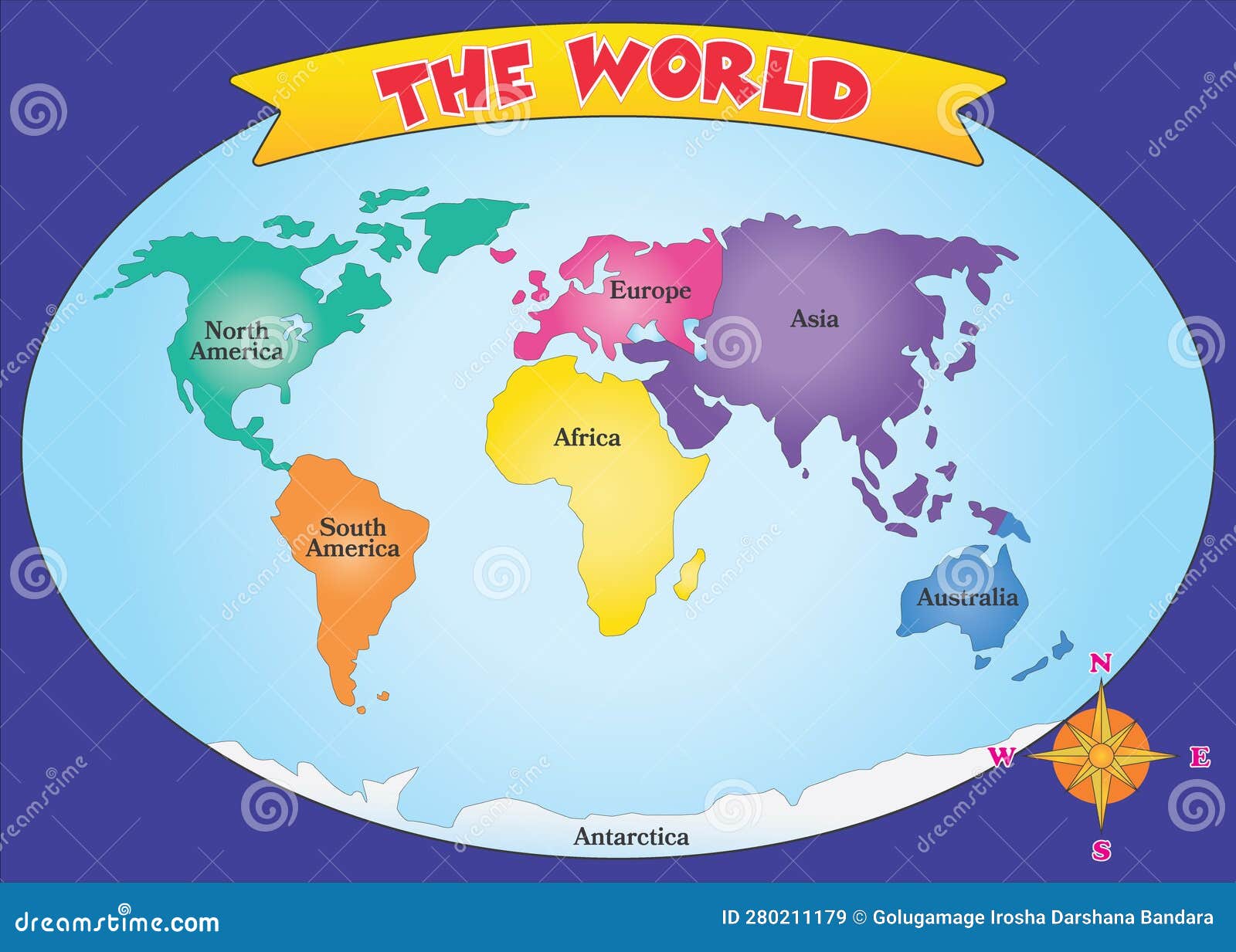
When you look at a map of the world with continents, you aren't just looking at neutral physical science. You're viewing centuries of cartographic history, political choices, and mathematical projections that turn our round planet into a flat surface. Understanding how these massive landmasses are categorized helps you read past the visual bias built into standard schoolroom posters.
Geographers define a continent as a large, continuous landmass on Earth, yet the exact number of continents isn't fixed by strict geological laws. Different global education systems teach distinct models based on cultural traditions. Whether you grew up learning a seven-continent framework or a six-continent model changes how you visualize global space.
The Two Major Continental Models
The way humanity divides Earth's landmasses follows two primary traditions. These frameworks stem from historical exploration, cultural boundaries, and educational systems rather than rigid plate tectonics.
The seven-continent model is standard in English-speaking countries, China, and parts of Western Europe. It separates landmasses into Asia, Africa, North America, South America, Antarctica, Europe, and Australia. In this view, the Ural Mountains and the Caucasus mark the conventional dividing line between Europe and Asia, even though they share a single continuous tectonic plate known as Eurasia.
The six-continent combined Eurasia model is widely taught across Russia, Eastern Europe, and parts of Asia. It treats Europe and Asia as a single continent called Eurasia while keeping Africa, North America, South America, Antarctica, and Australia separate.
Other variations exist around the world. Latin American educational models often treat North and South America as a single continent named America because of shared colonial histories and geographic continuity. When examining any map of the world with continents, checking the regional origin of the cartographer reveals which tradition shaped the layout.
How Map Projections Distortion Reality
Flattening a three-dimensional sphere onto a two-dimensional piece of paper requires mathematical compromises. Every cartographic projection distorts at least one property: area, direction, scale, or shape.
The Mercator projection, created by Gerardus Mercator in 1569, remains the most recognizable design in modern classrooms and digital web browsers. It preserves angles and straight lines, making it exceptionally useful for marine navigation. However, it severely exaggerates landmasses as you move away from the equator. On a standard Mercator map, Greenland appears roughly the same size as Africa, even though Africa's landmass is about fourteen times larger than Greenland's.
To correct these visual imbalances, cartographers use equal-area projections like the Peters projection or the Gall-Peters projection. These alternatives show continents in their true relative proportions, though they distort shapes by stretching landmasses near the poles. Choosing one projection over another shifts how viewers perceive the global prominence of northern versus southern nations.
The Cultural Boundaries of Eurasia
The division between Europe and Asia is entirely cultural rather than geological. Tectonically, Europe sits on the western edge of the Eurasian plate, sharing a border with Asia that lacks any physical ocean barrier.
Ancient Greek scholars initially used the terms Europe and Asia to describe the lands north and south of the Aegean Sea. Over time, European colonial powers expanded this conceptual line eastward to define their own sphere of influence. This historical framing established Europe as an independent continent distinct from Asia, despite unbroken land connections spanning thousands of miles.
Regions near this historical boundary, such as Turkey and the Caucasus nations, navigate a dual identity that bridges Western and Eastern cultural traditions. Recognizing this arbitrary border helps explain why physical geography often clashes with political and social classifications.
Sub-Questions Answered: Beyond the Basics
Why is Australia considered a continent and not an island?
The distinction between an island and a continent comes down to sheer scale and tectonic independence. Australia sits on its own distinct continental tectonic plate, whereas large landmasses like Greenland rest on the North American plate. Furthermore, Australia covers over 7.6 million square kilometers, making it significantly larger than any classified island.
How do tectonic plates relate to continents?
Continental crust differs fundamentally from oceanic crust in density and composition. Granitic continental rocks float higher on the Earth's mantle than denser basaltic oceanic crust. While tectonic plate boundaries often align with continental margins, plates frequently contain a mix of both land and ocean floor, such as the North American plate which extends to the middle of the Atlantic Ocean.
Why is Antarctica placed at the bottom of standard maps?
North-up orientation is a cartographic convention rather than an absolute physical law in space. Early European explorers navigated using the North Star, placing north at the top of their charts. Inverting a map to place Antarctica at the top is geographically valid, as space has no inherent up or down.
Common Mistakes in Global Mapping
- Treating map projections as objective truth: Forgetting that every flat map distorts either size or shape leads to skewed perceptions of global geography.
- Confusing political borders with tectonic plates: Assuming that country borders or continental dividing lines follow natural geological faults.
- Ignoring regional naming conventions: Relying exclusively on the seven-continent model without realizing that billions of people learn alternative classifications.
Frequently Asked Questions
How many continents are there on Earth?
The accepted number depends on regional educational systems. The English-speaking world typically teaches seven continents, while parts of Eastern Europe and Latin America teach six continents by combining Europe and Asia or the Americas.
Which continent is the largest by area and population?
Asia is both the largest continent by land area and the most populous, containing over 4.7 billion people across diverse regions ranging from Siberia to Southeast Asia.
Why does Greenland look so large on world maps?
Greenland appears massive on standard Mercator projections because the map stretches landmasses near the poles to maintain rectangular grid lines and navigation angles. In reality, Africa and South America dwarf Greenland in square mileage.
Where is the exact border between Europe and Asia?
The conventional boundary follows the Ural Mountains in Russia, the Ural River, the Caspian Sea, the Caucasus Mountains, and the Black Sea straits, though this line is a historical and political construct rather than a physical ocean barrier.



