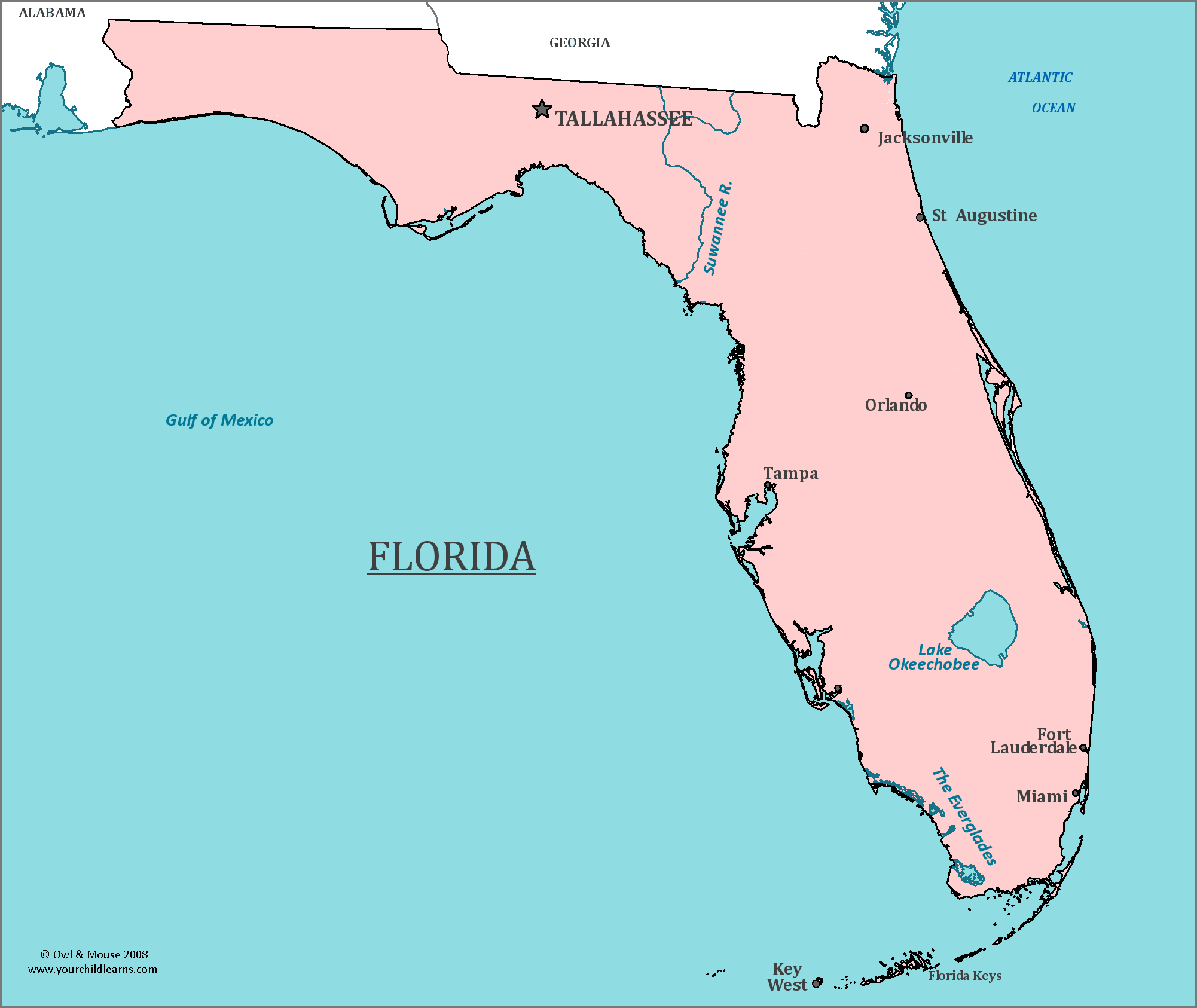
Florida is undeniably part of North America. It sits on the North American tectonic plate, forms a contiguous part of the United States mainland, and rests thousands of miles north of the continental divide separating the two American landmasses. Yet, people ask this question with surprising frequency.
Geography isn't just about lines on a map. Climate, proximity to the equator, and heavy cultural ties to countries south of the US border often blur public perception. Let's look at why this confusion happens, what science and politics say about the region, and how Florida actually fits into the global picture.
The Plain Geographical Reality
From a purely cartographic and scientific standpoint, Florida is situated entirely within the continent of North America. The United States Geological Survey (USGS) classifies the state as an integral part of the North American continental shelf.
Geologically, Florida rides on the North American Plate. South America occupies an entirely different tectonic plate—the South American Plate. The physical separation between the two continents is marked by the Darién Gap, a dense, mountainous rainforest situated between Panama and Colombia. Florida lies more than two thousand miles north of this natural continental boundary.
Furthermore, Florida is the southeasternmost state of the contiguous United States. It connects directly to Georgia and Alabama to its north, making it physically inseparable from the North American landmass.
Why Do People Get Confused?
If the maps are clear, why does the question persist? Several distinct factors distort how people perceive Florida's place in the Western Hemisphere.
Subtropical Climate and Latitude
Florida's southernmost tip, Key West, sits just about 24 degrees north of the equator. Parts of South Florida feature a true tropical climate, complete with mangrove swamps, coral reefs, and year-round warmth. Because much of North America is associated with temperate or cold weather, heavy winters, and snow, the palm trees and sweltering summers of Miami feel worlds away from the traditional image of a northern continent.
Proximity to the Caribbean and Latin America
Geography places Florida as a maritime neighbor to the Caribbean islands and Central America. Havana, Cuba, is only about 90 miles south of Key West. This closeness creates a massive cultural bridge. Cities like Miami function as commercial and demographic crossroads for the entire Western Hemisphere.
Cultural Overlaps
People often confuse geographic continents with cultural regions. Florida shares deep linguistic, economic, and familial ties with Spanish-speaking nations across both Central and South America. Because millions of residents trace their heritage to countries like Colombia, Venezuela, Argentina, and Cuba, the local culture feels distinctly international, leading casual observers to mislabel its continental belonging.
Political, Economic, and Institutional Frameworks
Beyond physical rocks and soil, global institutions and treaties place Florida firmly inside North American jurisdiction.
- National Governance: Florida is one of the 50 states governed by the federal laws of the United States.
- Trade Pacts: The US operates within North American trade agreements, such as the United States-Mexico-Canada Agreement (USMCA), tying Florida's economy directly to its northern neighbors.
- Security Alliances: Continental defense treaties, including the North American Aerospace Defense Command (NORAD), explicitly cover the airspace and coastal waters of Florida as part of North American defense zones.
When you fly from New York to Miami, you're taking a domestic flight within the same country. When you fly from São Paulo to Miami, you are crossing an international boundary from South America into North America.
Common Misconceptions About Florida's Location
Let's clear up a few persistent myths regarding the state's positioning:
- Myth: Florida is part of Central America because it juts out into the water.
- Reality: Central America is an isthmus connecting North and South America. Florida is a peninsula attached to the North American mainland.
- Myth: Tropical weather makes a region part of South America.
- Reality: Continents are defined by tectonic plates and historic landmass boundaries, not by weather patterns or temperature zones. Parts of Hawaii and Texas also experience tropical or semi-tropical conditions while remaining firmly rooted in North America.
- Myth: "Latin America" is a southern continent.
- Reality: Latin America is a cultural and linguistic classification covering nations where Romance languages are spoken. It includes countries in North America (like Mexico), Central America, South America, and the Caribbean.
Frequently Asked Questions
Is Florida considered part of the Caribbean?
No. While Florida shares historical, economic, and weather patterns with the Caribbean, it is a US state attached to the North American continent. The Florida Keys sit at the edge of the Straits of Florida, which separate the US from Cuba and the wider Caribbean.
Why is Miami often called the capital of Latin America?
Miami earns this informal title because it serves as the primary corporate, financial, and cultural hub linking the United States with Spanish-speaking markets in Central America, South America, and the Caribbean. Its demographics and business networks heavily lean toward Latin American commerce, which often misleads people about its geographic continent.
Does Florida share any land borders with countries outside the US?
No. Florida shares land boundaries only with two US states: Georgia to the north and Alabama to the northwest. Its remaining borders are entirely maritime, touching the Atlantic Ocean and the Gulf of Mexico.
How far is Florida from South America geographically?
The closest point in South America is Colombia, located roughly 1,100 miles south-southeast of Miami across the Caribbean Sea.



