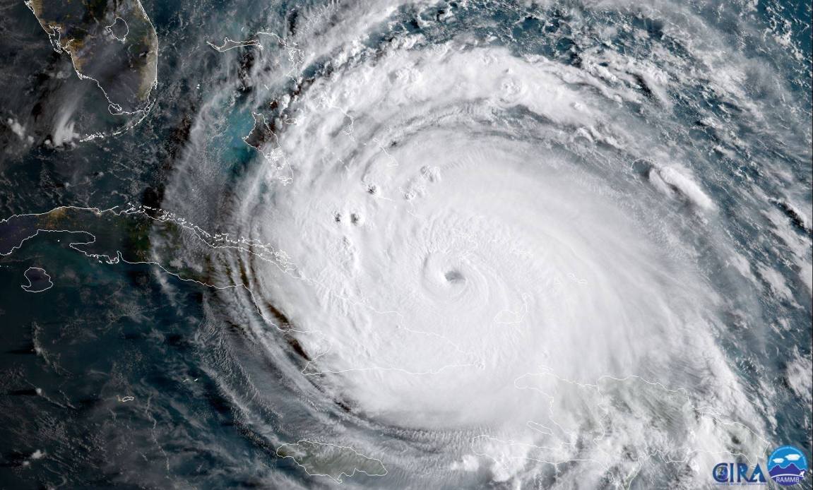
When a major weather system forms off the coast, millions of people pull out their phones to check radar loops, wind speeds, and projected storm tracks within seconds. This immediate access to meteorological data wasn't always available. Early mobile operating systems offered sluggish web pages or clunky, low-resolution images that took minutes to load over cellular networks. The evolution of iOS transformed smartphones into pocket-sized meteorological stations capable of rendering high-definition, real-time radar data anywhere in the world.
Understanding how mobile software revolutionized weather tracking requires looking past simple app interfaces and examining the underlying architecture. Modern smartphones feature powerful graphics processors, precise location services, and high-speed cellular connections that allow developers to build sophisticated visualization tools. These technological leaps changed how everyday users monitor severe weather and how professional meteorologists distribute vital safety information to the public.
The Technical Shift from Desktop to Mobile
Before mobile operating systems supported hardware-accelerated graphics, checking severe weather meant sitting in front of a desktop computer or watching local television broadcasts. Early internet weather portals relied on static JPEG images generated by meteorological agencies every few minutes. Loading a new radar loop meant waiting for multiple image files to download sequentially over dial-up or early broadband connections.
The introduction of dedicated mobile application platforms changed this dynamic entirely. Instead of downloading full web pages, mobile software could request raw meteorological data streams and render them locally using the device's graphics hardware. Developers utilized vector graphics and compressed data formats to display smooth, pinch-to-zoom radar maps. This shift meant users could track a storm's trajectory down to their exact street corner, using GPS chips embedded directly inside their phones.
Processing Power and Radar Rendering
Rendering live radar data requires significant computational overhead. Doppler radar stations sweep the sky constantly, collecting vast amounts of data regarding precipitation velocity, intensity, and direction. Translating these raw data points into a color-coded map on a phone screen involves complex interpolation algorithms.
Early mobile hardware struggled with these calculations, resulting in laggy maps and frequent crashes when users tried to zoom in on rapidly developing squall lines. As mobile chipsets evolved with dedicated graphics cores and neural engines, app developers gained the performance headroom needed to render multiple layers of data simultaneously. Today's devices effortlessly overlay high-resolution radar imagery with topological maps, wind vectors, and active warning polygons without dropping frames.
Location Services and Hyper-Local Forecasting
A major turning point in mobile weather tracking was the integration of persistent, accurate location tracking. Traditional forecasts were regional, covering broad metropolitan areas or entire counties. If a severe thunderstorm was moving through a region, residents relied on generalized broadcast alerts that might not reflect conditions at their specific address.
With continuous GPS integration, mobile software knows your exact coordinates in real time. This capability enabled hyper-local forecasting features, such as minute-by-minute precipitation predictions. Instead of stating that rain will start in the afternoon, modern software calculates the exact trajectory of a storm cell relative to your device's GPS coordinates, providing precise alerts like "moderate rain starting in four minutes."
Privacy and Battery Management
Delivering precise location-based weather tracking presented significant engineering challenges, particularly regarding battery consumption and user privacy. Continuously polling GPS hardware drains a phone's battery quickly, while constant background tracking raises valid data privacy concerns.
Engineers solved these hurdles by implementing geofencing and region-monitoring APIs. Instead of constantly checking exact GPS coordinates, the operating system registers broader regional boundaries. The app only wakes up to pull high-precision location data when the device enters an active severe weather warning zone. This architectural balance allowed developers to build reliable emergency alert systems that don't drain the battery in a few hours.
Integration of Public and Private Meteorological Networks
The software ecosystem surrounding mobile weather tracking relies on a vast network of data providers. Government agencies like the National Oceanic and Atmospheric Administration operate the foundational radar infrastructure, collecting raw atmospheric data and making it publicly available through open data initiatives.
Private companies and independent developers build upon these open data pipelines, creating specialized applications tailored to different user needs. Some apps focus on raw radar fidelity for storm chasers, while others prioritize clean, accessible interfaces for everyday commuters. This separation of concerns fosters rapid innovation, as third-party developers can test new user interface paradigms and visualization techniques much faster than government agencies can update their legacy portals.
Crowdsourced Weather Data
Modern mobile meteorology isn't limited to satellites and massive Doppler towers. Today's software also incorporates crowdsourced sensor data from millions of active devices. Features integrated into modern mobile ecosystems allow users to report local weather conditions—such as hail size, localized flooding, or sudden wind damage—directly through their devices.
Aggregating these manual reports with automated sensor inputs creates a denser observation network than traditional meteorology ever achieved alone. Artificial intelligence algorithms filter this incoming data stream, cross-referencing user reports with radar signatures to verify severe weather events instantly.
How Mobile Alerts Changed Public Safety
Beyond letting people check if they need an umbrella, mobile weather tracking fundamentally altered how emergency management agencies communicate imminent danger. Traditional emergency broadcasting relied on television crawl text, outdoor sirens, and radio announcements, all of which required the recipient to be actively listening or watching.
Mobile operating systems introduced native emergency alert channels that bypass standard application layers to push life-saving warnings directly to device screens. When a tornado warning or flash flood emergency is issued for a specific polygon, the system triggers a high-priority notification that overrides silent modes.
The Psychology of Mobile Warning Systems
Immediate push notifications changed how people react to severe weather threats. Studies by organizations like the Federal Emergency Management Agency show that individuals who receive hyper-localized, map-based warnings on their phones take protective action faster than those relying on generalized broadcast media.
Seeing a visual representation of a storm cell moving directly toward a marked home location creates a sense of urgency that abstract county-wide warnings often fail to convey. This direct line of communication between meteorological data and the end user has saved countless lives during severe weather outbreaks.
Frequently Asked Questions
How do mobile weather apps get real-time radar data?
Mobile apps pull data feeds directly from government meteorological agencies and private radar networks via Application Programming Interfaces. The app downloads compressed data packets and uses the phone's graphics processor to render the color-coded maps on your screen.
Why do some weather apps show different radar timing?
Different apps use different predictive models and update frequencies. Some refresh their data every two minutes using raw radar scans, while others rely on proprietary forecast models that update less frequently but attempt to smooth out radar artifacts.
Does background weather tracking drain phone battery?
Modern mobile operating systems use efficient region-monitoring frameworks rather than continuous GPS polling. Apps only use high-precision location services when you open the application or when you enter an active weather alert zone, minimizing battery drain.
Are free weather apps less accurate than paid ones?
Accuracy depends on the underlying meteorological data source rather than the app's price tag. Most apps, whether free or paid, pull from the same foundational radar networks operated by national weather services. Paid apps typically remove advertisements or offer advanced data layers like velocity displays.



