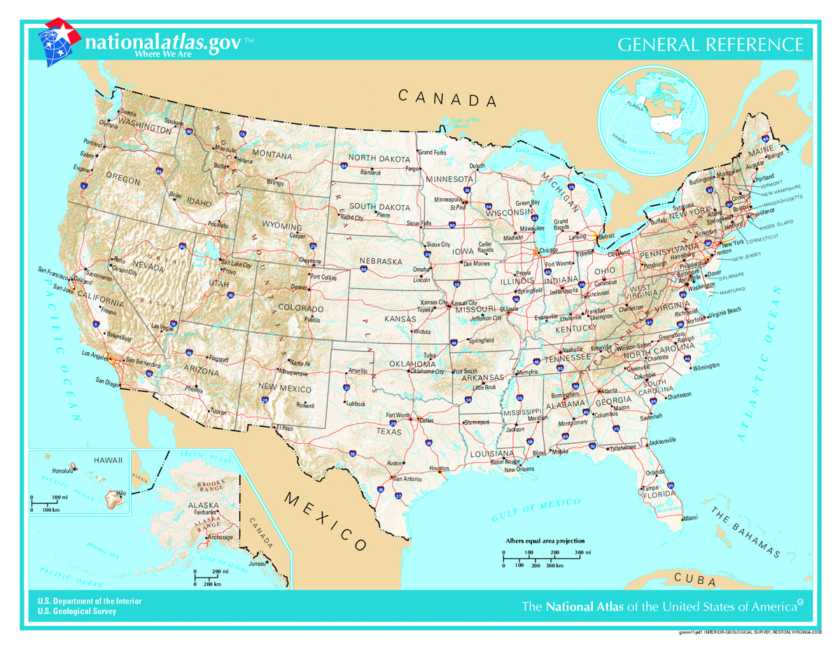
Interstate 40 stretches over 2,550 miles from Barstow, California, to Wilmington, North Carolina. It serves as a primary transcontinental corridor for commercial trucks, logistics networks, and daily commuters alike. If you're studying national freight corridors, understanding this route requires looking past simple geography into how regional bottlenecks, distribution hubs, and major highway intersections shape American commerce.
Unlike northern routes that face severe winter closures, I-40 provides a reliable year-round path across eight states. It connects the vital distribution networks of the Southwest and Southern California ports directly to major consumer markets across the Sun Belt and the East Coast.
The Geographic Span and Route Breakdown
The highway begins at an interchange with Interstate 15 in Barstow, California, cutting eastward through the Mojave Desert before crossing into Arizona. From there, it traverses New Mexico, passing through Albuquerque and Gallup, and cuts across the Texas Panhandle via Amarillo.
As the road continues east, it navigates Oklahoma City and crosses Arkansas toward Memphis, Tennessee, where it bridges the Mississippi River. The final stretch winds through Nashville and Knoxville, climbs the Blue Ridge Mountains into North Carolina through Asheville, and terminates near the port city of Wilmington.
- Western Segment: Barstow to Albuquerque spans desert terrain with long stretches between major service stops, requiring careful fuel planning for commercial fleets.
- Central Segment: Oklahoma City through Memphis acts as a high-density interchange zone, intersecting major north-south arteries like Interstate 35 and Interstate 55.
- Eastern Segment: Nashville to Wilmington navigates mountainous terrain in Appalachia before flattening out toward the Atlantic seaboard.
Freight Mobility and Economic Impact
Commercial freight is the lifeblood of I-40. Millions of tons of cargo move along this corridor annually, driven by manufacturing plants, agricultural centers, and intermodal yards situated near the highway. Initiatives like the I-40 TradePort Corridor project aim to modernize this infrastructure by integrating cleaner logistics technology and automated cargo management systems.
Trucking companies rely on I-40 because it bypasses some of the severe weather risks associated with Interstate 80 or Interstate 90 further north. However, high freight volumes mean certain urban stretches—particularly around Memphis, Nashville, and Oklahoma City—frequently experience severe congestion during peak hours.
Major Interchanges and Connections
Strategic intersections allow freight to transition smoothly between major regional corridors. Fleet managers track these junctions closely to optimize transit times and avoid urban bottlenecks.
- Interstate 15 (Barstow, CA): Links Pacific port traffic directly into the eastern-bound I-40 system.
- Interstate 25 (Albuquerque, NM): Provides a direct vertical corridor north toward Colorado and south toward El Paso.
- Interstate 35 (Oklahoma City, OK): Creates a central crossroads connecting Canada to the Texas Gulf Coast.
- Interstate 55 (West Memphis, AR): Facilitates movement down the Mississippi River valley toward New Orleans.
- Interstate 81 (Dandridge, TN): Offers an alternate diagonal route north into the Mid-Atlantic and Northeast regions.
Common Operational Challenges for Fleets
Operating heavy commercial vehicles along I-40 presents distinct operational hurdles. Drivers and dispatchers must account for several recurring friction points along the route.
- Mountain Grades: The transition through western North Carolina and eastern Tennessee involves steep mountain passes that reduce fuel efficiency and slow down heavy loads.
- Parking Shortages: Finding safe, legal parking for semi-trucks during mandatory rest periods remains difficult, particularly through the central and western stretches.
- Severe Weather Events: While milder than northern tiers, winter storms can still trigger sudden closures in the mountains of New Mexico and North Carolina.
- Bridge Maintenance: Aging infrastructure across major river crossings, such as the Mississippi River crossings near Memphis, frequently requires scheduled lane closures for structural rehabilitation.
To monitor real-time road conditions, weight station statuses, and emergency alerts, drivers regularly consult the Federal Highway Administration for national updates and individual state department of transportation portals.
Frequently Asked Questions
How long does it take to drive the entire length of Interstate 40?
Driving the full 2,550+ miles from Barstow to Wilmington takes roughly 38 to 42 hours of continuous driving under normal traffic conditions, though federal hours-of-service regulations mean commercial drivers take significantly longer.
Which major cities are directly connected by I-40?
Key metropolitan areas along the route include Albuquerque, Amarillo, Oklahoma City, Little Rock, Memphis, Nashville, Knoxville, Greensboro, Raleigh, and Wilmington.
Is Interstate 40 part of the old Route 66?
Yes. Large portions of I-40 in New Mexico, Arizona, and Oklahoma directly parallel or overlay historic U.S. Route 66, which it largely replaced as a high-speed transcontinental highway.
What are the steepest grades on I-40?
The most challenging elevation changes occur in western North Carolina and eastern Tennessee through the Appalachian Mountains, where trucks must navigate extended grades requiring careful braking management.



