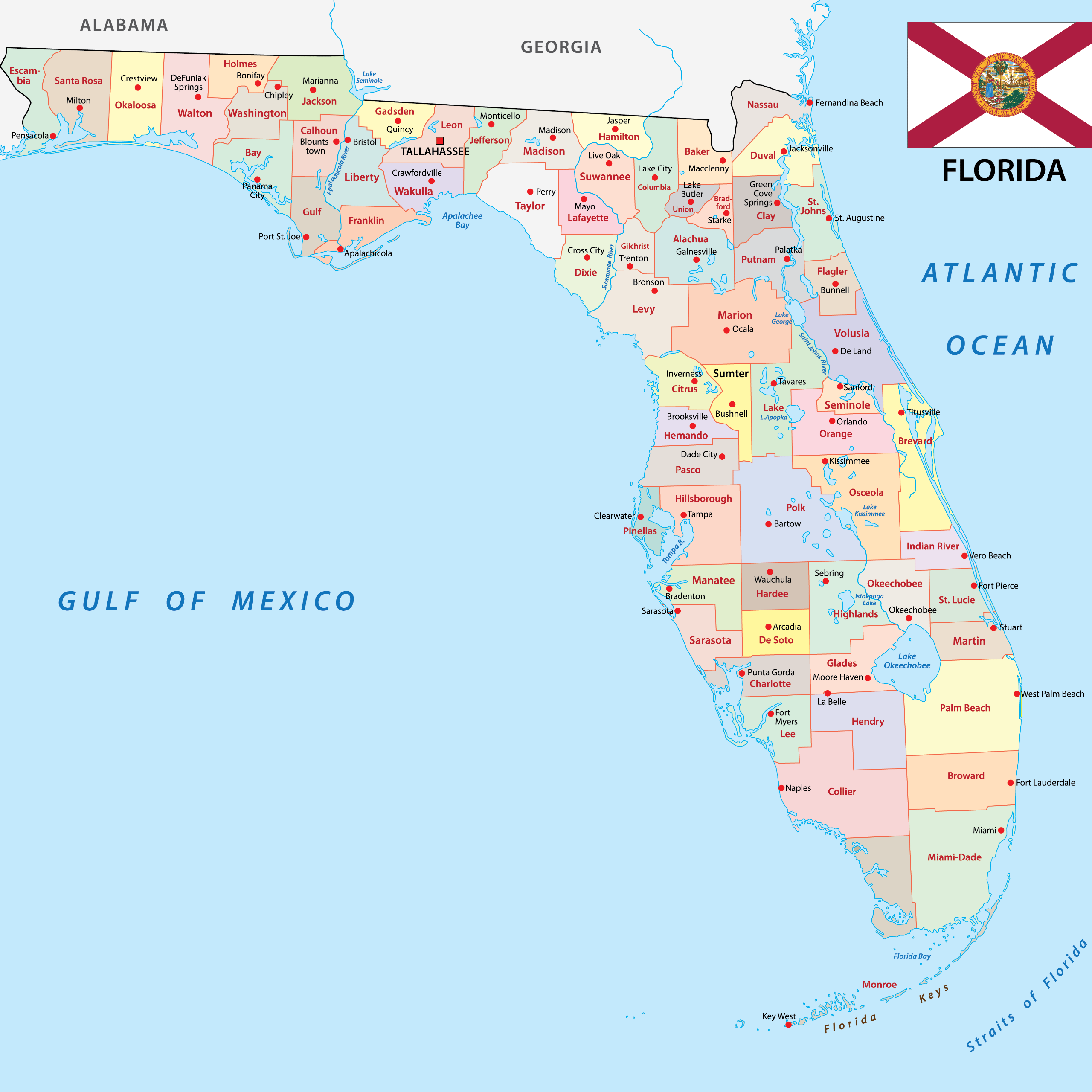
Hurricane Milton struck the west coast of Florida as a powerful Category 3 storm on October 9, 2024, leaving a profound mark on the state's infrastructure. Originating in the western Gulf of Mexico, the system underwent explosive intensification, reaching rare Category 5 status with winds touching 180 mph before a slight weakening cycle prior to landfall. Understanding how this event unfolded provides critical context for emergency preparedness, meteorological tracking, and coastal resilience across the region.
The storm's trajectory took it across the Gulf of Mexico toward the central-west Florida peninsula, making official landfall near Siesta Key in Sarasota County. Mandatory evacuation orders spanned numerous coastal and low-lying counties as officials warned of catastrophic storm surges, widespread power failures, and destructive wind velocities. Rather than moving as a slow meandering system, Milton maintained a brisk forward speed that limited total rainfall duration in certain zones while creating extreme precipitation rates elsewhere.
Meteorological Evolution and Path
Milton's rapid development surprised forecasters, jumping from a disorganized tropical disturbance into a major hurricane within a remarkably brief window. Favorable atmospheric conditions, including high sea surface temperatures in the Gulf of Mexico, fueled its rapid strengthening.
- Initial Formation: Formed on October 5, 2024, in the western Gulf of Mexico from a lingering tropical wave.
- Peak Intensity: Reached Category 5 strength with a central pressure dropping to 895 mbar, making it one of the most intense recorded storms in the Gulf.
- Landfall Parameters: Crossed the Florida coastline near Siesta Key at approximately 8:30 PM EDT on October 9, 2024, packing maximum sustained winds near 120 mph.
As the system crossed the Florida peninsula, it interacted with a frontal boundary, accelerating toward the northeast and exiting into the Atlantic Ocean as an extratropical low. Meteorological tracking data from agencies like the National Hurricane Center mapped every phase of this transition, assisting local municipalities in issuing timely advisories.
Landfall Impacts and Structural Damage
The destruction left behind by Milton stemmed from a combination of violent winds, unprecedented rainfall totals, and significant storm surge along the Gulf coast. Communities still recovering from earlier seasonal storms faced compounding challenges.
Storm surge inundation reached critical levels along southwest and central Florida, with gauges in areas like Naples and Fort Myers recording water levels exceeding five feet above normal high tide lines. Simultaneously, the northern semicircle of the hurricane triggered an extraordinary precipitation event. Parts of Pinellas and Hillsborough counties recorded nearly 20 inches of rain within a 24-hour window, translating to a statistical rainfall event exceeding a 1-in-1,000-year frequency for cities like St. Petersburg.
Beyond coastal flooding, Milton spawned an unprecedented tornado outbreak across the Florida peninsula. Over 40 tornadoes touched down on October 9 alone, tearing through regions spanning the east and west coasts and causing severe structural damage to residential neighborhoods and agricultural properties.
Emergency Response and Evacuation Protocols
State and local authorities initiated large-scale evacuations days before landfall, utilizing contraflow highway procedures on major arteries such as Interstate 75 and Interstate 4 to expedite outbound traffic. County emergency management teams issued mandatory orders for residents living in mobile homes, barrier islands, and low-lying surge zones.
The Florida Division of Emergency Management coordinated multi-agency search and rescue missions immediately following the storm's passage. Utility crews mobilized hundreds of thousands of line workers from across the country, restoring power to millions of affected homes and businesses despite severe access impediments caused by downed trees, washed-out bridges, and deep urban flooding.
Frequently Asked Questions
What category was Hurricane Milton when it hit Florida?
Hurricane Milton made landfall near Siesta Key, Florida, as a major Category 3 hurricane with maximum sustained winds of 120 mph.
Why did Hurricane Milton intensify so quickly?
Extremely high water temperatures in the Gulf of Mexico combined with low wind shear allowed the system to undergo explosive deepening, briefly reaching Category 5 strength before interacting with land and drier air.
How much rain did Hurricane Milton drop?
Rainfall totals varied widely by location, but parts of the Tampa Bay area and Pinellas County recorded historic amounts approaching 20 inches within a single day, causing severe flash flooding.
Did Hurricane Milton cause tornadoes?
Yes, Milton triggered a historic tornado outbreak for a tropical cyclone in Florida, producing dozens of confirmed tornadoes that damaged homes and infrastructure hours before and during the primary landfall.



