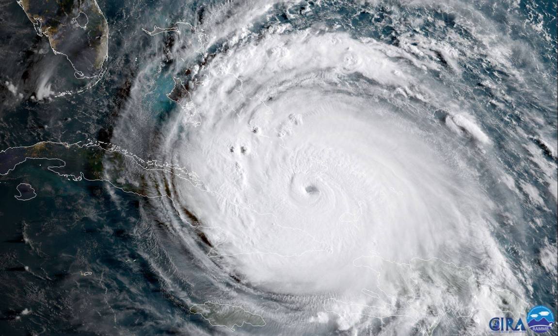
Hurricane Ian stands as one of the most destructive storms in modern United States history, forever altering Southwest Florida when it struck in late September 2022. Packing winds of 150 mph at landfall, the storm triggered a catastrophic 12-to-18-foot storm surge that leveled coastal communities, displaced millions, and caused over $110 billion in total damages. This comprehensive account examines the precise timeline, meteorological mechanics, immediate impact, and lasting structural aftermath of the disaster.
Understanding the magnitude of the event requires looking closely at how rapidly the cyclone intensified and where emergency preparations fell short. The system evolved from a tropical wave into a massive Category 4 hurricane in less than a week, catching many coastal residents off guard despite advanced warnings from the National Hurricane Center. We'll break down the day-by-day progression, the specific vulnerabilities exposed during the flood response, and the lessons learned for future emergency management.
Meteorological Origins and Genesis
The storm began on September 19, 2022, as a persistent tropical wave moving off the west coast of Africa into the Atlantic. Environmental conditions remained marginal for rapid development during its early trans-Atlantic trek, but favorable atmospheric moisture and low wind shear allowed the system to organize significantly as it approached the central Caribbean Sea.
- On September 23, the National Hurricane Center designated the disturbance as Tropical Depression Nine.
- Later that same day, increased convective organization prompted meteorologists to upgrade the system to Tropical Storm Ian.
- By September 26, warm ocean sea surface temperatures fueled rapid strengthening, pushing Ian into Category 1 status as it tracked northward toward western Cuba.
Cuba bore the initial brunt of the intensifying cyclone. On September 27, Ian made landfall in Pinar del Río province as a powerful Category 3 storm. Sustained winds reaching 125 mph knocked out the entire national power grid, leaving 11 million people in total darkness. The terrain interaction temporarily disrupted the inner core, but open, exceptionally warm waters in the Gulf of Mexico awaited the system on the other side.
The Rapid Escalation and Approach to Florida
Once clear of Cuba, Ian entered the southeastern Gulf of Mexico and encountered an environment primed for explosive intensification. Deep, warm loop currents provided virtually unlimited energy, allowing the system to expand significantly in both physical size and wind intensity.
By the early morning hours of September 28, Ian reached its peak intensity as a monstrous Category 4 hurricane with maximum sustained winds of 155 mph. Forecasters noted that the storm's forward speed slowed down significantly just before landfall. This deceleration compounded the threat, allowing hurricane-force winds and heavy rainbands to hammer the Florida coastline for extended periods.
Emergency management agencies issued urgent evacuation orders across multiple barrier islands, yet many residents chose to ride out the storm. The vast wind field meant that tropical-storm-force winds extended more than 400 miles from the center, affecting nearly the entire Florida peninsula long before the eye made official contact with the mainland.
Landfall Timeline: September 28, 2022
The exact timeline of September 28 marked a harrowing chapter for Southwest Florida residents.
At 3:05 PM EDT, Hurricane Ian made its historic landfall near Cayo Costa, just west of Fort Myers, packing sustained winds of 150 mph. This tied it for the fifth-strongest hurricane landfall in United States history and the fourth-strongest in Florida records.
Just hours later, at approximately 5:05 PM EDT, the core made a second landfall near Punta Gorda, continuing its destructive path across Charlotte and Lee counties. The eyewall battered barrier islands like Sanibel and Fort Myers Beach with relentless fury. Homes were sheared off their concrete foundations, boats were tossed inland like toys through canal systems, and storm surges rushed onshore at unprecedented speeds.
The shallow underwater topography of the National Centers for Environmental Information coastal shelf acted as a hydraulic wedge, forcing a wall of water inland that ultimately peaked between 12 and 18 feet above normal tide levels in places like Naples and Fort Myers.
Immediate Impact and Destruction Across Florida
The morning after landfall revealed a landscape of utter devastation. More than 2.4 million homes and businesses lost power across the state, and drinking water systems failed in dozens of counties due to main breaks and flooded treatment plants.
Structural engineering assessments completed weeks later showed that approximately 97 percent of buildings on Fort Myers Beach suffered major damage or total destruction. Storm surge waters completely filled ground-level parking garages, inundated hospitals, and severed key causeways connecting barrier islands to the mainland.
Rainfall totals broke historical records. Ponce Inlet recorded an astonishing 31.52 inches of rain, while inland cities like Orlando experienced severe urban flooding as local lakes overflowed their banks. Search and rescue teams deployed high-water vehicles, helicopters, and airboats to pull thousands of stranded citizens from rooftops and flooded interiors.
The Carolinas Encore and Dissipation
After crawling across the Florida peninsula as a weakening tropical storm, Ian re-emerged over the open waters of the Atlantic Ocean on September 29. Fueled by the warm Gulf Stream, the system briefly regained hurricane status before making its final landfall near Georgetown, South Carolina, on September 30 with sustained winds of 85 mph.
While the damage in South and North Carolina was far less catastrophic than in Florida, the storm still produced significant coastal flooding, beach erosion, and power outages affecting over 300,000 customers. The system finally dissipated over central North Carolina on October 1, bringing an end to its destructive 12-day lifecycle.
Recovery Challenges and Long-Term Aftermath
The human toll was profound, with direct and indirect fatalities totaling over 150 individuals in Florida alone. Initial economic losses climbed past $112 billion, making it the costliest disaster in Florida's history and the third-costliest hurricane on record nationwide.
Debris management became an immediate logistical nightmare. Local authorities estimated that the storm generated over one million cubic yards of organic and structural debris in Sarasota and Lee counties alone. Rebuilding codes faced intense scrutiny, as communities debated whether to elevate new construction significantly higher or relocate entirely away from vulnerable flood zones.
Ecosystems also suffered severe disruptions. Massive freshwater runoff into coastal estuaries created hypoxic dead zones, triggering red tide blooms and fish kills that impacted local marine life for months.
Frequently Asked Questions
What category was Hurricane Ian when it hit Florida?
Hurricane Ian made its primary landfall at Cayo Costa, Florida, as a strong Category 4 hurricane with maximum sustained winds of 150 mph.
How many people died during Hurricane Ian?
The storm resulted in over 150 direct and indirect fatalities in Florida, making it one of the deadliest hurricanes to strike the state in decades.
Why was the storm surge so severe in Southwest Florida?
The combination of a wide wind field, slow forward movement, and the shallow underwater shelf off the Gulf coast pushed an unprecedented 12-to-18-foot wall of water onto barrier islands and coastal communities.
How much total damage did Hurricane Ian cause?
Total economic and insured losses across Florida and the Carolinas exceeded $112 billion, ranking it among the costliest natural disasters in U.S. history.



