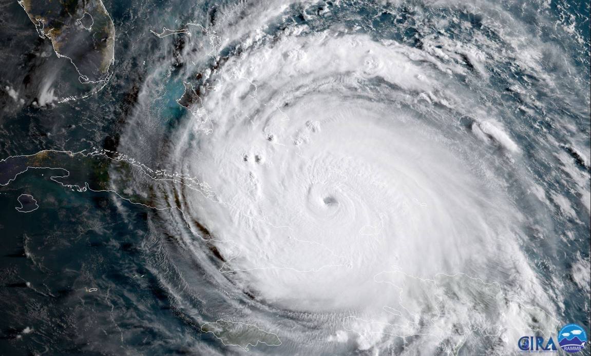
Tracking a major storm requires accurate data, reliable tracking resources, and a clear understanding of coastal risks. Hurricane Erin developed as a powerful tropical system, tracking across the Atlantic and sending dangerous high surf, rip currents, and coastal flooding toward the United States East Coast and Atlantic Canada. Even when a system stays offshore, it produces life-threatening marine hazards and severe weather shifts.
Knowing how to interpret tracking data, understanding watch and warning criteria, and following emergency protocols protect your household during severe weather events. This guide breaks down tracking methods, historical path details, and actionable safety measures.
Understanding the Track and Movement of Hurricane Erin
Storm tracking relies on satellite imagery, reconnaissance aircraft, and computer forecasting models. When monitoring a system like Hurricane Erin, meteorologists analyze the forward speed, central pressure, and maximum sustained winds to project the cone of uncertainty.
Erin followed a complex trajectory across the Atlantic basin, reaching peak intensity as a Category 5 major hurricane before curving north and tracking parallel to the United States East Coast. Though the core of the storm remained offshore, its massive wind field generated impacts across multiple coastal states.
Key Tracking Metrics to Monitor
- Sustained Winds: Measures the baseline power of the storm, which dictates structural damage potential upon land interaction.
- Forward Speed: Determines how quickly conditions will deteriorate or improve in a specific coastal sector.
- Central Pressure: Lower atmospheric pressure typically indicates a stronger, more concentrated storm engine.
- Wind Radii: Highlights how far tropical-storm-force and hurricane-force winds extend outward from the center.
For official, real-time map data during any active weather event, consult the National Hurricane Center.
Coastal Impacts and Marine Hazards
Even without a direct landfall, large offshore hurricanes generate severe oceanic threats. Erin produced life-threatening rip currents, high surf, and significant beach erosion stretching from Florida through New England and Atlantic Canada.
Coastal communities experienced tidal flooding during high-tide cycles, prompting local authorities to close beaches, restrict swimming, and suspend ferry services. Understanding these marine dynamics helps prevent preventable water-rescue incidents.
Recognizing Surf and Rip Current Dangers
- Strong Undertow: Breaking waves push immense volumes of water onto the shore, which must rush back out through narrow channels, creating fast-moving rip currents.
- Beach Erosion: Elevated wave action strips sand away from dunes, compromising coastal infrastructure and roadway foundations.
- Storm Surge Flooding: Low-lying coastal roads often flood hours before the peak wave action arrives, trapping drivers who attempt to cross water-covered asphalt.
Essential Safety and Evacuation Protocols
When local emergency management officials issue advisories or evacuation orders, prompt action is critical. Preparing an emergency kit and knowing your evacuation zone ahead of time minimizes panic when weather conditions shift.
Review the Ready.gov Hurricane Preparedness Guide to ensure your household meets baseline safety recommendations for severe weather events.
Step-by-Step Storm Preparation Checklist
- Secure Outdoor Assets: Bring inside loose lawn furniture, potted plants, trash cans, and decorative items that can become projectiles in high winds.
- Build an Emergency Supply Kit: Stock non-perishable food, bottled water (one gallon per person per day), medications, flashlights, and extra batteries to last at least three days.
- Protect Important Documents: Store identification, insurance policies, and financial records in a waterproof container or secure digital cloud folder.
- Charge Communication Tools: Power up all mobile devices, backup battery banks, and emergency weather radios before grid power disruptions occur.
- Monitor Local Alerts: Tune into official local government channels or emergency broadcasts for real-time updates and evacuation routing changes.
Common Mistakes to Avoid During Severe Weather
Misjudging a storm's trajectory or underestimating secondary hazards leads to dangerous situations. Avoid these frequent errors:
- Ignoring Offshore Storms: Assuming an offshore hurricane poses zero risk ignores the danger of powerful rip currents, rogue waves, and coastal flooding.
- Driving Through Standing Water: Just six inches of moving water can knock down an adult, and two feet can sweep away most vehicles. Turn around and find an alternate route.
- Relying Solely on Social Media: Unverified posts often spread outdated tracking graphics or incorrect closure notices. Always verify safety directives through official municipal websites.
Frequently Asked Questions
Did Hurricane Erin make landfall in the United States?
No. Erin tracked offshore parallel to the United States East Coast, but its expansive wind field and severe wave action created major coastal flooding, beach erosion, and dangerous rip currents across multiple states.
What is the difference between a tropical storm watch and a warning?
A watch means tropical storm conditions are possible within the specified area, usually within 48 hours. A warning means those conditions are expected within 36 hours, and immediate preparation actions should be finalized.
How far out do tropical storm winds extend?
Major storms often feature a massive footprint. For example, tropical-storm-force winds can extend hundreds of miles away from the center, meaning impacts occur well outside the projected center line.
What should I do if caught in a rip current?
Don't fight the current by swimming directly back to shore against the flow. Swim parallel to the shoreline until you escape the pull of the current, then swim diagonally back toward the beach.



