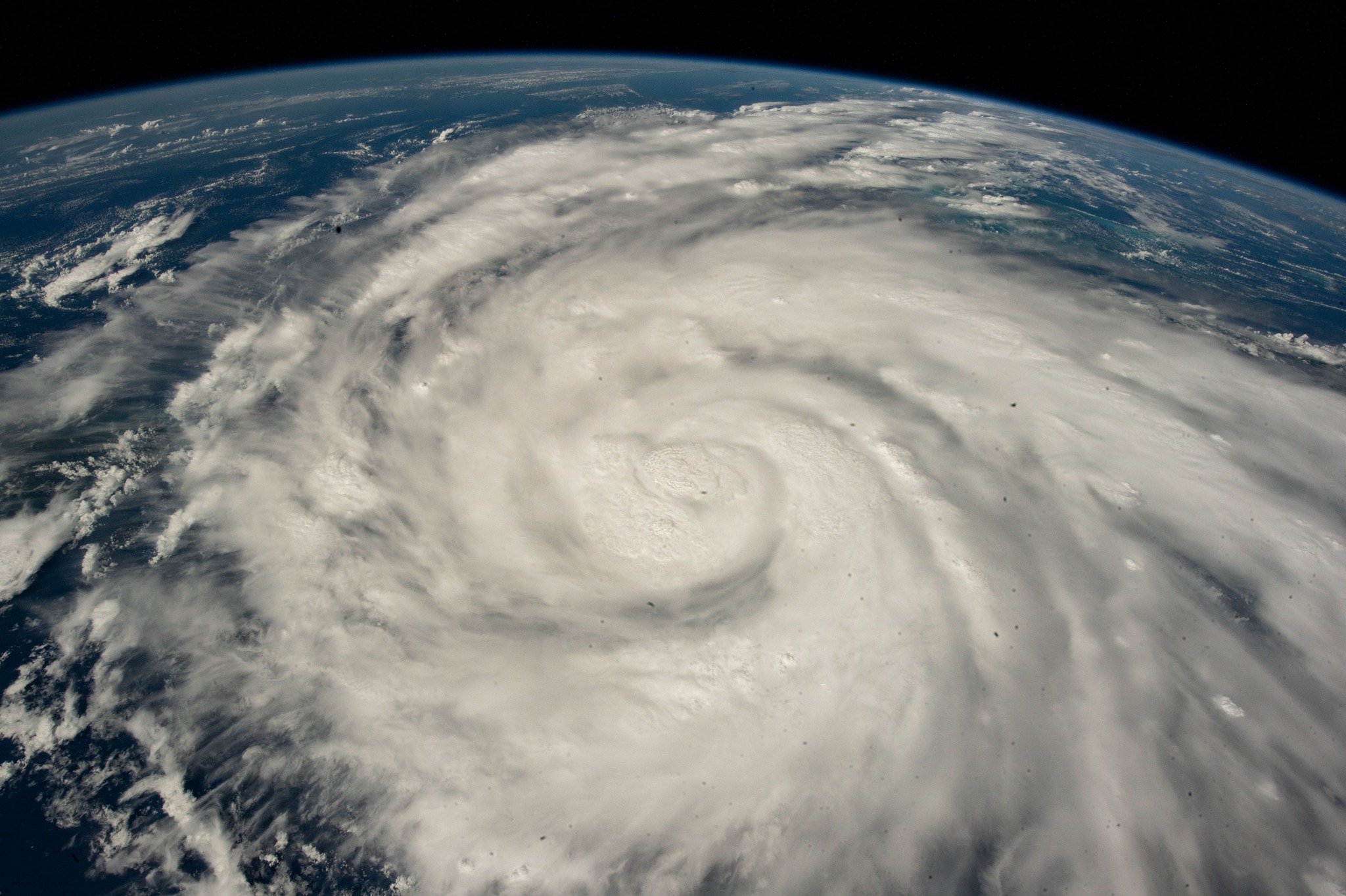
When Hurricane Agatha formed in the eastern Pacific in late May 2022, few anticipated its remnants would cross Central America and help spawn a completely separate system in the Atlantic Basin. While Agatha itself made landfall in Mexico, its atmospheric fingerprint reached all the way to the North Carolina coast, demonstrating how early-season storms can trigger cascading weather events across geographic boundaries. Understanding this phenomenon requires examining how Pacific energy transitions into Atlantic threats and what those interactions mean for coastal vulnerability.
Preseason tropical activity rarely stays contained to a single basin. When moisture and spin cross from the Pacific to the Atlantic, they often interact with stationary front lines near the southeastern United States. For barrier islands like the Outer Banks, these hybrid setups frequently produce heavy rainfall, persistent winds, and coastal erosion long before the official peak of hurricane season.
The Genesis of a Cross-Basin Preseason Storm
Hurricane Agatha began as a robust eastern Pacific tropical depression on May 28, 2022, rapidly intensifying into a powerful Category 2 hurricane before striking Oaxaca, Mexico, on May 30. As the core circulation dissolved over rugged terrain, mid-level energy survived the crossing. This lingering vorticity drifted into the southwestern Gulf of Mexico and the western Caribbean Sea.
[Pacific Basin] Hurricane Agatha (Late May)
       ↓
[Central America Terrain] Core Dissipates / Mid-Level Energy Survives
       ↓
[Atlantic Basin] Interaction with Stationary Front → Tropical Storm Alex
Once this residual energy reached warmer Atlantic waters, it merged with a broad trough of low pressure. Atmospheric conditions favored rapid reorganization. By early June, the disturbance consolidated into Tropical Storm Alex, the first named storm of the 2022 Atlantic hurricane season. This cross-basin transition highlights a vital mechanism in modern meteorology: tropical systems dying in one ocean can seed cyclogenesis in another.
Atmospheric Anatomy of Preseason Systems
Early-season tropical cyclones differ structurally from peak-season hurricanes in August and September. They usually feature broad, asymmetric wind fields and lack tight, symmetric core structures.
- Warm-Core to Baroclinic Transitions: Preseason storms frequently interact with lingering winter or spring frontal boundaries. This interaction turns a pure tropical system into a hybrid or subtropical setup, expanding the wind field outward.
- Elevated Moisture Content: Originating from tropical moisture feeds, these systems carry immense precipitable water. Even a disorganized disturbance can drop torrential rainfall over saturated coastal soils.
- Subtle Steering Currents: Weak steering ridges often trap early-season storms near the coast, causing them to linger and compound local impacts over multiple tidal cycles.
For the Outer Banks, a broad, disorganized wind field poses a unique hazard. Instead of a sharp, brief punch from a compact eyewall, barrier islands experience prolonged gales that push water against the soundside and ocean shoreline for days.
Outer Banks Vulnerability and Preseason Impacts
While Tropical Storm Alex passed south of the immediate Outer Banks tracking northeastward toward Bermuda, its sprawling moisture shield and tightening pressure gradient slammed North Carolina with gale-force winds and coastal flooding. Barrier islands function as narrow ribbons of sand highly sensitive to prolonged wave action.
Prolonged onshore winds generate persistent wave run-up, eating away at dune lines before communities have recovered from winter nor'easters. Preseason storms catch infrastructure off guard. Beach nourishment projects may still be scheduled or incomplete, and seasonal tourism traffic peaks abruptly as summer begins.
Infrastructure along NC Highway 12 remains perpetually vulnerable to these events. When high surf coincides with astronomical spring tides, even a distant storm's outer fetch pushes ocean water across the asphalt, isolating villages from Rodanthe down to Hatteras.
Meteorological Lessons from Cross-Basin Events
The trajectory from Agatha to Alex reshaped how forecasters monitor tropical connections. Meteorologists track the survival of remnant moisture across Central America much more closely now. Key takeaways from this event include:
- Basin Interaction: Never treat Pacific and Atlantic basins as entirely isolated. Upper-level troughs can easily translate energy across the narrow Isthmus of Tehuantepec.
- Forecast Lead Time: Preseason genesis often happens quickly, shortening the window for local emergency management teams to prepare vulnerable barrier islands.
- Cumulative Erosion: Sequential weather events—such as a harsh winter followed by an aggressive May tropical precursor—prevent natural dune recovery.
You can review ongoing tropical monitoring and historical storm tracks directly through the National Hurricane Center. For regional infrastructure updates and coastal planning initiatives, the North Carolina Department of Transportation provides specific insights into how state roads manage recurring overwash events.
Frequently Asked Questions
Did Hurricane Agatha directly hit the Outer Banks?
No. Hurricane Agatha made landfall in southern Mexico. However, its atmospheric remnants crossed into the Atlantic Basin and helped form Tropical Storm Alex, which impacted the southeastern United States and Outer Banks with heavy rain and wind.
Why are preseason tropical storms dangerous for barrier islands?
Preseason storms often possess large, disorganized wind fields rather than compact eyes. This structure pushes water against coastlines for extended periods, maximizing beach erosion and soundside flooding during high tides.
How do Pacific storms cross over into the Atlantic?
While the surface cyclone usually dissipates over rugged Central American mountains, the mid-level atmospheric spin and moisture plume often survive the trip, re-emerging over the warm waters of the Gulf of Mexico or Caribbean.
What infrastructure is most at risk during Outer Banks storms?
NC Highway 12 is the primary lifeline for the barrier islands and frequently suffers from sand overwash and severe ocean encroachment, cutting off access to southern villages.



