Geography isn't just about memorizing capitals on a map or tracing the borders of countries. At its core, dynamic planet geography examines the physical and human processes shaping our Earth, from shifting tectonic plates to rapidly evolving climate systems. When we look at the world through this lens, we see a living, breathing system where lithospheric, atmospheric, and biospheric components interact constantly.
Understanding how our dynamic planet functions requires moving beyond static maps to study active earth systems. Physical geography measures how energy from the Sun and heat from Earth's interior drive erosion, vulcanism, and weather patterns. These processes don't happen in isolation; they form complex feedback loops that determine regional climates, soil fertility, and human settlement patterns across the globe.
Plate Tectonics and Surface Evolution
Earth's outer shell isn't a single unbroken crust. It's fractured into rigid lithospheric plates floating on the semi-fluid asthenosphere beneath. These plates move at rates of a few centimeters per year, driven by thermal convection currents originating in the mantle.
Where plates pull apart at divergent boundaries, new crust forms through volcanic activity, creating massive underwater mountain chains like the Mid-Atlantic Ridge. Where they collide at convergent boundaries, immense tectonic forces crumple the crust into towering mountain ranges like the Himalayas or force dense oceanic crust down into subduction zones, triggering deep earthquakes and explosive volcanic arcs.
Transform boundaries, such as the San Andreas Fault, involve plates grinding horizontally past each other. Stress builds along these fault lines until friction gives way, releasing energy as seismic waves. Geographers study these movements to map hazard zones and understand how topography changes over millions of years.
Atmospheric Circulation and Climate Systems
The atmosphere acts as a massive thermal engine, redistributing heat from the equator toward the poles. Solar radiation strikes Earth unevenly, creating warm air masses at the equator that rise and create low-pressure zones. As this air cools aloft, it moves toward the mid-latitudes and sinks, forming subtropical high-pressure belts.
This global air movement, combined with Earth's rotation via the Coriolis effect, establishes permanent wind patterns like the trade winds and westerlies. Ocean currents work in tandem with these winds. Surface currents, driven by wind friction, and deep-water thermohaline circulation move immense volumes of heat around the globe.
For more details on global climate patterns, visit the National Oceanic and Atmospheric Administration.
Geomorphology and Landscape Shaping
Geomorphology looks at the specific landforms shaping Earth's surface and the processes responsible for their creation. Weathering breaks down solid rock physically through freeze-thaw cycles or chemically through mineral dissolution. Once weathered, material moves downhill through erosion, driven by water, wind, ice, and gravity.
Rivers carve V-shaped valleys and deposit fertile sediment on floodplains, supporting human agriculture for millennia. Glaciers carve out dramatic U-shaped valleys and leave behind moraines that mark their historical limits. Arid landscapes, shaped by windblown sand, form shifting dunes and rocky pavements that challenge survival.
- Fluvial systems: Dominated by running water, shaping river basins and deltas.
- Glacial systems: Dominated by moving ice masses, carving high-latitude and alpine terrain.
- Aeolian systems: Dominated by wind action in arid and semi-arid environments.
- Coastal systems: Driven by wave energy, tides, and sediment transport along shorelines.
Human Geography and Environmental Interaction
Physical landscapes dictate where societies build cities, establish trade routes, and farm. Yet human geography examines how societies alter these natural systems in return. Urbanization replaces permeable soils with concrete, changing local hydrology and increasing flood risks during heavy storms.
Resource extraction transforms ecosystems, altering local topography and water tables. Understanding these interactions is critical for managing natural hazards and planning sustainable infrastructure. Geographers use geographic information systems to model flood risks, track deforestation, and optimize urban planning.
To explore global geographical datasets and mapping tools, check the U.S. Geological Survey.
Frequently Asked Questions
What is the difference between physical and human geography?
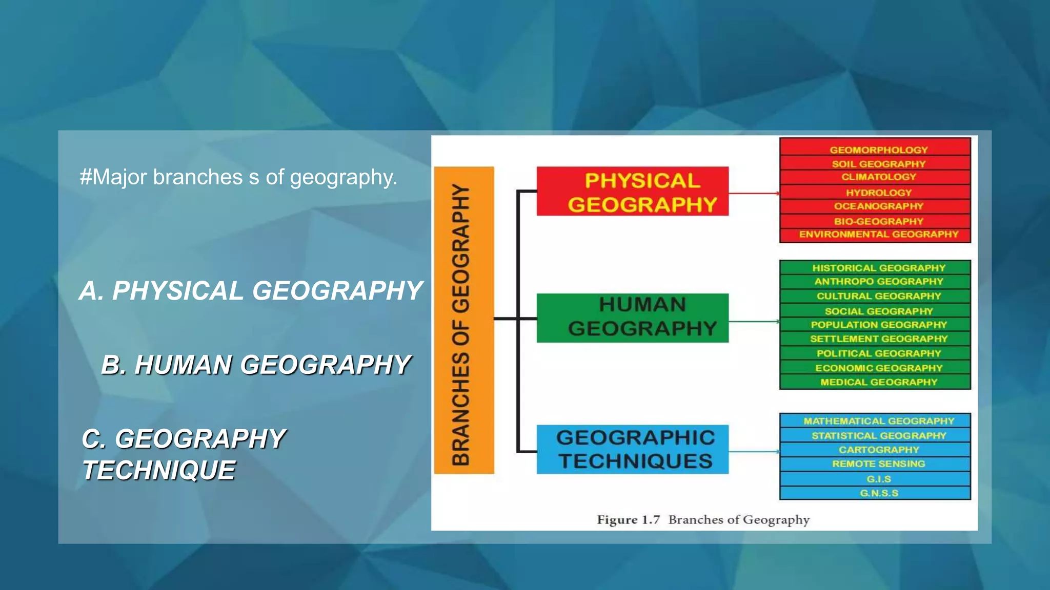
Physical geography focuses on natural Earth processes, including landforms, climate, soils, and ecosystems. Human geography examines human societies, cultural traits, economic activities, and how humans modify their physical environments.
How do tectonic plates actually move?
Tectonic plates move because of heat escaping from Earth's interior. This heat generates convection currents in the mantle, where warm, less dense rock rises and cooler, denser rock sinks, dragging the overlying crustal plates along.
Why is climate change a central focus of modern geography?
Modern geography integrates human and environmental data. Climate change alters weather patterns, sea levels, and ecosystem distributions, which directly impacts agriculture, water availability, and human migration patterns worldwide.
What tools do modern geographers rely on?
Geographers use geographic information systems, remote sensing satellites, global positioning systems, and field surveys to collect, analyze, and visualize spatial data about Earth's surface and human activity.