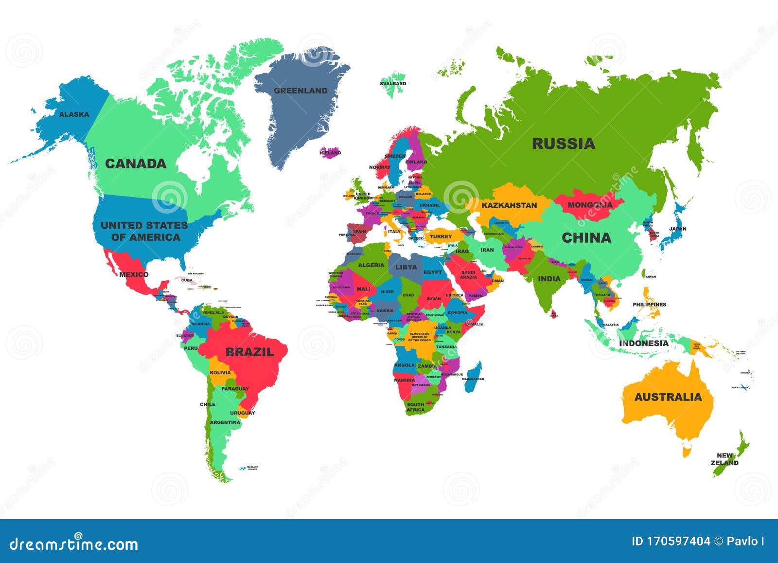
When people think of North America, sprawling landscapes like the Canadian Rockies or iconic cities like New York usually come to mind. Yet the continent extends far beyond Canada and the United States, encompassing 23 sovereign nations alongside numerous dependent territories. Geographically stretching from the Arctic Archipelago down through the Isthmus of Panama and across the Caribbean Sea, North America features a diverse mix of cultures, languages, and political statuses.
Understanding how the continent is divided requires looking past simple stereotypes. North America isn't just three major countries; it includes the distinct sub-regions of Northern America, Central America, and the Caribbean. Each zone contributes unique historical, economic, and political dimensions to the continental landmass.
Sovereign Nations of North America
The continent hosts 23 independent, internationally recognized sovereign states. These countries manage their own foreign policies, economies, and domestic laws. They span a massive range in geographic size, from vast continental powers to microstates on tropical archipelagos.
- Canada: Occupying the northernmost portion of the continent, Canada is the second-largest country in the world by total area.
- United States of America: Bordering Canada to the south, the US is a federal republic comprised of 50 states, several major overseas territories, and the federal district of Washington, D.C.
- Mexico: Located south of the US, Mexico serves as a cultural and economic anchor bridging North and Central America.
Beyond these three massive landmasses, Central America features seven sovereign nations that form the narrow land bridge connecting to South America:
- Belize
- Costa Rica
- El Salvador
- Guatemala
- Honduras
- Nicaragua
- Panama
The remaining sovereign nations are island states situated throughout the Caribbean Sea:
- Antigua and Barbuda
- The Bahamas
- Barbados
- Cuba
- Dominica
- Dominican Republic
- Grenada
- Haiti
- Jamaica
- Saint Kitts and Nevis
- Saint Lucia
- Saint Vincent and the Grenadines
- Trinidad and Tobago
For official population metrics and updates on global state boundaries, you can reference the United Nations Statistics Division.
Sub-Regions and Geographic Divisions
Geographers typically split North America into three distinct sub-regions based on climate, culture, and tectonic placement.
Northern America includes Canada, the United States, Greenland (an autonomous territory of Denmark), and Saint Pierre and Miquelon (an overseas collectivity of France). This region is characterized by advanced industrial economies, extensive boreal forests, and lower population densities in northern latitudes.
Central America contains the nations stretching south from Mexico to Colombia's border. This region features rugged mountain ranges, active volcanoes, tropical rainforests, and a shared heritage tied primarily to Spanish colonization, with the exception of English-influenced Belize.
The Caribbean consists of thousands of islands grouped into archipelagos. While many are independent nations, a large percentage remain politically tied to European nations or the United States. Tourism, agriculture, and offshore financial services drive the economies across these island communities.
Dependent Territories and Overseas Collectivities
Not every piece of land in North America belongs to an independent government. Numerous islands and territories maintain political affiliations with external sovereign states, primarily the United Kingdom, France, the Netherlands, and the United States.
- United Kingdom: Overseas territories include Bermuda, the Cayman Islands, the British Virgin Islands, Anguilla, Montserrat, and the Turks and Caicos Islands.
- France: Collectivities and departments include Guadeloupe, Martinique, Saint Barthélemy, Saint Martin, and Saint Pierre and Miquelon.
- Netherlands: Constituent countries and special municipalities include Aruba, Curaçao, Sint Maarten, and the Caribbean Netherlands (Bonaire, Sint Eustatius, and Saba).
- United States: Territories include Puerto Rico and the United States Virgin Islands.
These territories manage internal local governance while relying on their parent nations for defense and international affairs. Economic data for these regions is regularly tracked by agencies like the World Bank.
Common Misconceptions About North American Geography
Geographical definitions often create confusion, particularly regarding cultural terms versus continental boundaries.
Many people confuse the geographic continent of North America with the political or economic bloc of "North America" defined by trade pacts like the USMCA. While trade agreements focus solely on Canada, the US, and Mexico, the actual physical continent reaches much further south.
Another common point of confusion involves Central America and the Caribbean. Some casual observers mistakenly assume Central America is a separate continent. In reality, it forms the southern sub-region of the North American tectonic plate and landmass. Similarly, people frequently misclassify Caribbean islands as part of South America, even though most sit on the North American plate or Caribbean plate adjacent to the northern continent.
Frequently Asked Questions
Is Mexico part of North America or Central America?
Mexico is geographically part of the North American continent. While its southern states share cultural and ecological traits with Central America, the country sits squarely within the North American landmass.
Is Greenland part of North America?
Geographically, Greenland sits on the North American tectonic plate and is considered part of the continent. Politically, however, it functions as an autonomous territory within the Kingdom of Denmark.
How many total countries and territories are in North America?
The continent contains 23 independent sovereign countries alongside more than 20 dependent territories, mostly located throughout the Caribbean basin and the North Atlantic.
Why is Central America not considered its own continent?
Continents are defined by large continuous landmasses and tectonic plates. Central America is simply an isthmus—a narrow strip of land connecting the larger North American and South American continents.



