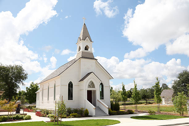
Finding where to worship when you move to a new neighborhood, travel for work, or visit an unfamiliar city shouldn't feel like a puzzle. The official Church Meetinghouse Locator is a digital tool designed to help you pinpoint physical chapels, view precise meeting times, and identify your assigned congregation anywhere in the world. Whether you're tracking down a Sunday service or looking for specialized language-specific branches, understanding how to navigate this directory saves time and removes guesswork.
The official directory bridges the gap between global church administration and local attendance. Instead of relying on outdated printed directories or vague word-of-mouth directions, users can leverage interactive digital mapping systems to discover precise building addresses, bishop contact details, and scheduled meeting hours updated daily by local administrators.
Core Features of the Meetinghouse Locator
The platform provides more than just a simple pin on a digital map. It integrates several layers of geographic and administrative data to ensure visitors and members get accurate information.
- Assigned Congregations: Entering a specific residential street address reveals the exact ward or branch boundary you live within, identifying where you hold formal membership records.
- Closest Physical Buildings: If you're traveling or visiting outside your home boundaries, the tool highlights the geographically closest meetinghouses, even if they belong to a different administrative stake or district.
- Specialized Unit Filters: The search interface lets you filter results by specific demographics or needs, such as Young Single Adult (YSA) wards, student units, or non-English language services.
- Meeting Times and Leadership Contact: Selecting a specific pin opens a detailed panel displaying the exact start time for sacrament meetings, Sunday School, and auxiliary classes, alongside phone numbers for local presiding officers.
Step-by-Step Guide to Finding a Congregation
Using the official tool takes only a few moments if you follow a structured approach. Here is how to locate a meetinghouse from your computer or mobile device:
- Open your web browser and navigate to the official Church of Jesus Christ website or go directly to the map utility page.
- Locate the search input box on the screen. You can type in a full street address, a postal code, or a broader city name. If you are in a remote area without street numbers, use the manual pin-drop feature on the map interface.
- Apply filters if you require specific accommodations, such as a particular meeting language or a specialized young adult group.
- Examine the search results, which separate options into closest physical locations and formally assigned boundary units.
- Click on a specific marker icon to review meeting times, building rules, parking details, and leadership contact names.
Overcoming Common Search Challenges
Even with a streamlined tool, users often run into minor hiccups when searching international or rapidly developing regions.
One frequent issue involves boundary changes. Neighborhood growth often prompts local leaders to split stakes and wards, which can cause temporary mismatches between third-party mapping software and official church databases. Always rely on the official church directory rather than generic map applications, because commercial maps rarely track ecclesiastical boundaries.
Another challenge occurs when searching in rural or developing regions where street addresses are non-existent or informal. In these instances, typing a street name will yield no results. Switch to satellite or topographic map views, zoom into the known town center, and use the manual coordinate placement tool to drop a pin. This forces the system to calculate nearby meetinghouses based on geographic proximity rather than text strings.
Privacy, Accounts, and Extended Access
While basic map features are open to the general public, logging in with an official church account unlocks deeper administrative layers. Members who sign in can view detailed stake boundaries, boundary overlap maps, and specific home-teaching or ministering assignments that aren't visible to casual public visitors.
The system treats user data carefully. It does not track individual mobile locations for surveillance purposes; instead, it simply processes the static text address or dropped pin you submit to return the corresponding geographical intersection from its spatial database.
For further reading on religious architecture, community spaces, and global ecclesiastical mapping history, you can explore resources provided by Encyclopædia Britannica. To understand how large-scale directory systems manage global spatial data, reference documentation on geographic information systems via USGS.
Frequently Asked Questions
Can I use the locator on my smartphone without installing an app?
Yes. The interface is optimized for mobile web browsers. You can open your phone's browser, navigate to the map utility, and allow location permissions to instantly find nearby chapels without downloading standalone software.
What should I do if the listed meeting time is incorrect?
Schedule adjustments happen due to local building construction, holiday events, or shared stake facility rotations. If you spot a discrepancy, use the built-in feedback or report link on the page to notify administrative clerks who manage daily database updates.
Why do I see multiple congregations meeting in the same building?
Many facilities house two or more distinct wards or branches to accommodate growing local memberships. Each congregation meets at staggered hours throughout Sunday morning and afternoon to share chapel and classroom space efficiently.
How do I find out which boundary I legally reside in if my street is brand new?
New housing developments often take months to appear in digital geographic databases. If your street isn't recognized, search using the address of the nearest established neighboring street, or contact the local stake clerk directly for boundary verification.