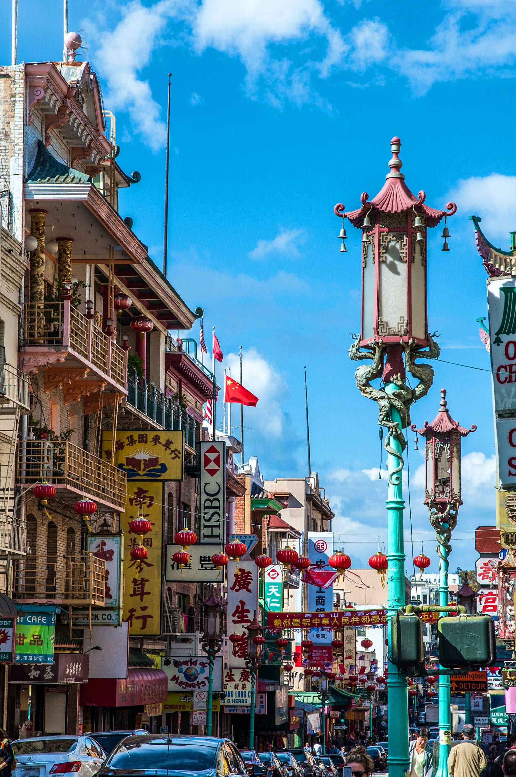
Finding your way through a historic Chinatown requires looking past standard mapping apps and tuning into the physical rhythm of the district. Traditional enclaves often predate modern municipal grids, resulting in dense networks of side streets, internal courtyards, and vertical storefronts that defy a simple pin drop. Whether you're visiting for the morning wet markets or evening dining, successful navigation depends on recognizing historic street patterns, reading architectural cues, and understanding local pedestrian flow.
Traditional urban enclaves developed organically around early commercial hubs, railway stations, or ports of entry. As communities grew under specific historical pressures, architecture expanded upward and inward. Ground floors became active storefronts, while upper levels housed multi-generational residences or community associations. Because these districts grew incrementally rather than through top-down planning, street widths vary drastically, and alleyways often double as primary pedestrian arteries. Recognizing this unique urban morphology prevents frustration when satellite signals bounce off high-rise canyon walls or digital maps misidentify storefront entrances.
Decoding Urban Enclave Grids and Alleys
Standard GPS tools often fail in dense urban cores because tall buildings block satellite line-of-sight. Furthermore, digital map pins frequently point to the structural center of a building rather than the specific shop entrance tucked inside an alley or basement level.
To navigate effectively without getting turned around, use a hybrid approach that pairs digital tools with physical landmarks.
- Identify Main Artery Gates: Most historic districts feature ceremonial archways or Paifang at primary entry points. Use these monuments as baseline coordinates to orient your position relative to major transit hubs.
- Read the Vertical Layering: Commercial activity rarely stays at street level. Look up for vertical signage, banners, and second-story tea houses or restaurants accessible via narrow exterior stairwells.
- Treat Alleys as Arteries: In districts like San Francisco Chinatown, internal passages such as Ross Alley or Wentworth Place function as vital pedestrian shortcuts. Walking these lanes reveals local craft shops and bakeries missing from major directory apps.
According to research from urban planning studies on immigrant enclaves published by Springer Nature, the spatial layout of historic districts reflects a deliberate adaptation of built environments to foster community cohesion and commerce.
Temporal Navigation: Timing Your Visit
The geography of a cultural district transforms entirely depending on the hour of day. Moving through the neighborhood requires matching your itinerary to the local tempo.
Morning Market Hours (8:00 AM to 11:00 AM)
Mornings belong to residents. Wet markets, produce stalls, and wholesale bakeries operate at peak capacity. Streets are filled with shoppers carrying carts and baskets, making fast-paced walking nearly impossible. This is the ideal time to observe daily community life, but keep your pace slow and yield to locals purchasing fresh ingredients.
Afternoon Lull (2:00 PM to 5:00 PM)
Many family-run businesses observe a quiet period during mid-afternoon. Crowds thin out significantly, giving visitors an unobstructed opportunity to examine architectural details, historic plaques, and temple courtyards without navigating heavy foot traffic.
Evening Commerce (6:00 PM to 10:00 PM)
Neon signs ignite, restaurant doors open wide, and the main thoroughfares shift into high gear. While this window offers the best dining atmosphere, delivery vehicles and dense crowds require constant vigilance on narrow sidewalks.
Essential Wayfinding Strategies
Navigating successfully means avoiding common pitfalls that trip up first-time visitors.
- Carry Physical Cash: While modern cafes accept digital wallets, many generational herbalists, small bakeries, and wet market vendors operate strictly on cash transactions.
- Confirm Entrances Manually: If a mapping app points you toward a solid brick wall, look for an adjacent courtyard entrance, side alley, or exterior staircase. Businesses frequently occupy deep interior spaces.
- Respect Residential Boundaries: Remember that these neighborhoods are living, working communities rather than open-air museums. Always ask permission before photographing residents or private spaces such as family association halls.
- Master Public Transit Connections: Rely on municipal transit authorities like the MTA or local equivalents to identify perimeter subway stations and bus routes that drop you directly at the district's outer gates.
Frequently Asked Questions
Why does GPS navigation fail inside historic cultural districts?
Tall buildings create urban canyons that block or reflect satellite signals. Additionally, multi-story developments and interconnected interior courtyards confuse digital mapping algorithms, often placing the destination pin on the wrong side of a block.
Are walking tours necessary for exploring Chinatown?
Self-guided exploration works well if you rely on major architectural landmarks and gateways for orientation. However, guided tours led by local community preservation groups offer deeper historical context regarding second-story associations and hidden alleyways.
What is the best time of day to avoid heavy crowds?
Visit between 2:00 PM and 5:00 PM. This afternoon window falls between the morning market rush and the evening dining peak, providing a quieter environment for photography and architectural observation.
How should visitors handle language barriers on street signs?
Many historic districts feature bilingual street signs and storefront banners. Downloading an offline translation application with image-scanning capabilities helps decipher menu items and historical markers instantly without requiring a live cellular connection.



