Understanding Chicago At A Glance
Chicago stands as the beating heart of the American Midwest, blending gritty industrial heritage with soaring modern ambition. Often mislabeled with coastal comparisons, the city commands its own distinct identity anchored by Lake Michigan, a legendary architectural lineage, and seventy-seven official community areas. It operates as a bustling economic and cultural engine without losing the approachable warmth characteristic of the region.
Navigating the city requires looking past surface-level cliches. From the financial canyons of the Loop to the quiet tree-lined residential blocks of the North Side, Chicago functions as a mosaic of distinct enclaves. Visitors and newcomers frequently underestimate its scale, geographic layout, and deep cultural roots. Getting your bearings means examining how the urban grid works, where the historical milestones took place, and what makes this Midwestern metropolis tick.
Geography and Urban Layout
The city's layout is remarkably logical, anchored by the intersection of State and Madison Streets in downtown Chicago. This point serves as the origin for the city's addressing system. The Chicago River snakes through the urban core, dividing the municipality into three primary sections:
- The North Side: Known for dense residential living, expansive green spaces like Lincoln Park, and vibrant commercial strips.
- The West Side: A historic mix of manufacturing roots, medical districts, and diverse cultural neighborhoods like Little Italy and Humboldt Park.
- The South Side: Home to major academic institutions, industrial corridors, historic parks, and cultural pillars like the Museum of Science and Industry.
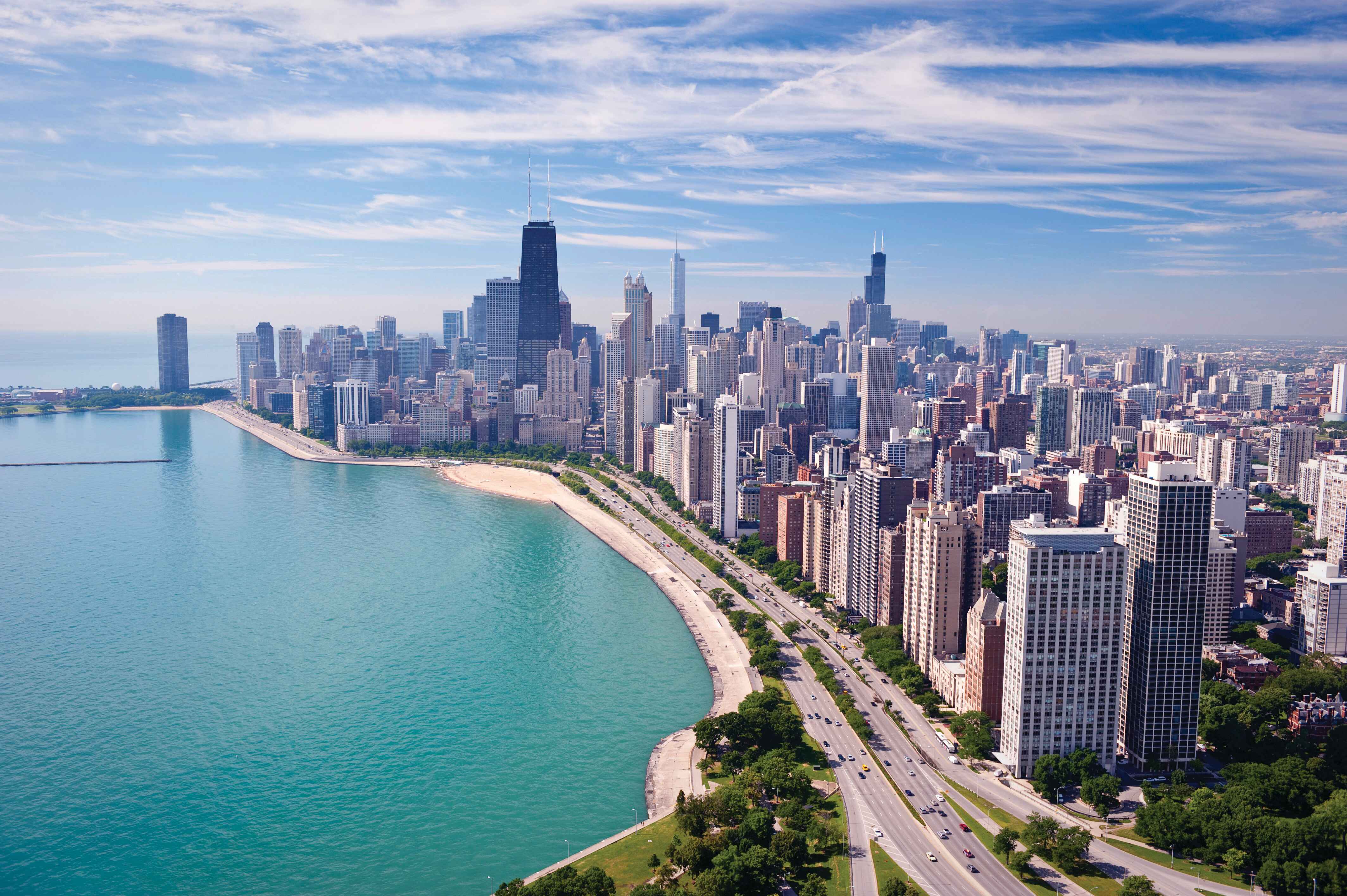
The continuous public lakefront is one of Chicago's defining traits. Unlike many major metropolitan waterfronts dominated by private industrial ports, Chicago preserves nearly its entire shoreline for public parks, beaches, and bike paths. According to the City of Chicago Official Site, miles of uninterrupted green space run parallel to Lake Michigan, offering year-round recreation.
Architectural Innovation and Landmarks
Architecture is the physical manifestation of Chicago's history. Following the devastating fire of 1871, urban planners and engineers treated the leveled grid as a blank canvas. This led directly to the birth of the Chicago School of architecture, pioneering steel-frame construction and the modern skyscraper.
Downtown showcases these breakthroughs side by side. The Willis Tower (still widely called the Sears Tower by locals) and the John Hancock Center define the skyline, while historic gems like the Chicago Cultural Center display intricate mosaics and Tiffany glass domes.
Essential Architectural Stops
- The Loop: Walk past the Rookery Building and the Chicago Board of Trade to see early commercial masterpieces.
- The River Cruise: Architectural boat tours down the main branch of the Chicago River provide deep context on structural evolution.
- Prairie Style: Head south to Hyde Park to tour Frank Lloyd Wright's historic Robie House.
Cultural Identity and Neighborhoods
Reducing Chicago to downtown skyscrapers misses the point entirely. The city's soul lives in its distinct neighborhoods, each shaped by waves of domestic and international migration. Pilsen reflects a vibrant Mexican-American heritage through murals, galleries, and authentic cuisine. Chinatown serves as a bustling hub of commerce, dim sum parlors, and community landmarks.
Music remains central to the local identity. Chicago blues took root as southern migrants brought delta traditions up the Illinois Central Railroad, finding a permanent home in clubs along the South and North Sides. House music was born in underground South Side warehouses during the early 1980s, eventually conquering global dance floors.
Economy and Daily Life
While tourism draws millions of annual visitors, the local economy runs deep on finance, manufacturing, transportation, and technology. The Choose Chicago Tourism Authority tracks massive convention numbers at McCormick Place, cementing the city as a primary destination for business travelers.
Public transit via the Chicago Transit Authority (CTA)—affectionately known as the "L"—connects outlying neighborhoods to the central business district efficiently. Navigating daily life here means mastering the transit system, understanding seasonal weather shifts, and embracing a pragmatic Midwestern work ethic.
Frequently Asked Questions
Why is Chicago called the Windy City?
While the city certainly experiences genuine meteorological gusts off Lake Michigan, historians note the moniker originally gained traction in the 19th century due to boastful politicians competing with New York to host the World's Columbian Exposition.
How many neighborhoods does Chicago have?
The city recognizes seventy-seven official community areas, though dozens of smaller, hyper-local neighborhoods and sub-districts exist within those boundaries.
When is the best time of year to visit?
Late spring through early autumn offers the most pleasant weather, accompanied by an endless rotation of outdoor street festivals, neighborhood music events, and lakefront activities. Winter brings bitter temperatures, but also world-class holiday markets and restaurant promotions without peak tourist crowds.
Is Chicago easy to navigate without a car?
Yes. The CTA operates an extensive rail and bus network that reaches nearly every major attraction, neighborhood commercial district, and regional airport.


