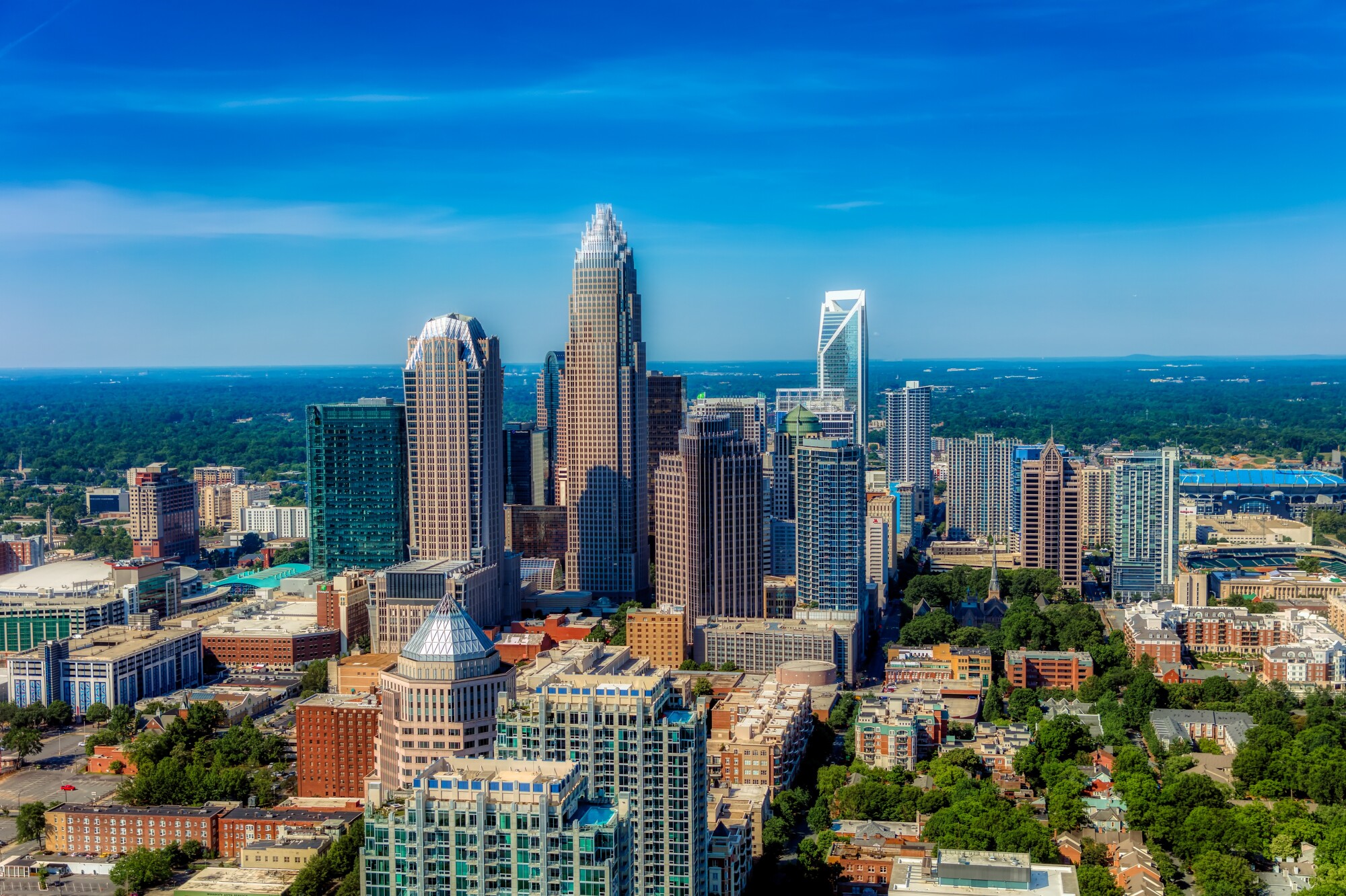
Charlotte occupies a strategic location in the rolling Piedmont region of North Carolina, roughly 180 miles inland from the Atlantic coast and 85 miles east of the Blue Ridge Mountains. As the county seat of Mecklenburg County, the city sits at an elevation of about 750 feet above sea level, anchored by the intersection of historical trade routes that defined its initial layout. Unlike many coastal or river-bound metropolitan hubs constrained by natural barriers, Charlotte expanded outward across a decentralized grid, evolving from a railroad and textile center into a major financial powerhouse.
Understanding the Queen City requires examining how its physical geography, transportation corridors, and demographic shifts shaped its modern urban identity. From the dense cluster of high-rises in Uptown to the rapidly densifying transit-oriented neighborhoods along the light rail, Charlotte represents a unique study in American urban growth.
The Physical Landscape and Crossroads Origins
The physical foundation of Charlotte began long before European settlement, shaped by an ancient Native American east-west trading path that crossed a prominent regional ridge. In the mid-18th century, settlers traveling south along the Great Wagon Road from Pennsylvania and Virginia intersected with this native path. At that exact crossroads, a small village took root, eventually named in honor of Charlotte of Mecklenburg-Strelitz, the queen consort of Great Britain.
This intersection of historic routes became Trade and Tryon Streets, establishing the core axis of Uptown Charlotte. Because the settlement did not rely on a major navigable river or port for survival, its physical growth faced few natural restrictions. The terrain features gentle rolling hills of the Piedmont upland, interspersed with minor creeks like Little Sugar Creek and Irwin Creek. Without water barriers constraining expansion, the city grew horizontally, creating a sprawling network of neighborhoods connected by arterial roads.
The local climate further influenced its development. The nearby Blue Ridge Mountains act as a partial buffer against severe weather systems moving inland from the coast or down from the continental interior. Summers bring humid conditions, but winters remain relatively mild, encouraging outdoor activity and a steady influx of residents seeking temperate seasonal shifts without extreme alpine winters.
From Textile Hub to Financial Capital
Charlotte's economic geography shifted dramatically across three distinct eras: resource extraction, industrial manufacturing, and modern finance.
During the early 19th century, a localized gold rush following a discovery in nearby Cabarrus County positioned Charlotte as a minor hub of precious metal processing, even hosting a branch of the United States Mint. By the late 19th century, industrialist D.A. Tompkins and local leaders leveraged the expanding railway network to build a ring of cotton mills and manufacturing plants. Textile production turned Charlotte into the commercial engine of the Carolinas.
As the textile industry waned, the city pivoted toward banking and corporate services. Today, Charlotte stands as the second-largest banking center in the United States, trailing only New York City. It serves as the corporate headquarters for financial giants like Bank of America, alongside major operations for Wells Fargo and Truist. This corporate identity transformed Uptown's skyline, replacing low-rise brick warehouses with soaring glass towers.
To explore the official municipal planning frameworks and growth maps guiding this ongoing economic expansion, you can review resources provided by the City of Charlotte.
Urban Form and the Evolution of Neighborhoods
Charlotte's urban form has long been characterized by decentralization, but recent decades brought a concerted push toward densification, transit-oriented development, and historic neighborhood revitalization.
Uptown and the Grid
Uptown—divided into the Fourth Ward, Third Ward, Second Ward, and First Ward—serves as the civic and financial core. Despite the disruption caused by mid-century urban renewal projects and highway construction like Interstate 277, Uptown has evolved into a residential neighborhood with green spaces like Romare Bearden Park and cultural institutions like the Mint Museum.
The Transit Corridors
The opening of the LYNX Blue Line light rail system altered the trajectory of Charlotte's urban geography. Neighborhoods immediately south of Uptown, such as South End, transformed from industrial brownfields into dense corridors of multi-family housing, craft breweries, and tech startups. Similar growth patterns emerged along the Blue Line extension toward University City, proving that transit investments could successfully reshape a car-centric city into a more walkable urban ecosystem.
Ring Neighborhoods and Subdivisions
Beyond the urban core, distinct districts maintain unique identities. Historic areas like Dilworth and Myers Park showcase early 20th-century suburban streetcar design with heavy tree canopies, while outer employment nodes like Ballantyne evolved from vacant farmland into massive master-planned corporate and residential hubs.
Demographic Shifts and Modern Identity
Charlotte's population growth consistently outpaces many traditional U.S. metropolitan regions, driven by job opportunities in finance, technology, energy, and healthcare.
The city's demographic makeup is younger and more racially diverse than much of the surrounding Southeast. An influx of domestic and international migrants expanded Hispanic, Asian, and multi-ethnic communities across Mecklenburg County and surrounding areas like Iredell, Lincoln, and Lancaster counties.
This rapid expansion presents structural challenges. Housing supply has struggled to match population demand, leading to rising home values and rental cost burdens for lower-income households. Urban planners and local stakeholders continue to debate how to manage growth through updated policy maps and community area plans to preserve affordability while maintaining the tree canopy and neighborhood character that defines the Queen City.
Frequently Asked Questions
Why is Charlotte called the Queen City?
Charlotte was named in honor of Charlotte of Mecklenburg-Strelitz, who became the queen consort of Great Britain and Ireland in 1761. Local leaders adopted the moniker "Queen City" to reflect this royal namesake.
What is the primary geographic feature of Charlotte?
Charlotte sits in the Piedmont region of North Carolina, characterized by rolling hills, an elevated position between the Appalachian Mountains and the Atlantic coast, and an absence of major navigable rivers, which allowed the city to expand outward in a decentralized grid.
How did the light rail impact Charlotte's urban identity?
The LYNX Blue Line shifted Charlotte away from strict automobile dependency by catalyzing high-density, transit-oriented development. Neighborhoods like South End experienced rapid transformation from industrial zones into walkable mixed-use districts featuring apartments, retail, and public greenways.
What are the main economic drivers in Charlotte?
Charlotte's economy is anchored by financial services—ranking as the second-largest banking center in the U.S.—alongside rapidly expanding technology sectors, energy companies, healthcare systems, and a prominent craft brewing industry.


