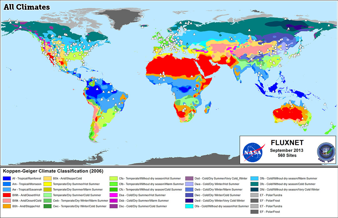
Caracas sits in a high mountain valley just miles from the Caribbean coast, creating a unique climate that breaks typical tropical rules. While many tropical capitals suffer from year-round stifling heat, the city's altitude of roughly 900 meters provides a permanent spring-like atmosphere. You won't find extreme seasonal temperature shifts here, but you will encounter distinct wet and dry periods alongside microclimates created by the surrounding peaks of the Venezuelan coastal range.
Understanding the weather in Venezuela's capital requires looking beyond standard meteorological charts. The city's geography dictates daily cloud formations, sudden afternoon downpours, and sharp temperature drops after sunset. Whether you're planning a trip or studying regional geography, knowing how altitude interacts with tropical weather patterns helps make sense of this Andean valley.
The Geographic Engine Behind Caracas Weather
To understand why the weather behaves the way it does, you have to look at the topography. Caracas occupies a narrow valley nestled within the Cordillera de la Costa. Towering mountain walls, including the massive El Ávila peak, separate the city from the sea.
This elevation acts as a natural air conditioner. Average temperatures hover comfortably around 22°C (72°F) year-round. Without this altitude, the city's latitude—just 10 degrees north of the equator—would produce intense, sweltering heat similar to Venezuela's coastal lowlands. Instead, daily highs rarely exceed 28°C (82°F), and nights often require a light jacket as temperatures dip toward 16°C (60°F).
The Two Distinct Seasons
Caracas experiences two primary seasons rather than the traditional four. Each brings predictable atmospheric shifts that dictate daily life in the valley.
The Dry Season (December to April)
The dry season marks the most popular time to visit the city. Skies stay mostly clear, humidity drops to comfortable levels, and rainfall is minimal.
- Temperature: Days are warm and sunny, with afternoon highs averaging 26°C to 28°C. Nights are crisp, sometimes dropping below 15°C.
- Atmosphere: Winds from the northeast bring clean, dry air over the coastal mountains, reducing smog accumulation in the valley.
- Precipitation: Months like February record almost zero rainfall, making outdoor activities and city exploration straightforward.
The Rainy Season (May to November)
The transition into May brings the wet season, characterized by higher humidity and frequent afternoon storms.
- Daily Rhythms: Mornings usually start bright and clear. As solar heating builds moisture over the valley, clouds gather rapidly by midday, leading to heavy convective downpours and thunderstorms between 2:00 PM and 6:00 PM.
- Rainfall Totals: August and October typically see the heaviest precipitation, contributing to an annual total of roughly 800 mm (32 inches).
- Vegetation: The surrounding mountains and urban parks transform into lush, vibrant green landscapes during these months.
Microclimates Within the Valley
Not all neighborhoods experience the exact same weather. The valley floor slopes downward from west to east, and surrounding neighborhood elevations vary significantly.
Higher eastern sectors, such as Altamira or sub-urban areas climbing up the mountain slopes, feel noticeably cooler and windier than the denser central valley floor. Slopes facing eastward toward prevailing Caribbean winds also capture higher moisture and heavier fog banks, particularly during the rainy months. This creates localized pockets where mist rolls in over houses while lower districts remain clear.
Historical Climate Trends and Environmental Pressures
Urban expansion has noticeably altered local meteorological patterns over the decades. According to studies tracked by the World Meteorological Organization, expanding concrete surfaces and reduced green space inside the valley have contributed to an urban heat island effect.
Nighttime temperatures have crept upward compared to historical averages from the mid-20th century. Furthermore, intense downpours during the peak of the wet season frequently test urban drainage systems built along the altered path of the Guaire River, making flash flooding a recurring hazard in low-lying sectors.
Frequently Asked Questions
When is the best time to visit Caracas for good weather?
The period from December through April offers the most stable weather, featuring clear skies, lower humidity, and minimal rain, making it ideal for outdoor exploration.
Does it ever get cold in Caracas?
True cold weather doesn't exist here due to its tropical latitude, but winter nights can feel chilly. Temperatures occasionally drop to around 14°C (57°F) on clear January nights, catching unprepared travelers off guard.
Why do rainstorms happen mostly in the afternoons?
Solar radiation heats the valley floor during the morning, causing warm air to rise rapidly. This air meets cooler mountain currents, condensing moisture into heavy rain clouds that break into afternoon thunderstorms.
How does elevation protect Caracas from extreme tropical heat?
For every 1,000 meters of elevation gain, ambient temperature drops roughly 6.5°C. Sitting at nearly 900 meters, Caracas enjoys permanent relief from the intense heat pounding Venezuela's low-altitude coastal regions.



