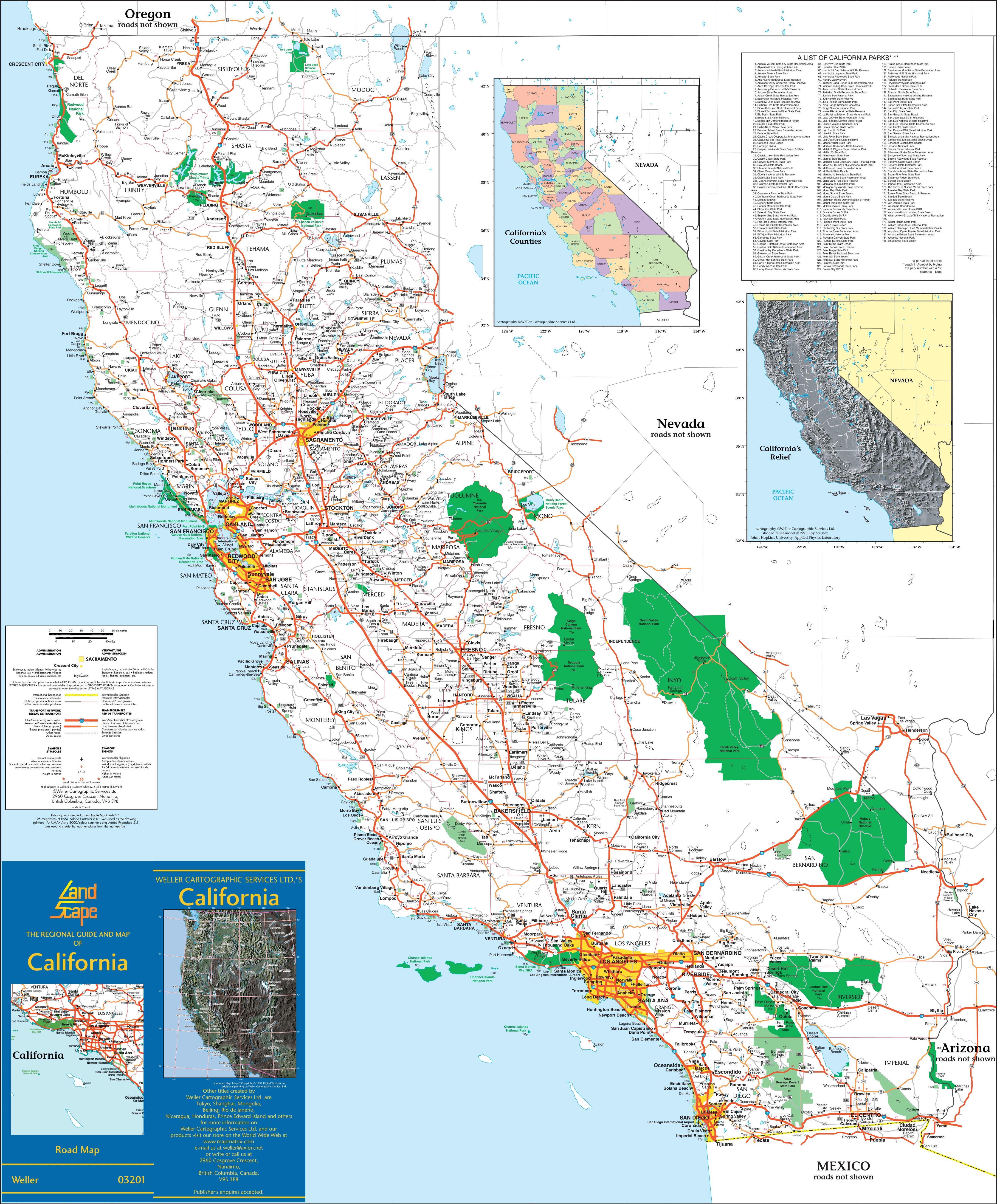
California anchors the western edge of the United States, facing the vast expanse of the Pacific Ocean. When people talk about coastal identity in the Golden State, they often default to images of palm trees, surf culture, and foggy northern cliffs. Yet, the reality of California's shoreline goes far deeper than surfboards and cinematic clichés. It spans over 840 miles of diverse terrain, multiple distinct regional microclimates, and an evolving cultural footprint that shapes how residents interact with the ocean.
Understanding this identity means looking past the surface glamour. The state's coastal strip is split into distinct ecological and cultural zones, each redefining what it means to live on the edge of the continent. From the misty, redwood-lined bluffs of the North Coast to the urban density of Southern California's beach cities, the Golden State doesn't have just one coastal identity—it hosts a patchwork of them.
Defining the California Coastline
Geographically, California sits squarely on the Pacific Rim, bordered by Oregon to the north, Mexico to the south, and the Pacific Ocean to the west. But treating it as a single uniform coast ignores major geological and cultural shifts.
The state breaks down into three primary coastal segments:
- The North Coast: Characterized by rugged cliffs, heavy rainfall, sparse population density, and ancient redwood forests that meet the sea.
- The Central Coast: Home to sweeping bays like Monterey, agricultural powerhouses like the Salinas Valley, dramatic drops at Big Sur, and a slower, agrarian-meets-oceanic pace.
- The South Coast: Dominated by long sandy beaches, extensive marine infrastructure, massive population centers from Los Angeles to San Diego, and a globally exported pop-culture lifestyle.
Each region fosters a different relationship with the ocean. Northern residents often view the Pacific as a powerful, untamed element demanding respect and conservation. Southern residents frequently treat the ocean as an accessible backyard playground.
Cultural Evolution and Mythmaking
The global perception of California's coast owes a massive debt to mid-century media, literature, and the surf boom. Movies, music, and television packaged the Southern California shore as a perpetual summer. This mythos overshadowed the industrial ports, commercial fisheries, and working-class marine towns that actually built the state's coastal economy.
Strip away the marketing, and you find a working coastline. Major international trade moves through the Port of Los Angeles and the Port of Long Beach, handling a significant percentage of containerized cargo entering the United States. Meanwhile, historical industries like commercial fishing out of San Francisco and San Diego have had to adapt to strict environmental regulations and changing marine ecosystems managed by agencies like the California Coastal Commission.
Ecological Realities and Climate Pressures
Living on the edge of the Pacific comes with severe natural challenges. California's coastal identity is increasingly defined by how communities respond to environmental stress.
Key pressures reshaping the shore include:
- Erosion and Sea-Level Rise: Rising tides threaten historic coastal real estate, crumbling cliffs in places like Pacifica, and vital infrastructure like the Pacific Coast Highway.
- Wildfires: Coastal scrublands and chaparral, once viewed as safe from deep-woods fires, face intense seasonal blazes driven by offshore winds.
- Water Management: Balancing urban demand with delicate coastal estuaries requires constant legislative and infrastructural navigation.
Communities aren't just building sea walls anymore; they're implementing managed retreat strategies and restoring natural wetlands to absorb storm surges. This practical adaptation replaces older, purely cosmetic views of the shore with a resilient, survival-focused mindset.
Economic Shifts Along the Pacific Edge
The economic gravity of California pulls heavily toward the water. Real estate values along the shore reflect extreme demand, pricing out many working-class families and transforming beach towns into exclusive enclaves. At the same time, tech hubs in the San Francisco Bay Area influence marine policy, green energy research, and oceanographic tech development.
Tourism remains a massive economic driver. Millions of visitors travel along iconic routes like Visit California highlights, supporting local hospitality economies from Mendocino down to San Diego. Yet, balancing tourist foot traffic with habitat preservation remains a constant tightrope walk for local governments.
Frequently Asked Questions
How long is the California coastline?
Official measurements place the direct general coastline at roughly 840 miles. However, if you measure the total tidal shoreline—including bays, inlets, and offshore islands—the number climbs significantly higher into thousands of miles.
What is the difference between Northern and Southern California coasts?
Northern California features colder water, rocky headlands, heavy fog, and towering redwood forests with lower population density. Southern California features warmer water, wider sandy beaches, drier climates, and dense metropolitan development.
Is the entire California coast publicly accessible?
No. While the California Coastal Act guarantees robust public access compared to many other states, private property rights, military bases, and rugged, impassable cliffs mean certain stretches remain difficult or impossible to reach.
How does the Pacific Ocean affect California's climate?
The cold California Current flows southward from the North Pacific, cooling coastal air temperatures in the summer and moderating winter lows. This dynamic creates the famous coastal marine layer and heavy fog banks that creep inland.



