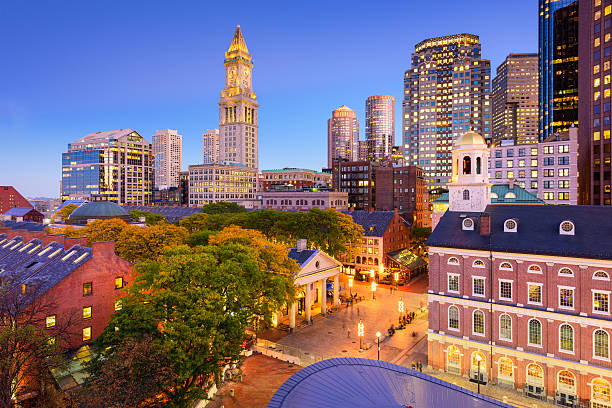
Navigating Boston starts with understanding its postal layout. Unlike cities laid out on strict grid systems, Boston's zip codes reflect centuries of colonial expansion, municipal annexation, and neighborhood evolution. If you're relocating, shipping packages, or analyzing local real estate, knowing how the city's postal codes function saves time and avoids costly mistakes.
The five-digit numeric system for Boston proper primarily begins with the prefix 021 or 022, spanning from the historic cobblestones of the Financial District out to the residential enclaves bordering municipal limits. This guide breaks down the structural logic of Boston postal geography, maps major neighborhood assignments, and highlights practical sorting tips that residents and businesses use every day.
Anatomy of a Boston Postal Code
Every U.S. postal code follows a hierarchical routing logic established by the United States Postal Service. The initial digit '0' designates the New England region, which includes Massachusetts, Maine, New Hampshire, Vermont, Rhode Island, and Connecticut.
The second and third digits narrow the destination to a central sectional center facility (SCF). For Boston, 021 routes through the main processing and distribution center serving Suffolk County and surrounding areas. The final two digits pinpoint specific carrier routes, postal stations, or large institutional buildings. For another look on this development, see the recent update from Reuters.
- 02108 through 02116: Concentrated in downtown core neighborhoods, Government Center, the Financial District, and Back Bay.
- 02118 through 02136: Covers surrounding residential and commercial districts like the South End, Roxbury, Dorchester, Jamaica Plain, and Hyde Park.
- 02210 and 02215: Specialized zones covering modern waterfront developments like the Seaport District and major academic institutions like Boston University.
Major Boston Neighborhoods and Their Codes
Because Boston grew by annexing independent towns throughout the 19th and 20th centuries—such as Charlestown, Dorchester, and Roxbury—postal boundaries often mirror historic municipal borders rather than modern political wards.
Downtown and the Commercial Core
The historic center of the city packs high population densities and commercial hubs into compact postal zones.
- 02108: Encompasses Beacon Hill, the Massachusetts State House, and parts of downtown. Streets here are narrow, winding, and heavily pedestrianized, requiring specialized delivery vehicles.
- 02109: Covers the North End, Waterfront, and custom house areas. This zone blends historic residential blocks with high-traffic tourist destinations near Faneuil Hall.
- 02110 & 02111: Represents the Financial District and Chinatown. These codes service high-rise office towers, dense residential apartments, and bustling commercial storefronts.
Back Bay, Fenway, and Academic Zones
Western extensions of the downtown core support massive student populations and cultural landmarks.
- 02115 & 02215: Centered around the Fenway-Kenmore neighborhood, housing institutions like Northeastern University, Boston University components, and Fenway Park. Delivery logistics fluctuate drastically here depending on Red Sox home game schedules.
- 02116: Spans the Back Bay shopping districts along Newbury Street and Boylston Street, blending luxury retail real estate with brownstone residences.
Residential Enclaves and Outer Neighborhoods
Moving away from the central peninsula, postal codes expand to cover sprawling residential neighborhoods.
- 02124 & 02126: Assigned to Dorchester and Mattapan, two of Boston's largest and most ethnically diverse residential communities.
- 02130: Covers Jamaica Plain, featuring a mix of Victorian homes, triple-deckers, and large green spaces like the Arnold Arboretum.
- 02136: Services Hyde Park at the southern tip of the city, maintaining a distinct neighborhood identity separate from downtown urban density.
Institutional and Unique Postal Designations
Not all Boston zip codes apply to standard residential streets. The USPS assigns specialized codes to large institutional campuses, high-volume corporate towers, and federal facilities to streamline mail processing.
For instance, specific government entities, major hospitals like Massachusetts General Hospital, and large universities often possess dedicated unique zip codes. Mail addressed to these institutions bypasses local station sorting and routes directly to internal mailrooms. When sending documents to medical or academic hubs, verifying whether the specific building requires its own unique code prevents sorting delays.
Practical Impacts on Real Estate and Logistics
Postal geography influences daily life in Boston far beyond dropping letters in a blue collection box.
Property Valuation and Market Segmentation
Real estate pricing in Boston correlates heavily with specific zip codes. Buyers frequently search properties by code to target specific school assignment zones, neighborhood vibes, or proximity to transit lines. A condominium in 02116 commands vastly different price-per-square-foot metrics than a single-family home in 02136, reflecting neighborhood desirability, historical preservation status, and market demand.
Emergency Services and Municipal Routing
Boston's emergency dispatch systems rely on precise geographic data layers tied to postal boundaries. Police districts, fire stations, and Emergency Medical Services (EMS) units use these spatial divisions to optimize response times across congested roadways and historic thoroughfares that lack modern grid layouts.
Shipping and E-Commerce Challenges
Navigating deliveries in Boston requires understanding local parking restrictions, narrow one-way streets, and seasonal snow emergencies. Couriers frequently encounter bottlenecks in dense codes like 02109 or 02114 where loading zones are scarce. Residents living in triple-decker apartments should always include specific unit numbers alongside the correct zip code to ensure couriers locate delivery drop-offs accurately.
Frequently Asked Questions
How many total zip codes are in Boston?
Boston proper contains over 30 active primary zip codes, ranging from downtown commercial districts to outer residential neighborhoods like Hyde Park and West Roxbury.
Do Boston zip codes cross municipal boundaries?
Most zip codes align with Boston city limits, but certain commercial or postal carrier routes extend slightly into neighboring municipalities like Brookline or Cambridge for operational efficiency.
Why do some Boston buildings have their own zip code?
High-rise commercial towers, major hospitals, and large university campuses receive unique zip codes from the USPS to handle high volumes of incoming and outgoing mail independently.
How do I verify the correct zip code for a new Boston address?
You can look up exact postal assignments using the official USPS Lookup Tool to ensure mail routing accuracy.



